Good evening,
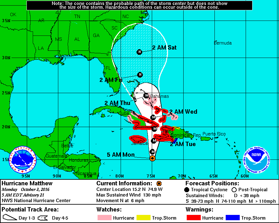
Hurricane Matthew, since last night, has been drifting steadily northwest and is currently located at 14.6 N and 74.8 W and is moving NW at 5 mph with winds of 145 mph and barometric pressure of 945 mb. The NHC models have shifted little since yesterday and the NHC is projecting a turn to the north tomorrow. It remains a compact storm and on its present course should pass near the western tip of Haiti. In light of its small hurricane-force wind field, Jamaica may not see hurricane conditions. Due to slow movement, heavy rain is forecast for southern Haiti of 15-25 inches and 10-20 inches in eastern Jamaica. If its current track holds, South Florida should not receive storm conditions.
I will write more detailed projections as it gets closer to our area.
Have a good night, I'll write again tomorrow.
Matt