Good evening.
At 5 pm Hurricane Matthew was located at 19.8 N and 74.3 W moving N @ 9 mph with a barometric pressure of 949 mbs and peak winds of 140 mph. The northern eye wall is currently making landfall along the very eastern tip of Cuba and should just barely graze the edge of "The Box". The NHC's current track is very similar to this am. At 11 am it has shifted a little to the east however on the last run due to a forecast of the Western Atlantic High getting a little stronger it has shifted again a little more to the west. On this track it brings Matthew on closest approach to Miami, about 155 miles off shore. Storm force winds are currently forecast to extend 140 miles to the NW and 110 miles to the SW of the center. In light of that they should remain off shore however just barely. A minor shift in positions could bring storm force winds of 40-50 mph to Miami-Dade and Broward Counties. Palm Beach County could receive more. Note on the present track peak winds would be in the 30s for Dade and Broward. Hopefully its northern motion will persist longer than forecast and bring Matthew a little more to our east. We'll just have to see.
I'll write again early tomorrow am. Things will get clearer with time.
Matt.
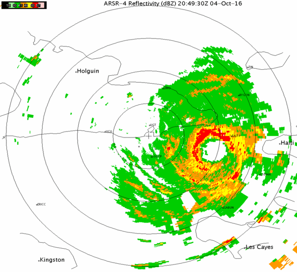
Live radar of Windward Passage 5 pm 10-4-16
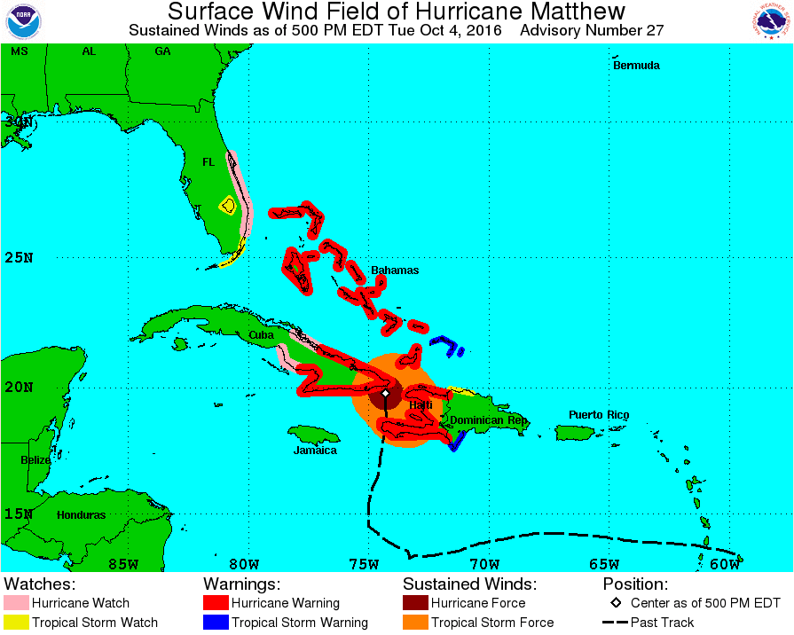
Surface wind field of Hurricane Matthew and track history 5 pm, 10-4-16