Most Intense Storm in Recorded History (Atlantic Basin) |
Hurricane Wilma.Formed: October 16, 2005
Dissipated: October 27, 2005 (Extratropical after October 26) Highest winds1-minute sustained: 185 mph (295 km/h) Lowest pressure: 882 mbar (hPa); 26.05 inHg (Record low in the Atlantic basin) Fatalities: 87 totalPart of the 2005 Atlantic hurricane season Hurricane Wilma was the most intense tropical cyclone ever recorded in the Atlantic basin, and was the most intense tropical cyclone recorded in the western hemisphere until Hurricane Patricia in 2015. Part of the record-breaking 2005 Atlantic hurricane season, which included three of the six most intense Atlantic hurricanes ever (along with #4 Rita and #6 Katrina), Wilma was the twenty-second storm, thirteenth hurricane, sixth major hurricane, fourth Category 5 hurricane, and second-most destructive hurricane of the 2005 season. A tropical depression formed in the Caribbean Sea near Jamaica on October 15, and intensified into a tropical storm two days later, which was named Wilma. After heading westward as a tropical depression, Wilma turned abruptly southward after becoming a tropical storm. Wilma continued intensifying, and eventually became a hurricane on October 18. Shortly thereafter, rapid intensification occurred, and in only 24 hours, Wilma went from a Category 1 to a Category 5 hurricane with winds of 185 mph (295 km/h) with the lowest barometric pressure ever recorded in the Atlantic Basin of 882 mbars, 25.99 inches of Hg. At its peak Wilma's eye was only 2 miles across ! Intensity slowly leveled off after becoming a Category 5 hurricane, and winds had decreased to 150 mph (240 km/h) before reaching the Yucatán Peninsula on October 20 and 21. After crossing the Yucatán Peninsula, Wilma emerged into the Gulf of Mexico as a Category 2 hurricane. As Wilma began accelerating to the northeast, gradual re-intensification occurred, and the hurricane became a Category 3 hurricane on October 24. Shortly thereafter, Wilma made landfall in Cape Romano, Florida with winds of 120 mph (190 km/h). As Wilma was crossing Florida, it had briefly weakened back to a Category 2 hurricane, but again re-intensified as it reached the Atlantic Ocean. The hurricane intensified into a Category 3 hurricane for the final occasion, but Wilma dropped below that intensity while accelerating northeastward. By October 26, Wilma transitioned into an extratropical cyclone southeast of Nova Scotia. Wilma made several landfalls, with the most destructive effects felt in the Yucatán Peninsula of Mexico, Cuba, and the US state of Florida. At least 62 deaths were reported, and damage is estimated at $29.4 billion (2005 USD, $35.6 billion 2016 USD), $21 billion (2005 USD, $25.4 billion 2016 USD) of which occurred in the United States alone.[1] As a result, Wilma is ranked as the fifth costliest storm in United States history. Source: Wikipedia |
Greatest 24-hour Rainfall Amount |
Global - 72" (LA Reunion Island)The greatest 24-hour rainfall amount in the world is 71.9 inches at Foc-Foc, La Reunion Island, an island located in the Indian Ocean to the east of Madagascar, Jan. 7-8, 1966. The rain was unleashed by a tropical cyclone churning in the Indian Ocean. The mountainous terrain across the island rises to as high as 10,070 feet above sea level on the Piton des Neiges volcano.
US - 43" (Alvin, TX)Alvin, Texas, was deluged by 43 inches of rain in 24 hours from July 24-25, 1979, setting an all-time record 24-hour rainfall for the U.S. The torrential rain fell as Tropical Storm Claudette made landfall near the Texas-Louisiana border before stalling right over Alvin. The 24-hour rainfall in Alvin may also be the record for the world's greatest 24-hour rainfall occurring over flat terrain, according to the Atlantic Hurricane Season Summary of 1979 released by the National Hurricane Center.
Other locations in Texas were also inundated by more than 30 inches of rain from Claudette. This rainfall map from Tropical Storm Claudette shows a bulls-eye of rain over southeastern Texas with amounts of over 30 inches. Courtesy of NOAA |
Highest US temperatureHighest Peak in US |
Denali (formerly Mount McKinley), in Alaska’s Denali National Park, is the highest point in the United States at 20,310 feet
|
Converting Millibars to Inches of Mercury
Quick approximation / conversion of millibars (mbs) to inches of mercury
1000 mbs = 29.53" Hg
Every mb up or down = 0.03"
For example # 1. 990 mbs = 29.53 -0.30= 29.23"
Example #2. 1010 mbs = 29.53 + 0.30= 29.83"
In general you need a barometric pressure of close to 29.00" ( 982-983 mbs) to have hurricane force winds. The lower the pressure usually the stronger the winds.
"The Box"
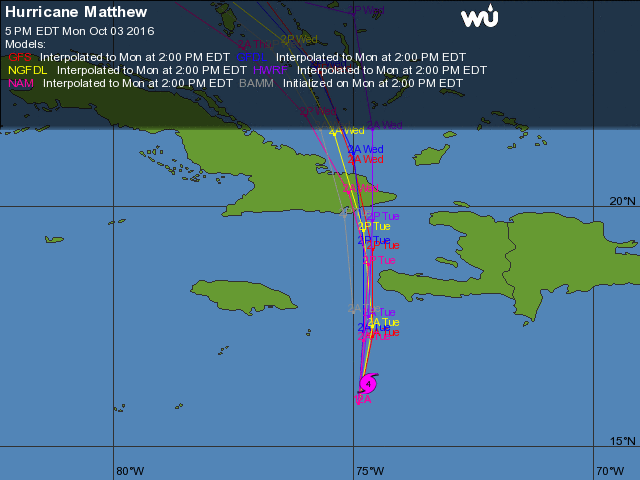
There is a 1 degree x 1 degree box of latitude and longitude framed by the NW tip of Haiti, the Eastern tip of Cuba and Great Inagua to the north. 20-21 degrees N and 73-74 degrees W. Storms that pass through this box have an approximately 50% chance of making a Florida landfall, particularly South Florida. Hurricane Matthew in October 2016 just grazed the edge of "The Box".
African Waves
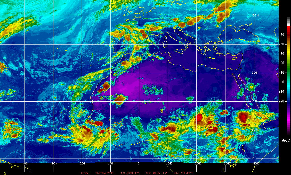
Tropical waves coming off of Africa between 10 and 12 degrees N latitude are the ones which pose the greatest potential threat to South Florida. Those are the ones with the greatest chances of getting into the Caribbean and getting south of us. Note due to the Coriolis Effect all storms want to move north. They only move in other directions when something is preventing them from moving north.
what to do during a hurricane
Park cars in garage or right up against your house on side opposite of strongest forecast winds. If out side of garage park right up against the garage doors. Just touching the doors lightly. This will actually help to protect your garage doors as well.
At home keep all interior doors closed. Stay away from windows even if they are shuttered. Carry a towel with you to protect yourself from debris or glass in the event of a breach. Don't open exterior doors or doors to your garage during the storm. Wear pants. If you're in an area of Hurricane force winds find an interior room, generally the smaller the better. Remove things from walls or shelves in that room in the event of a breach. If a breach occurs lay on the floor. Cover yourself with whatever is available. Stay safe. There will be lots of trees and branches down. Watch out for power lines. Power is likely to go out.
At home keep all interior doors closed. Stay away from windows even if they are shuttered. Carry a towel with you to protect yourself from debris or glass in the event of a breach. Don't open exterior doors or doors to your garage during the storm. Wear pants. If you're in an area of Hurricane force winds find an interior room, generally the smaller the better. Remove things from walls or shelves in that room in the event of a breach. If a breach occurs lay on the floor. Cover yourself with whatever is available. Stay safe. There will be lots of trees and branches down. Watch out for power lines. Power is likely to go out.
Fujiwhara Effect
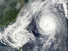
The Fujiwhara Effect is an interesting phenomenon which can happen when two or more hurricanes form very near each other. In 1921, a Japanese meteorologist named Dr. Sakuhei Fujiwhara determined that two storms will sometimes move around a common center pivot point.
The National Weather Service defines the Fujiwhara Effect as the tendency of two nearby tropical cyclones to rotate cyclonically about each other.
Another slightly more technical definition of the Fujiwhara Effect from the National Weather Service is a binary interaction where tropical cyclones within a certain distance (300-750 nautical miles depending on the sizes of the cyclones) of each other begin to rotate about a common midpoint. The effect is also known as the Fujiwara Effect without an ‘h’ in the name.
Fujiwhara’s studies indicate storms will rotate around a common center of mass. A similar effect is seen in the rotation of the Earth and moon. This barycenter is the center pivot point around which two rotating bodies in space will spin. The specific location of this center of gravity is determined by the relative intensity of the tropical storms. This interaction will sometimes lead to tropical storms 'dancing' with each other around the dance floor of the ocean.
Greatest storm total rainfall in Us.
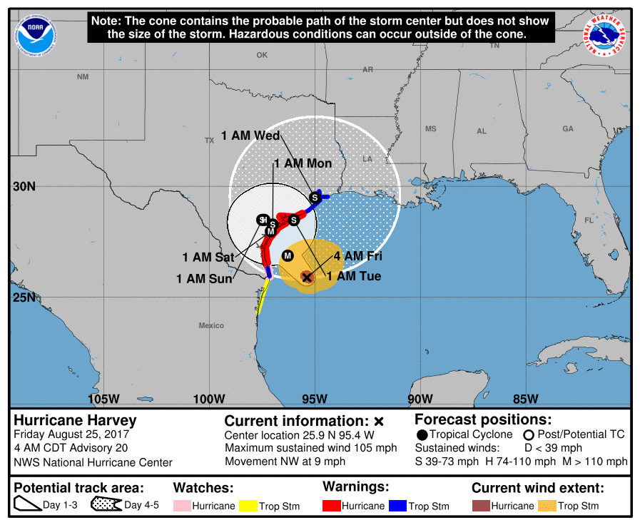
Hurricane Harvey
August 25 - 31, 2017. Slow moving Hurricane Harvey lead to a 6 day rain event with the Houston area receiving up to 52" of rainfall with extensive flooding. Nederland, Texas had the greatest storm total with 60.58" of rain.
In second place comes Hurricane Lane dumping 52.02" on the Big Island of Hawaii at elevation August 22 -26, 2018.
Eye walls of major hurricanes
As a general rule the worst part of a major hurricane is the eye wall. It is where the strongest winds and surge occur. The eye wall usually is around 5 miles thick. For example as Hurricane Florence was approaching the Carolinas in September of 2018, its eye was 20 miles wide therefore the swath of ocean below it that was experiencing major hurricane conditions was around 30 miles wide. I usually add 5-10 miles to account for the wobbling motion of the storms, thus conservatively 40 miles wide. Outside of the eye wall one usually does not experience sustained winds over Cat 1, though it can vary with the size and intensity of the storm. Therefore unless the center of the eye were to pass within 20 miles of you (at its current eye size) you would not likely experience major hurricane conditions. Note the eye can expand significantly, i.e., pay close attention to the size of the eye.


