Good afternoon.
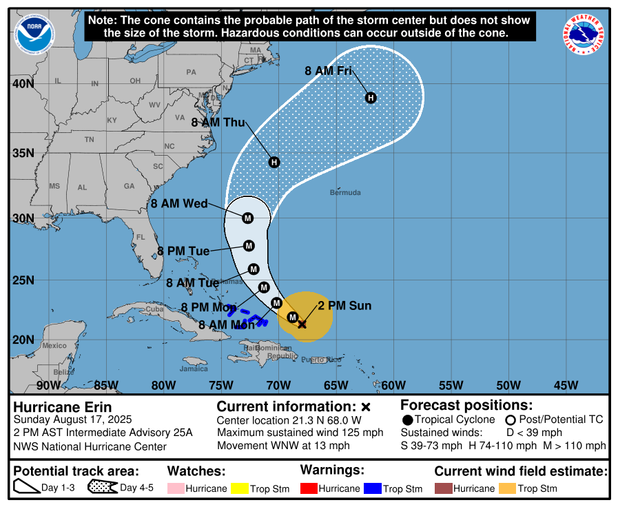
Just a quick update. Erin has been proceeding as forecast. All the models are in strong agreement with it missing the US. Erin underwent rapid intensification yesterday and went from a 75 mph Cat 1 to a 165 mph Cat 5 in less than a day. It is currently down to a 125 mph Cat 3. Conditions have to be perfect for storms to maintain Cat 5 status. In fact the longest any storm has been at Cat 5 is around 24 hours.
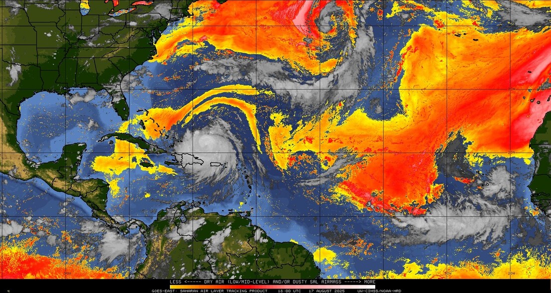
Though intense Erin is a very compact storm with hurricane force winds extending only 20 miles from the center. Yesterday at peak intensity the eye was only 6 miles across.
Over the next several days due to centripetal force its wind field should expand.
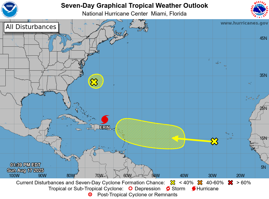
Elsewhere a weak potential wave will probably follow a path similar to Erin's.
Note Erin on it's current track is actually a very good things as it should remove a lot of heat from a key part of the ocean, reducing the risk of stronger storms near its path.
Until next time,
Matt.
Just a quick update. Erin has been proceeding as forecast. All the models are in strong agreement with it missing the US. Erin underwent rapid intensification yesterday and went from a 75 mph Cat 1 to a 165 mph Cat 5 in less than a day. It is currently down to a 125 mph Cat 3. Conditions have to be perfect for storms to maintain Cat 5 status. In fact the longest any storm has been at Cat 5 is around 24 hours.
Though intense Erin is a very compact storm with hurricane force winds extending only 20 miles from the center. Yesterday at peak intensity the eye was only 6 miles across.
Over the next several days due to centripetal force its wind field should expand.
Elsewhere a weak potential wave will probably follow a path similar to Erin's.
Note Erin on it's current track is actually a very good things as it should remove a lot of heat from a key part of the ocean, reducing the risk of stronger storms near its path.
Until next time,
Matt.