Good morning.
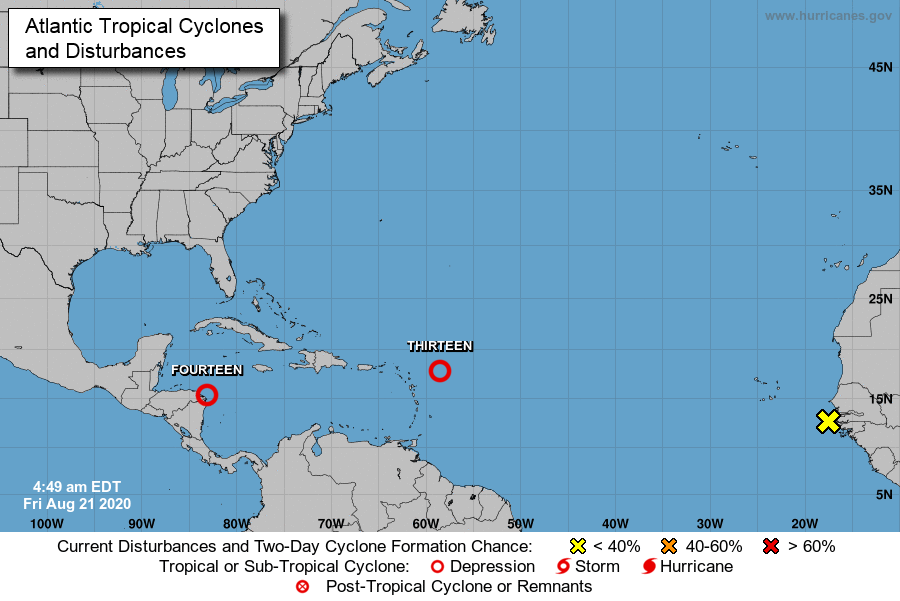
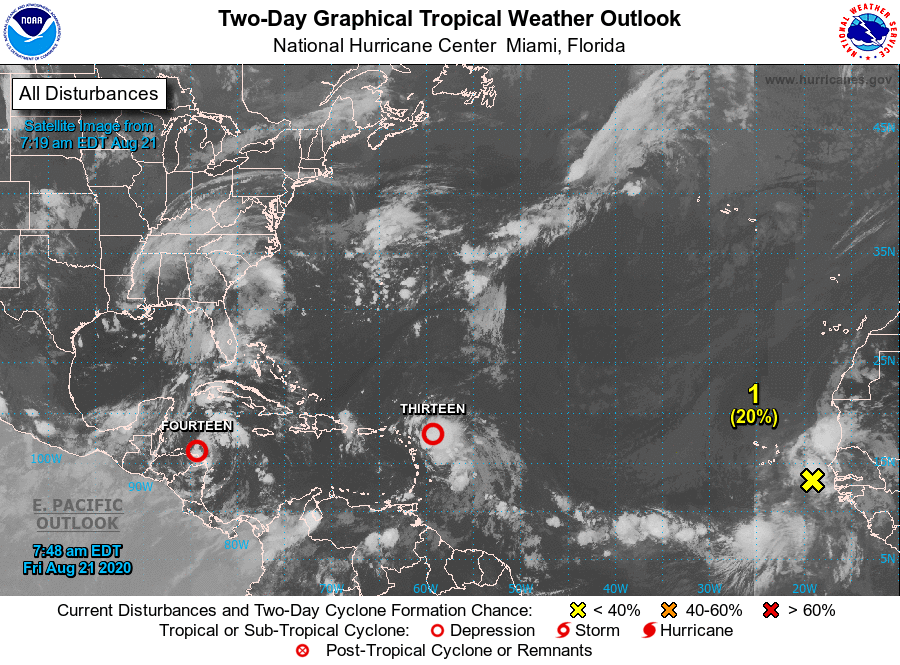
Over the past couple of days there have been some interesting developments, though both systems are still very poorly organized. Neither currently appear to pose a significant risk to South Florida.
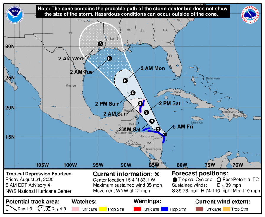
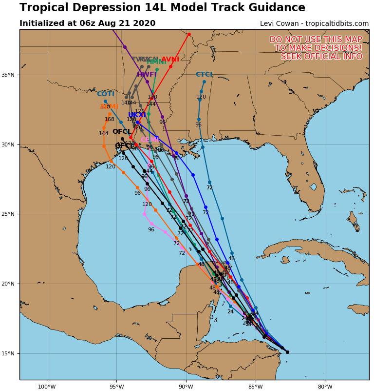
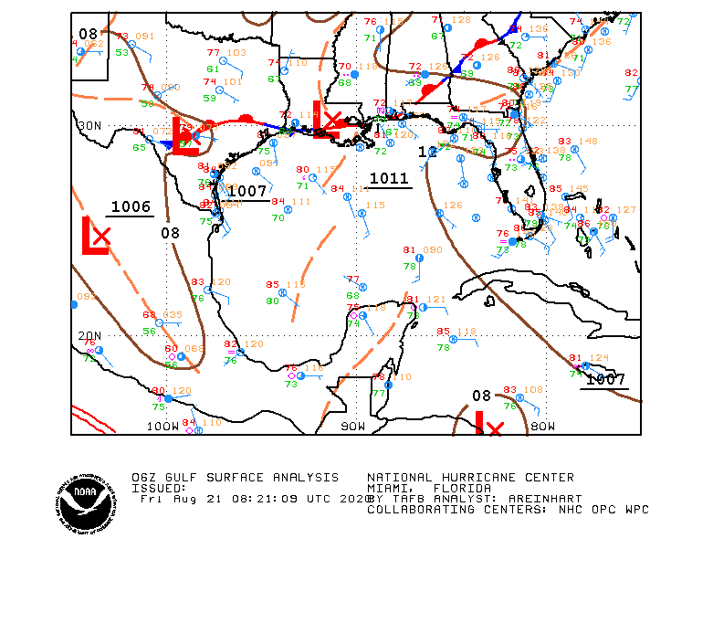
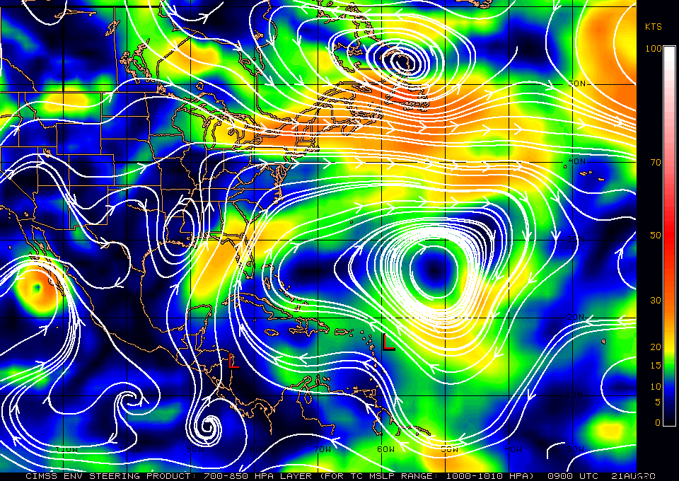
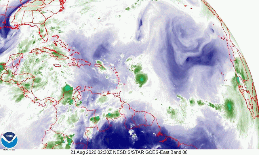
If you look at the water vapor loop, bottom diagram you will see an upper level low centered along the northern Gulf Coast near the Louisiana - Mississippi border. This is associated with a stationary front along the northern Gulf. ( see surface map of Gulf of Mexico below.) This will be the main factor steering both of these systems. One will come in on its back side the other just on its front side. The wild card which is totally unpredictable at this time is the interaction which will occur between the two systems as they start to approach each other and the northern Gulf of Mexico on Monday and Tuesday. See Fujiwhara Effect in Weather Trivia Section of this Blog.
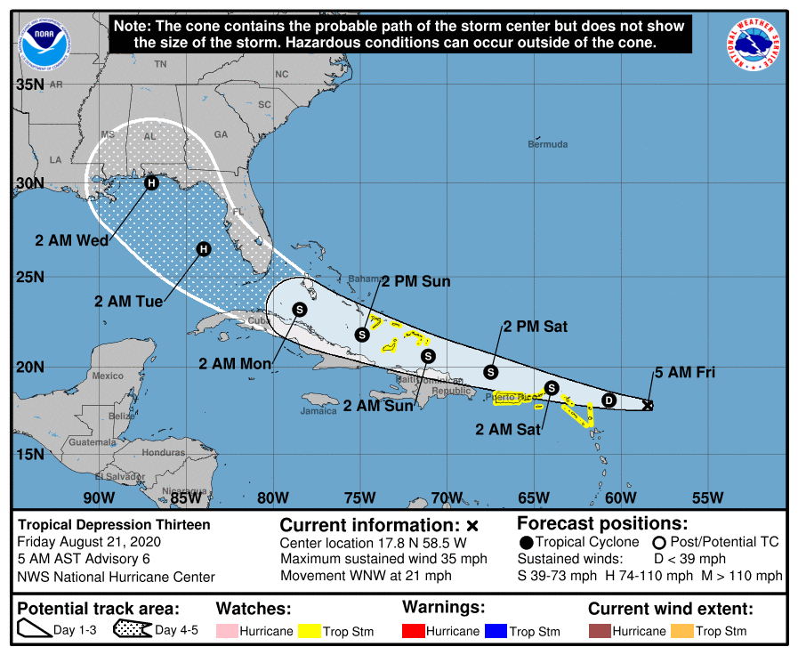
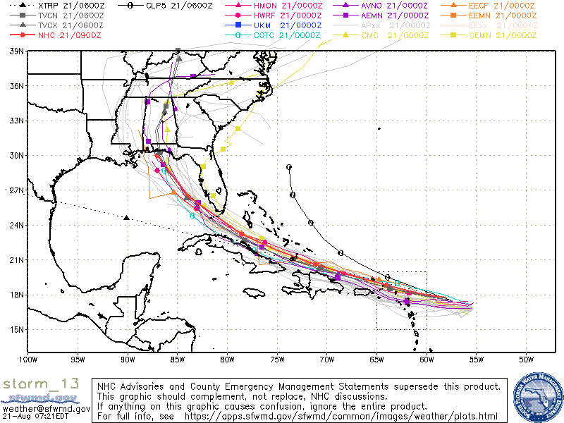
Of the two only TD #13 should have an affect on Florida. It is currently tracking south and west of NHC's projected path from yesterday and the NHC has adjusted their track accordingly. The model consensus brings it through the lower Florida Keys then toward the Florida - Alabama border near where the stationary front nips the Panhandle. If this track holds it would pass around 100-120 miles SW of the Miami area. Its weak tropical storm force wind field to the NE at that time is projected to extend 110 miles, therefore the southern parts of Miami-Dade County may experience winds in the 30-40 mph range in squalls and 2-4" of rainfall.
Its still too early to make an accurate prediction. TD #13 is currently uncoupled with a mid level center several hundred miles SE of the low level center. As we saw with Isaias weak systems can be tricky.
Frankly the one I'm concerned with is the one just off the coast of Africa now, but its way too early to say anything about it.
I'll write again tomorrow,
Matt.
Over the past couple of days there have been some interesting developments, though both systems are still very poorly organized. Neither currently appear to pose a significant risk to South Florida.
If you look at the water vapor loop, bottom diagram you will see an upper level low centered along the northern Gulf Coast near the Louisiana - Mississippi border. This is associated with a stationary front along the northern Gulf. ( see surface map of Gulf of Mexico below.) This will be the main factor steering both of these systems. One will come in on its back side the other just on its front side. The wild card which is totally unpredictable at this time is the interaction which will occur between the two systems as they start to approach each other and the northern Gulf of Mexico on Monday and Tuesday. See Fujiwhara Effect in Weather Trivia Section of this Blog.
Of the two only TD #13 should have an affect on Florida. It is currently tracking south and west of NHC's projected path from yesterday and the NHC has adjusted their track accordingly. The model consensus brings it through the lower Florida Keys then toward the Florida - Alabama border near where the stationary front nips the Panhandle. If this track holds it would pass around 100-120 miles SW of the Miami area. Its weak tropical storm force wind field to the NE at that time is projected to extend 110 miles, therefore the southern parts of Miami-Dade County may experience winds in the 30-40 mph range in squalls and 2-4" of rainfall.
Its still too early to make an accurate prediction. TD #13 is currently uncoupled with a mid level center several hundred miles SE of the low level center. As we saw with Isaias weak systems can be tricky.
Frankly the one I'm concerned with is the one just off the coast of Africa now, but its way too early to say anything about it.
I'll write again tomorrow,
Matt.