Good morning.
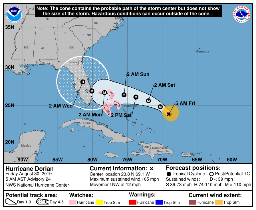
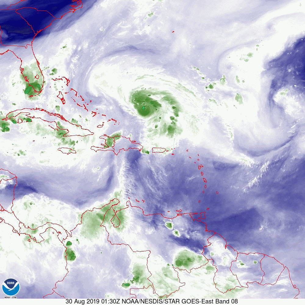
With regards to Dorian there are a few features of note this morning. First it is starting to move slightly west of North West in addition the models are coming into better agreement with a course more towards Central Florida. When looking at the water vapor loop below you will notice Dorian and the the upper level low which is over the Bahamas now and moving west. They appear to be moving at around the same speed. If you look at the Surface Map next you can see the trough between the 2 high pressure ridges that are steering Dorian. Notice how the line that it is on ends in Central Florida east of Lake Okeechobee. That intersection with the coast is Jupiter and is currently the area at greatest risk. Also note on the surface map the wide area between isobars north of Jupiter. That gap implies very weak steering forces. The result of this is that is should slow down markedly as it approaches the coast. This will lead to a prolonged rain and wind event. Notice the NHC's forecast track (first diagram) is much slower with Dorian making landfall on early Tuesday morning. That slowing will also lead to greater uncertainty in the forecast as with time things can change. The front to the north has stalled across north-central Florida, if Dorian can drift north enough it still potentially could get pulled NE by it and miss the state, though if you look at the Global Models, (fourth diagram) not many are showing this now. There is still one model that brings it into Southern Miami-Dade however it its an outlier. Of concern is that the European Models brings it near Boca Raton. If that were to happen Miami-Dade could experience weak Tropical storm force winds. Fortunately Dorian is forecast to remain a compact storm with Hurricane force winds extending only 20 miles from the center and storm force winds extending only 70 miles to the south and 80 miles to the north of the center. UNLESS the center passes within 20 miles of you, you will likely NOT experience a hurricane. Unfortunately it is forecast to be a Cat 4 Hurricane at landfall the damage to those in its path will be extreme. Due to the uncertainty in the forecast we will continue to need to watch this one closely.
Look closely at the fifth diagram, Wind Field Projections to see what type of winds you can expect for your location. This may be changing and I will forward revisions as needed. The last diagram is Sea Surface Temperatures. The reds are hot around 30 degrees Celsius. The Gulf of Mexico is super warm and that red plume of red off the east coast of Florida represents the Gulf Stream bringing that warm Gulf water into the Atlantic. If it stalls over that it could really enhance the wind and rain.
I will be writing at least twice a day, more frequently as it gets closer and if significant changes in the course should occur.
Until this afternoon.
Matt.