Good afternoon.
At 1 pm Hurricane Hunters found a new center of circulation of TS Eta over 200 miles to the ENE of the old center under the area of deep convection. This changes everything.
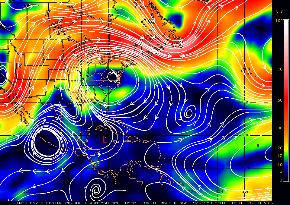
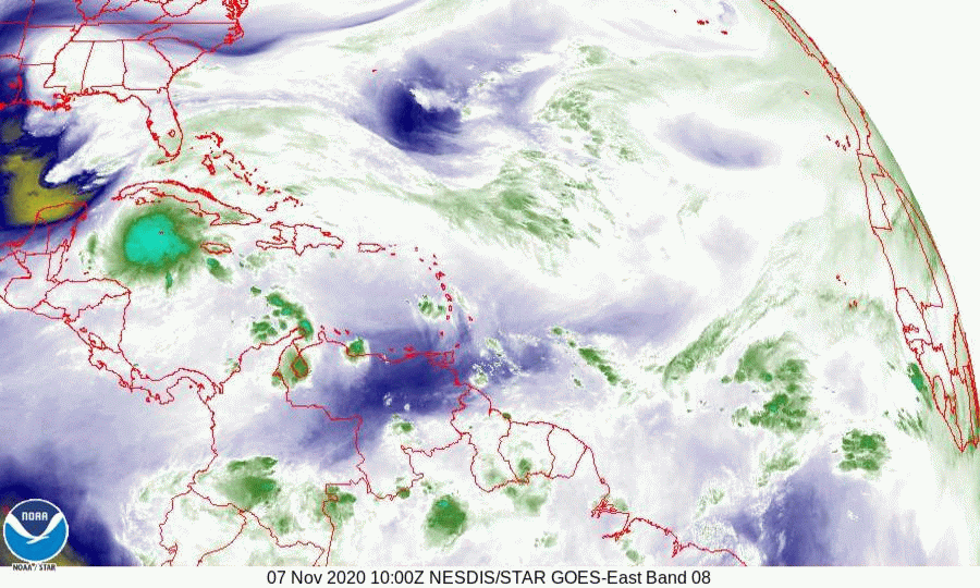
If you look at the water vapor loop below you can see the new center just north of Grand Cayman, The old center is just north of the Honduran coast. You can also see that the upper level low off of Louisiana is moving SSE.
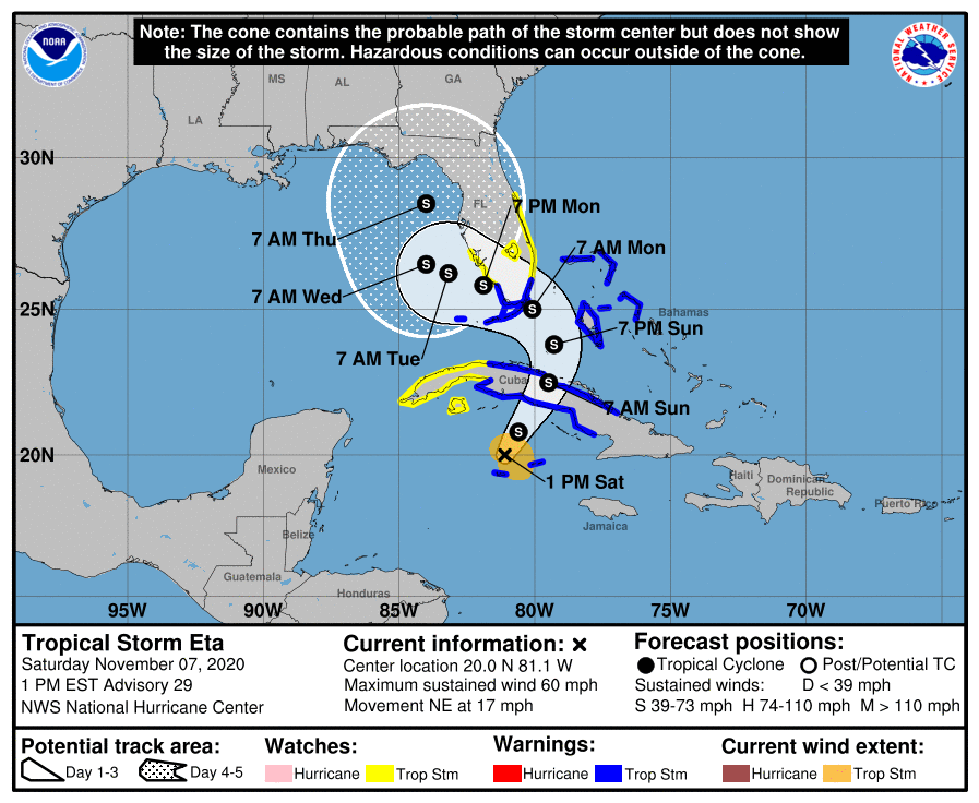
Eta is already south of the Florida Peninsula and a more eastward track is now highly likely. The NHC's current track takes it across Key Largo. Due to the high shear an even further eastward track is possible. As expected in this scenario it is now stronger, 60 mph and the NHC is calling for it to be a 60-65 mph storm as it approaches South Florida, now on Sunday night and Monday morning. The track is likely to change further however South Florida should prepare for winds in the 60s. Tropical storms tend to be tree storms rather than structure storms however there is always the potential for tornados.
I will write again this evening.
Until then, Matt.
At 1 pm Hurricane Hunters found a new center of circulation of TS Eta over 200 miles to the ENE of the old center under the area of deep convection. This changes everything.
If you look at the water vapor loop below you can see the new center just north of Grand Cayman, The old center is just north of the Honduran coast. You can also see that the upper level low off of Louisiana is moving SSE.
Eta is already south of the Florida Peninsula and a more eastward track is now highly likely. The NHC's current track takes it across Key Largo. Due to the high shear an even further eastward track is possible. As expected in this scenario it is now stronger, 60 mph and the NHC is calling for it to be a 60-65 mph storm as it approaches South Florida, now on Sunday night and Monday morning. The track is likely to change further however South Florida should prepare for winds in the 60s. Tropical storms tend to be tree storms rather than structure storms however there is always the potential for tornados.
I will write again this evening.
Until then, Matt.