Good morning.
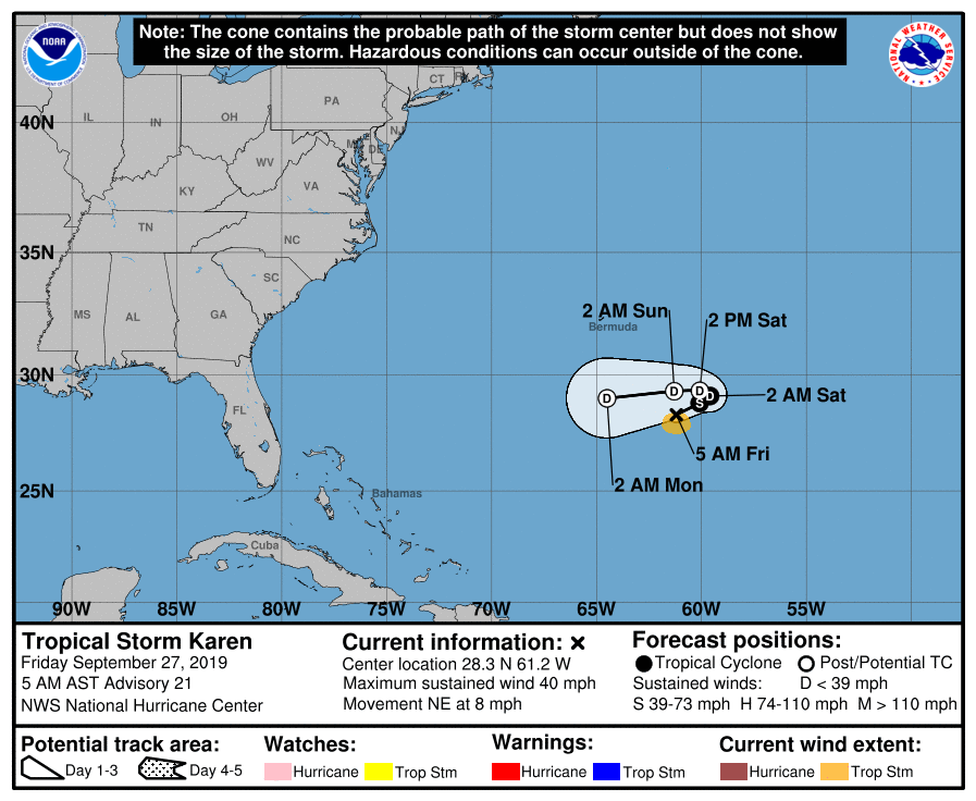
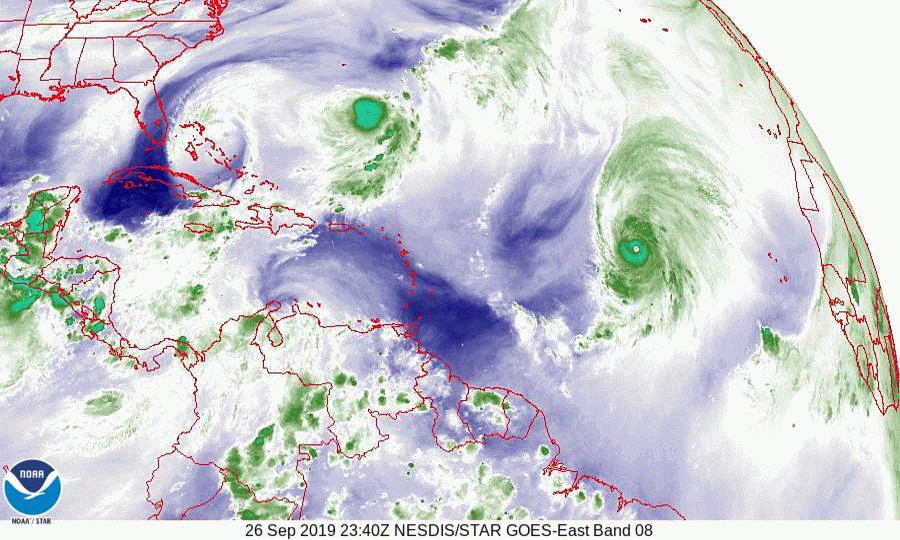
With regards to Karen we have good news. First it is north of where the NHC had expected it to be at this time. Second, and most importantly it is much weaker. The strong upper level westerly winds which I talked about on Monday have taken their toll. The latest NHC satellite observations could not find a clear center of circulation and all of the dynamic models are now forecasting dissipation within 4 days due to an increasingly hostile upper level environment. If you look at the water vapor loop below you can see that the upper level low, now over the northern Bahamas remains between Karen and the state of Florida. This is contributing to the shear of Karen. Currently the risk to Florida and the US is minimal.
Elsewhere Lorenzo is a Cat 4 storm and is slowly moving NNW and out to sea. It is drawing a lot of heat out of the ocean in the process which is also good news.
Presently there is nothing else out there and we should have another 1-2 weeks of low risk.
Until next time, Matt.