Good evening.
Today has been a historic day in the tropic with Hurricane Milton going from a 100 mph Cat 2 at 5 am to a 180 mph Cat 5 at 8 PM. Its barometric pressure of 897 mbs is the 4th lowest recorded in the Atlantic basin. (The lowest ever recorded was with Hurricane Wilma on 10/16/05 of 882 mbs.) Fortunately it will NOT be a Cat 5 at landfall along the West Coast of Florida early Thursday. The longest any hurricane has maintained Cat 5 intensity is around 24 hrs. Conditions have to be perfect for Cat 5s to exist. Conditions will not be perfect for Milton on Wednesday and Thursday.
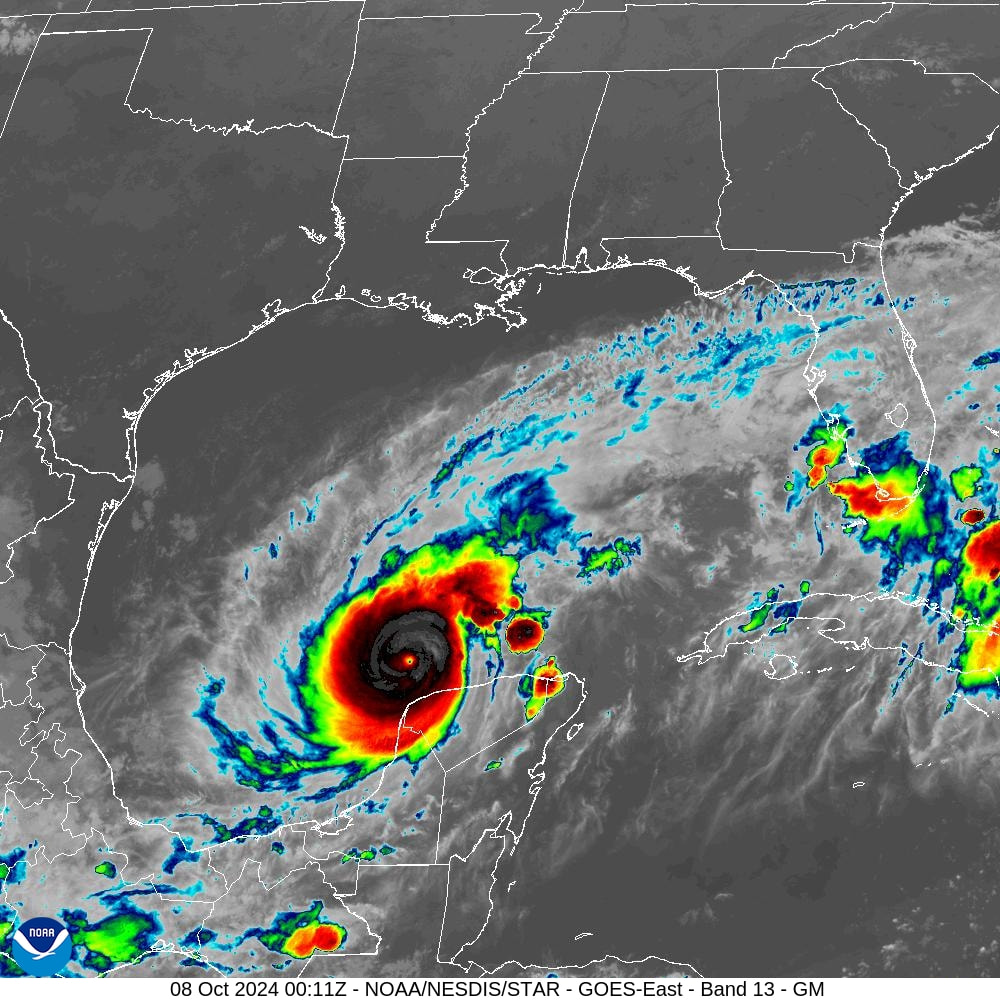
If you look a the water vapor loop below you will notice a few things. First you will notice Milton's eye during its incredible intensification period. Watch it shrink. Like a ballerina folding in her arms the eye tightens as it intensifies. It goes from approximately 10 miles across to probably less than 3 miles, incredibly small. Next notice that it is starting to gain latitude. This is good news because the sooner it gets further north the sooner it will start to encounter significant shear. As it does so the eye should start to expand and the winds should start to lessen, just how much we will have to see.
Also notice the dry air, yellow, to its north. This should start to entrain into the system tomorrow as it moves further north which should also tend to weaken it.
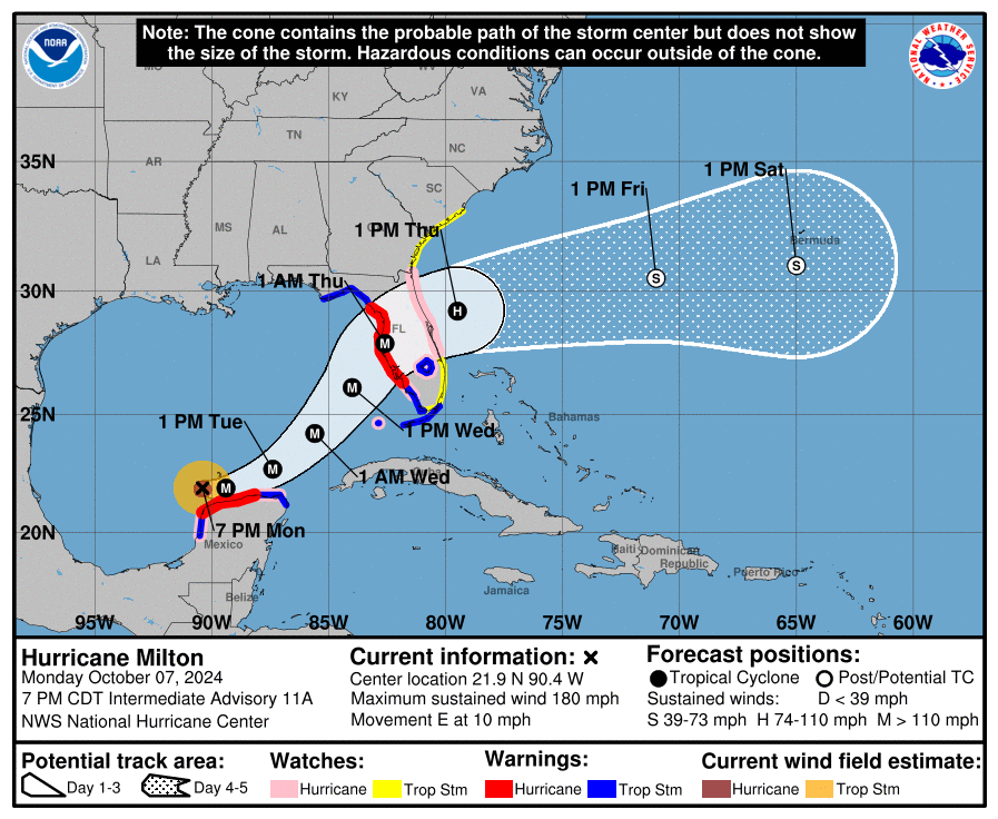
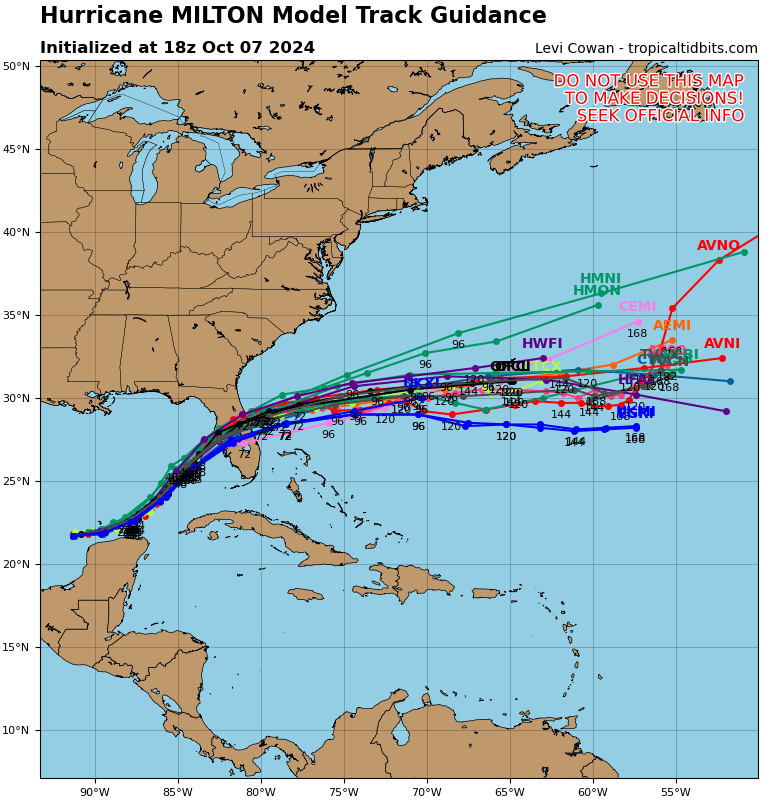
If you look at the models below you will notice extremely tight agreement amongst them over the next 24 hours after that there is a little spread. The models are currently pretty much in line with the track I noted this morning. The official NHC track continues to point to towards Tampa.
Tomorrow will be key in predicting Milton's precise path. We should have a better idea by about this time tomorrow. The NHC is currently calling for landfall around 1 am Thursday morning. Timing will also be key. The slower it goes the better as it will give the shear more time to weaken it, ie if it arrives sooner it will be stronger, the later the weaker. In addition centripetal forces will tend to expand the wind field with time at the expense of intensity which along with widening of the eye should lead to some more weakening. All we can hope for is as weak a system as possible at landfall, though it will not be weak. By Wednesday morning we should have better idea as to just what we can expect. This is likely to be a significant hurricane.
I'll be writing again tomorrow.
Until then,
Matt.


