Good morning.
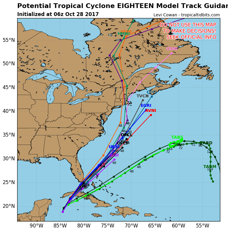
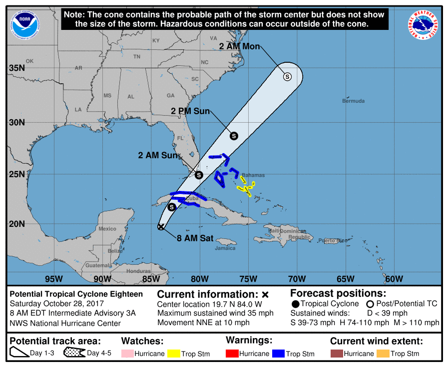
A broad area of disturbed weather this morning over the northwest Caribbean Sea is moving generally northward. The National Hurricane Center has called it "Potential Tropical Cyclone 18." Hurricane hunters yesterday found no defined center of circulation. There is currently high shear north of it and over Florida. This should prevent any significant development.
It should enhance shower activity later today and tonight, however I do not anticipate any significant wind for South Florida. Due to high shear out of the southwest, any significant weather should remain well to our east. The Bahamas may experience winds near tropical storm force. South Florida may have winds in the 20s to low 30s. The main weather we may experience will occur between 7 pm tonight and 7 am tomorrow.
This should not be a significant weather event for South Florida. We MAY get 1-2 inches of rain.
Until next time,
Matt