Good evening.
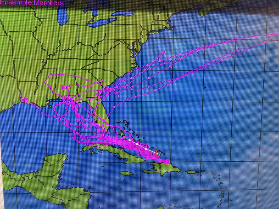
Since yesterday not much has changed with Invest 99-L which may be good news. It remains very poorly organized and its circulation center (currently near the Turks and Caicos) is exposed NW of most of its associated weather which is over and south of Hispaniola. It is presently experiencing 20-30 knots of shear which is causing this. The NHC has reduced its probability of development in the next 48 hours to 40%, and at 5 d to 70%. In 5 days it will be past us. In its current state it would take some time to get its act together. This makes the likelihood of a South Florida Hurricane low and it may not even make it to Tropical Storm status until it is past us. It is also possible that it may not even develop at all. It frankly looks very weak right now. (see below). By late tomorrow the shear above it will begin to subside and so slow development is possible. It is currently moving westward at 15-20 mph and at this speed should be in our vicinity Saturday night-Sunday. High pressure over the NW Gulf should continue to move it W to WNW. The NHC models as expected have begun to shift to the south (see below) and my track through the Florida Straits has not changed since yesterday.
I'll write again tomorrow but the prospects of a significant storm for S Florida appears to be much less.
My best to all,
Matt.

