Good evening.
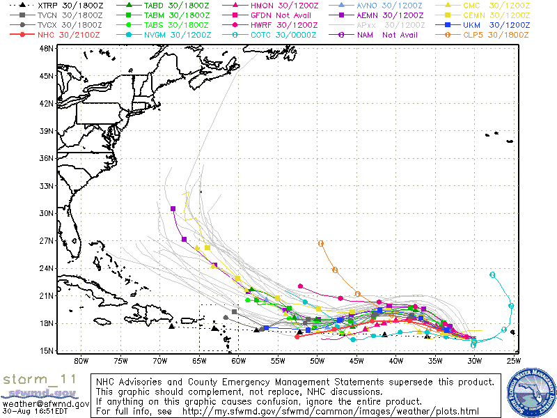
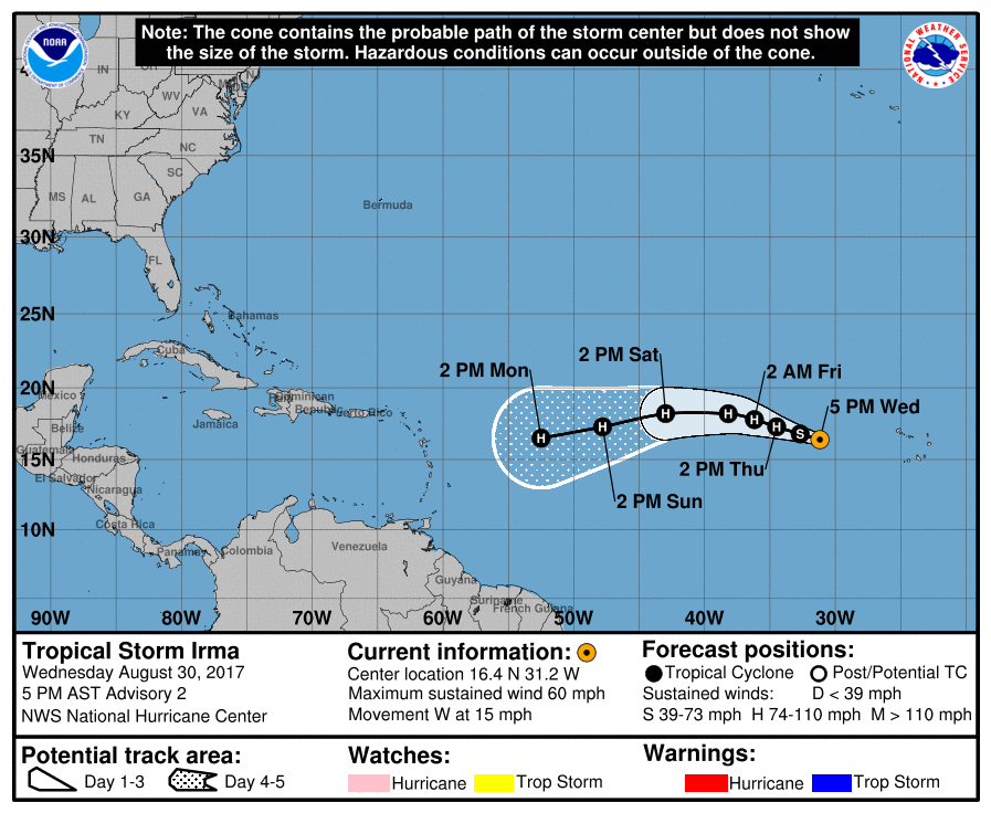
Tropical Storm Irma formed this afternoon, see above. It is in an area conducive for development and it is expected to become a hurricane tomorrow. Despite the fact that it is fairly far north, high pressure to its north is expected to deflect it to the SW, see above. Most of the models however still turn it away from South Florida into the Atlantic, (see below), however I am concerned that high pressure over the Atlantic could build to the west and it could potentially threaten Florida. It is way too early to make any accurate predictions at this time. Current weather patterns would move it to our east however weather is not static and in a week when it approaches the Caribbean things may be different. If it were to get south of Cuba I would be concerned with a landfall along the Florida Panhandle. We'll have to see how things progress over time but we're not out of the woods yet with this one.
Elsewhere Harvey is finally moving inland however has left historic rainfall in its wake. Areas around Houston have received up to 52" of rain and 46" have fallen in Beaumont, TX leaving behind devastating flooding. Two more waves over Africa will be emerging, like Irma did, over the next couple of days and will need to be watched as well. It generally takes about 10-14 days for storms to make it from the coast of Africa to our vicinity.
I'll probably write again on Friday, Matt.