Good morning,
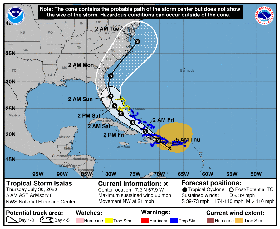
At 11 PM last night the National Hurricane Center finally felt they had found a center of circulation and tropical storm Isaias was named. Coordinates at that time were 15.8 N and 67.0 W. Looking at the coordinates from yesterday it was an exercise in futility with the NHC struggling to try to find a center of circulation. First it appeared to move strongly to the west, then back to the east, then down to the south and finally again back towards the north. It illustrated the difficulty in making a forecast on a system that does not exist. If the 11 PM, 2 AM, and 5 AM coordinates are accurate it appears that the storm may now be moving to the NW. Also of note is even though most of the convection has been in the Caribbean, most of its winds have been displaced well to the north east in the Atlantic. In light of this after it crosses Hispaniola we may see the remnants drawn further north and east. The current models are reflecting this possibility and now project it moving closer to the East Coast to Florida. If this occurred it would be good because, due to strong southwest shear, most of the weather is located well north east of the center and would therefore remain offshore. As it is almost impossible to determine what exactly its course was yesterday I am going to wait until this afternoon or evening before I write my forecast to see what actual motion it is taking.
Until then,
Matt