Good morning.
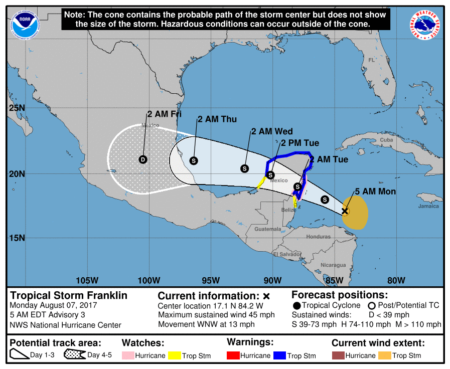
Just a quick update. TS Franklin formed overnight and is currently headed for the Yucatan Peninsula and Mexico. The NHC is forecasting it to be a 60-65 mph tropical storm at landfall. It is entering a low shear environment and currently has deep convection and I would not be surprised if it becomes a hurricane prior to landfall. Currently I anticipate landfall a little south of the NHC track above, into Northern Belize. It poses no threat to South Florida. Elsewhere surface low pressure over the Central Atlantic is currently interacting with a large upper level low north of Puerto Rico and is undergoing significant shear. The net affect of this interaction will be either it will be torn apart or deflected to the north. Both of which scenarios make a South Florida impact unlikely. There is nothng else out there at present. A low pressure area currently over Central Africa will emerge off the coast in about 4 days, this will be the next area that we'll need to watch.
Have a great week,
Matt.