Good morning.
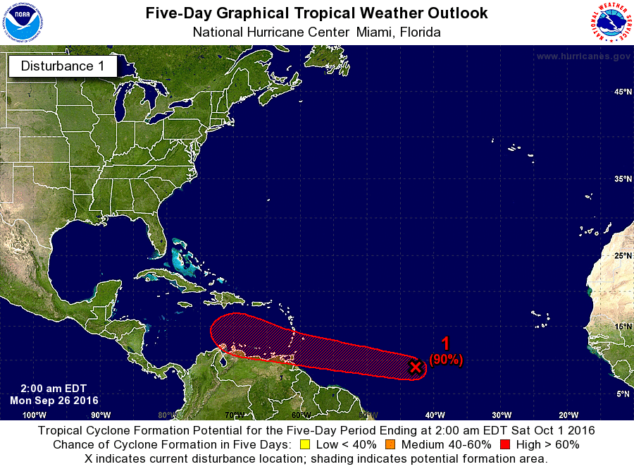
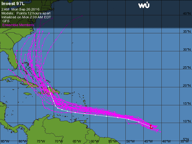
I am writing about a broad area of low pressure in the southern Central Atlantic which the NHC has labeled Invest 97L. It is currently located near 9 degrees N and 43 degrees W and is moving west at 15-20 mph. The NHC is giving it a 90% chance of tropical development in the next 5 d and it is forecast to enter the southern Caribbean Sea on Wednesday. It exited Africa a few days ago at around 9 degrees. In 5-7 days a frontal trough is forecast to stall over central Florida which if the system is far enough north would tend to turn it to the north. The NHC is currently forecasting it to turn sharply north in few day and pass to our east due to this front. It is currently quite far south and may even brush the north coast of South America, Venezuela, which would be very unusual. If it stays too far to the south it may not perceive the pressure weakness to its north in which case a course toward Central America or the Yucatan would be more likely. The pressure patterns around this system are quite complex. High pressure over Cuba, an upper level low over the Big Bend area of Florida and an approaching frontal system from the Mississippi Valley. Shear in the Caribbean is currently quite high as well.
Its too early to say much about this system at this time but we'll probably know more in a couple of days when it enters the Caribbean. I've attached some of the current models.
I'll let you know as things develop but I wouldn't be surprised at all if it takes the more southerly route.
Matt.

