Good evening.
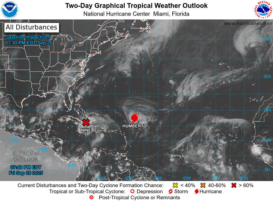
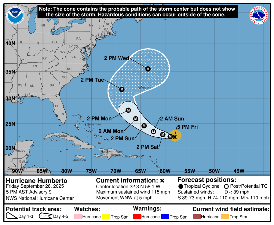
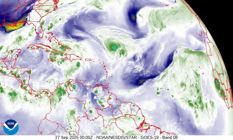
The last area of disturbed weather that I talked about has become H Humberto which is moving out to sea. A second area is showing signs of slow development and may be come TS Imelda tomorrow.
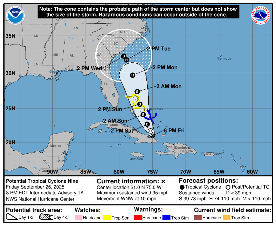
The weak frontal boundary that was over and just south of South Florida for the past 3 plus weeks has dissipated, however a new frontal system ,currently over north central Florida, is slowly moving SE and will likely replace it. This should help to protect Florida from potential Imelda however as it is still to our west it will allow the system to come closer, however it should still miss the state. The area at potential risk are the Coastal Carolinas, however I suspect that it will stall just off the coast and then move NE along the advancing front, out to sea.
Elsewhere a couple of weak waves are about to move off the coast of Africa which I'll be watching.
Until next time,
Matt.
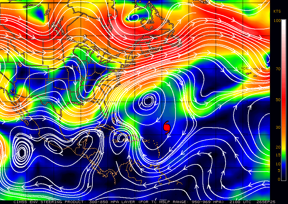
The last area of disturbed weather that I talked about has become H Humberto which is moving out to sea. A second area is showing signs of slow development and may be come TS Imelda tomorrow.
The weak frontal boundary that was over and just south of South Florida for the past 3 plus weeks has dissipated, however a new frontal system ,currently over north central Florida, is slowly moving SE and will likely replace it. This should help to protect Florida from potential Imelda however as it is still to our west it will allow the system to come closer, however it should still miss the state. The area at potential risk are the Coastal Carolinas, however I suspect that it will stall just off the coast and then move NE along the advancing front, out to sea.
Elsewhere a couple of weak waves are about to move off the coast of Africa which I'll be watching.
Until next time,
Matt.