Good morning.
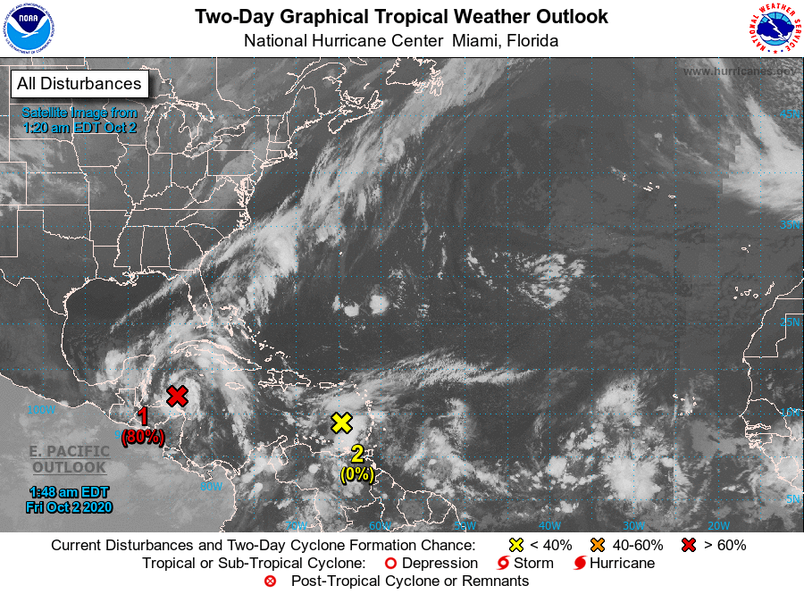
Things are starting to heat up again in the Tropics and as forecast the Western Caribbean Sea is the area to watch. There are 2 systems of note at present.
The first in the southwestern Caribbean is likely to become a tropical depression later today and make landfall on the Yucatan Peninsula before turning SW into the Bay of Campeche and dissipating.
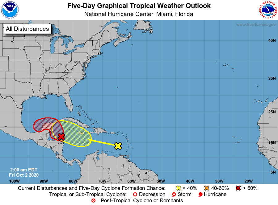
The second area is the one which we'll need to watch. If you look at the water vapor loop below you can see a cold front barely moving along the Big Bend area of Florida, with high SW shear aloft. The first system is too far south to feel it affects. If the system in the Eastern Caribbean gets far enough north by the time it enters the Western Caribbean it could be turned N and NE toward that front. The NHC is currently only giving it a 30% chance of development over the next 5 days. It currently has no organization in looking at the water vapor loop. If it should develop and get into the NW Caribbean a track toward the West Coast of Florida could happen with the current areas of greatest risk being between Ft Myers and Tampa.
Wind shear is extremely strong over Florida at present and unless it moves very rapidly NE it is unlikely to be a strong system. There is however a lot of hot water in the NW Caribbean.
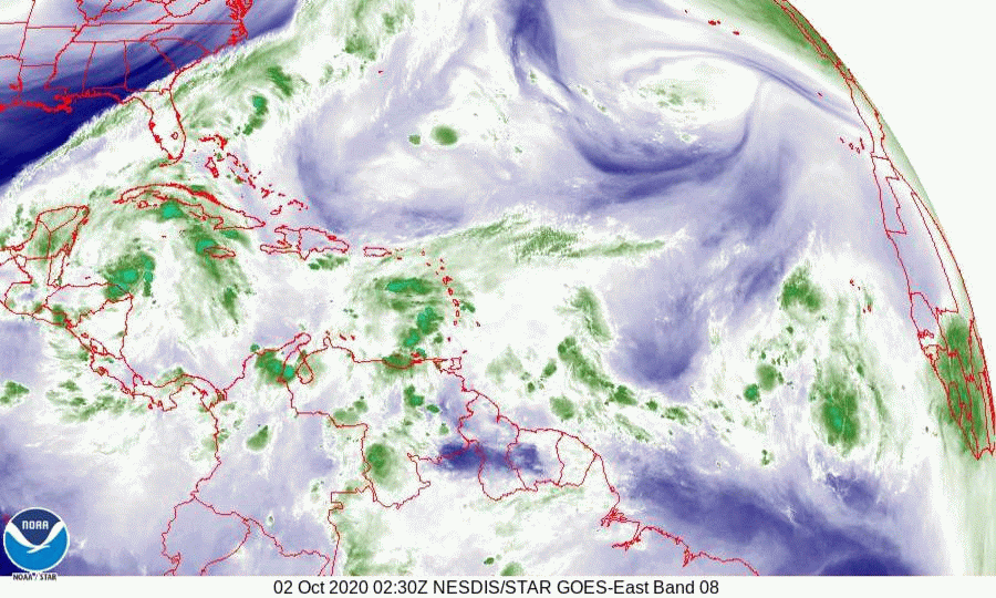
If you look at the IR image of Africa below you will notice the Inter-Tropical Convergence Zone over Africa with 4 systems lined up, notice that they are all below 10 degrees latitude. Tropical cyclones don't develop within 8 degrees of the equator due to the absence of spin. The Cape Verde season is almost over. It ends when the I T C Z moves south of 8 degrees latitude.
I'll continue to watch as things develop, or not.
Until next time,
Matt.
Things are starting to heat up again in the Tropics and as forecast the Western Caribbean Sea is the area to watch. There are 2 systems of note at present.
The first in the southwestern Caribbean is likely to become a tropical depression later today and make landfall on the Yucatan Peninsula before turning SW into the Bay of Campeche and dissipating.
The second area is the one which we'll need to watch. If you look at the water vapor loop below you can see a cold front barely moving along the Big Bend area of Florida, with high SW shear aloft. The first system is too far south to feel it affects. If the system in the Eastern Caribbean gets far enough north by the time it enters the Western Caribbean it could be turned N and NE toward that front. The NHC is currently only giving it a 30% chance of development over the next 5 days. It currently has no organization in looking at the water vapor loop. If it should develop and get into the NW Caribbean a track toward the West Coast of Florida could happen with the current areas of greatest risk being between Ft Myers and Tampa.
Wind shear is extremely strong over Florida at present and unless it moves very rapidly NE it is unlikely to be a strong system. There is however a lot of hot water in the NW Caribbean.
If you look at the IR image of Africa below you will notice the Inter-Tropical Convergence Zone over Africa with 4 systems lined up, notice that they are all below 10 degrees latitude. Tropical cyclones don't develop within 8 degrees of the equator due to the absence of spin. The Cape Verde season is almost over. It ends when the I T C Z moves south of 8 degrees latitude.
I'll continue to watch as things develop, or not.
Until next time,
Matt.