Good morning.
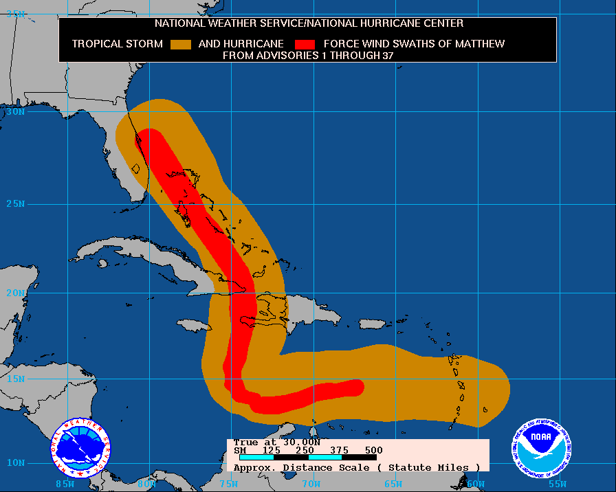
At 5 am Hurricane Matthew was located at 28.2 N & 80.0 W with a barometric pressure of 938 mbs and peak winds of 120 mph and was moving NNW @ 13 mph. It is currently about 25 miles offshore of the tip of Cape Canaveral and the western eye wall is just barely contacting the coast. Fortunately due to reasons noted in my 10/5/16 am forecast Matthew's actual track yesterday was about 30 miles east of the NHC's forecast track for yesterday morning. In light of this, as bad as things are and were yesterday, they would have been MUCH worse if Matthew had followed the forecast track.
From here Matthew is forecast to track parallel to the Florida coastline and then turn N and NE in response to a rapidly approaching front from the west. After that it may even loop back to re-threaten as a tropical storm??? (See forecast track below)
Miami-Dade had minimal weather yesterday. Sometimes its just better to be lucky.
My best to all, Matt.

