Good morning.
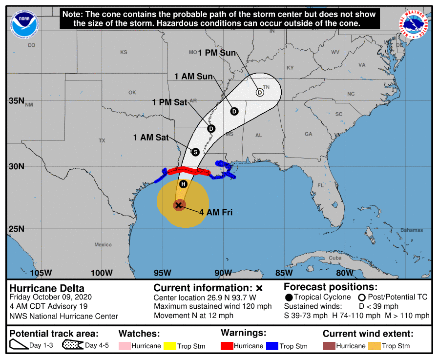
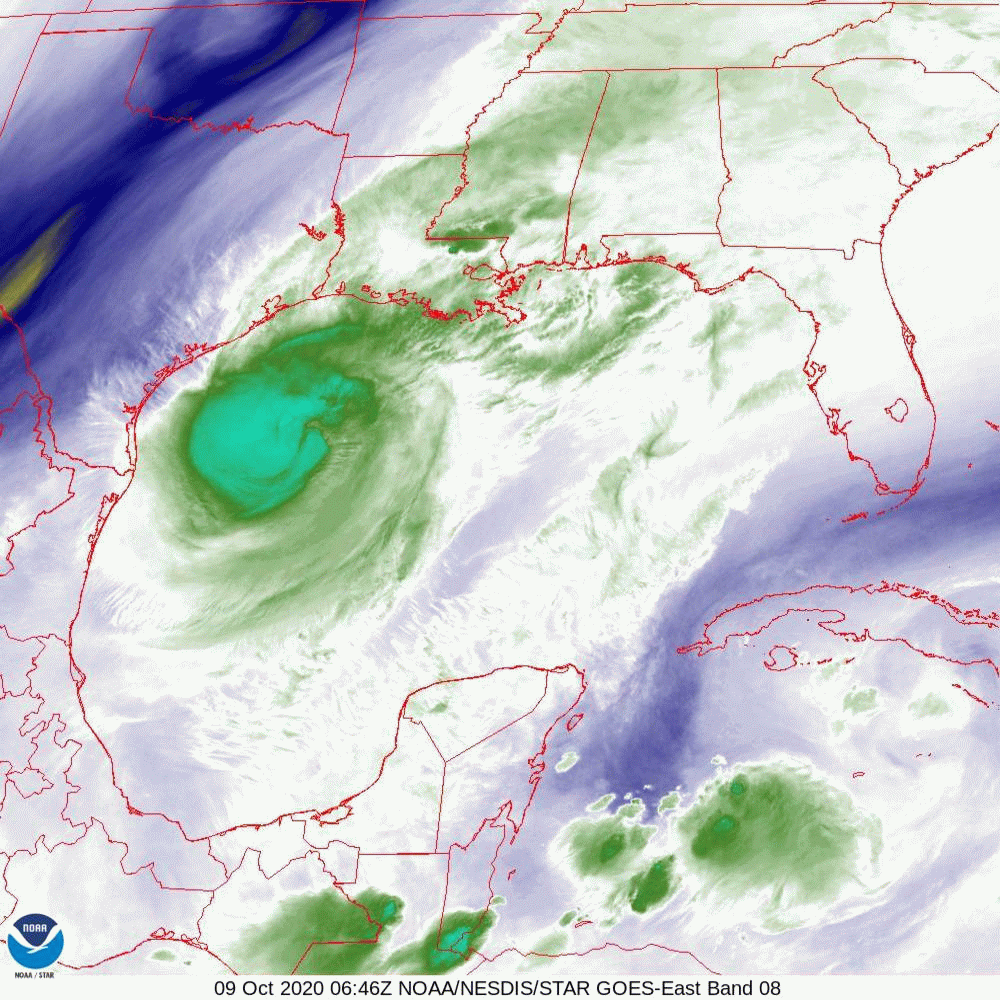
At 5 am Hurricane Delta was moving N @ 12 mph towards the SW Louisiana coastline. It is probably at its peak intensity now and gradual weakening prior to land fall is forecast due to increasing wind shear to its north and cooler waters. The NHC is currently calling for it to be a 100-110 mph Cat 2 at land fall. More likely peak sustained winds will be in the 90-100 mph range. If you look at the water vapor loop below you can see it starting to encounter SW shear.
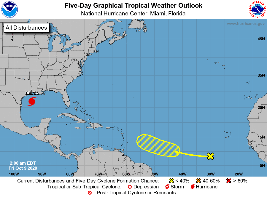
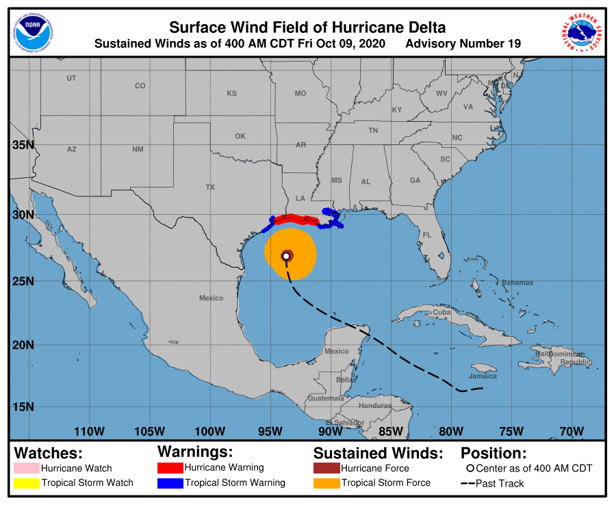
Delta currently has a 30 mile wide eye with hurricane force winds extending 35 miles to the east and 25 miles to the west of the center with strongest winds extending 20 miles from the center. If you look at the Wind Field diagram below, the dark orange area would have to pass over you to experience hurricane conditions. If you look at the Surface Map below you can see exactly where it is heading. It should make landfall around 9-10 pm tonight. You will also notice high pressure over Florida. This should protect the state both from Delta and the yellow X below.
If you look at the Sea Surface Temperature diagram below you can see how both Gamma and Delta have removed a lot of heat from the Western Caribbean. (Compare to prior diagrams, especially 10-2-20, 1 week ago. That is good.)
Until next time,
Matt.
At 5 am Hurricane Delta was moving N @ 12 mph towards the SW Louisiana coastline. It is probably at its peak intensity now and gradual weakening prior to land fall is forecast due to increasing wind shear to its north and cooler waters. The NHC is currently calling for it to be a 100-110 mph Cat 2 at land fall. More likely peak sustained winds will be in the 90-100 mph range. If you look at the water vapor loop below you can see it starting to encounter SW shear.
Delta currently has a 30 mile wide eye with hurricane force winds extending 35 miles to the east and 25 miles to the west of the center with strongest winds extending 20 miles from the center. If you look at the Wind Field diagram below, the dark orange area would have to pass over you to experience hurricane conditions. If you look at the Surface Map below you can see exactly where it is heading. It should make landfall around 9-10 pm tonight. You will also notice high pressure over Florida. This should protect the state both from Delta and the yellow X below.
If you look at the Sea Surface Temperature diagram below you can see how both Gamma and Delta have removed a lot of heat from the Western Caribbean. (Compare to prior diagrams, especially 10-2-20, 1 week ago. That is good.)
Until next time,
Matt.