Good morning.
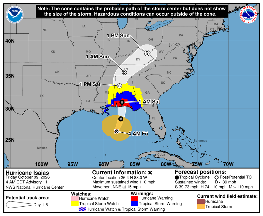
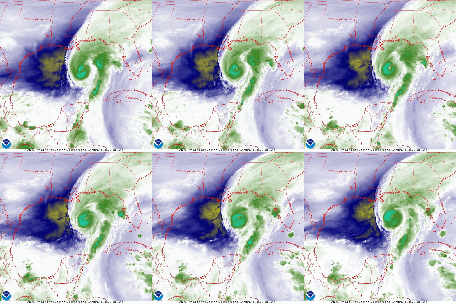
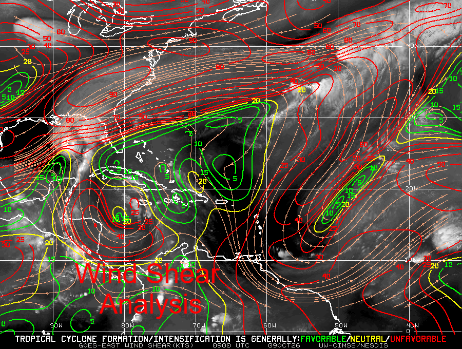
Hurricane Isaias is expected to make land fall tonight near or over Pensacola Bay. Peak sustained winds are currently 110 mph and it is anticipated to become a Cat 3 today however weakening is forecast to occur prior to landfall due to increasing shear as it moves northward. (see graphic below) It is still forecast to be a Cat 2 at landfall. I anticipate landfall at Avalon Blvd between Gulf Breeze and Midway FL over the Tiger Point Golf and Country Club. The Florida Panhandle will receive copious rain today with the main effects being storm surge and winds tonight. Hurricane force winds extend about 25 miles on each side of the center, strongest on the eastern side.
My best wishes to all in the path of this storm.
Until next time,
Matt.
Hurricane Isaias is expected to make land fall tonight near or over Pensacola Bay. Peak sustained winds are currently 110 mph and it is anticipated to become a Cat 3 today however weakening is forecast to occur prior to landfall due to increasing shear as it moves northward. (see graphic below) It is still forecast to be a Cat 2 at landfall. I anticipate landfall at Avalon Blvd between Gulf Breeze and Midway FL over the Tiger Point Golf and Country Club. The Florida Panhandle will receive copious rain today with the main effects being storm surge and winds tonight. Hurricane force winds extend about 25 miles on each side of the center, strongest on the eastern side.
My best wishes to all in the path of this storm.
Until next time,
Matt.