Good morning.
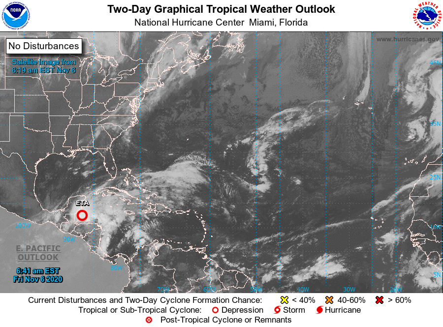
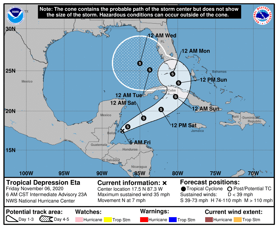
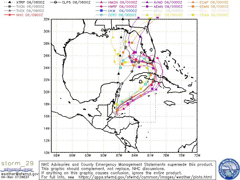
Tropical Depression Eta is currently located just east of Belize and is moving northward at 7 mph. Over night Eta has been moving north of where the NHC had anticipated it to be. At 11 pm their track took it further west passing near Dry Tortugas. The models at 2 am and 5 am have been shifting further east. We'll have to see if this trend continues or not. The keys will be, first when it starts to move NE as forecast and second how far east it gets before turning N and then NW due to an approaching front and cut off low which is expected to form in the Central Gulf of Mexico over the weekend. Extremely high shear exists north of Cuba and in particular over the Florida Straits and due to this Eta is not expected to become a hurricane again. In addition due to the high shear it is forecast to have a very large circulation with a lot of its weather displaced to the north and east of the center. The NHC is currently forecasting storm force winds to extend 150-200 to the NE of the center on Sunday and Monday.
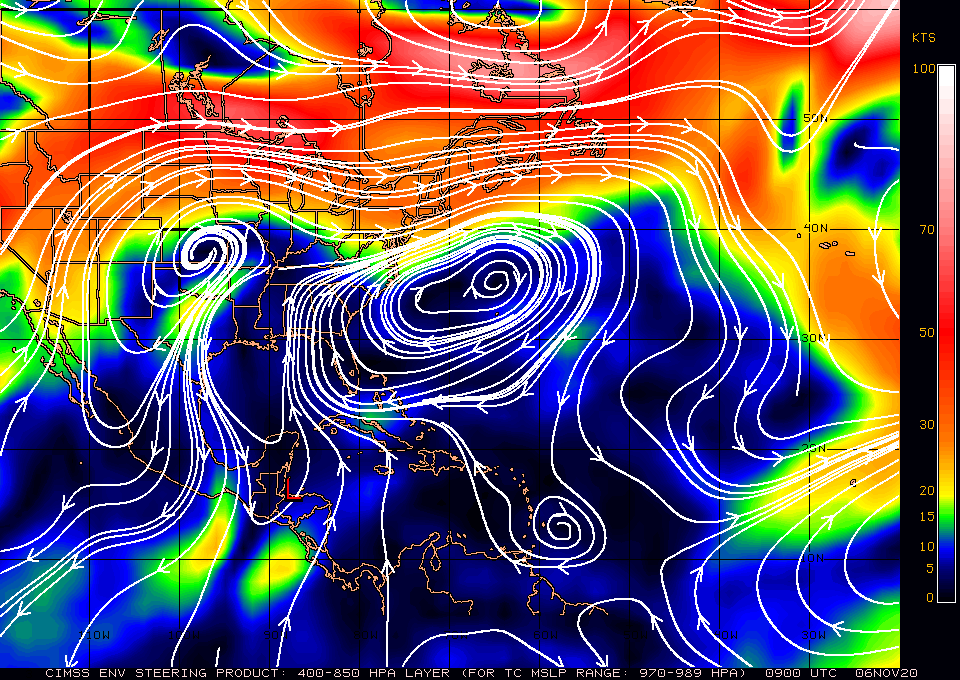
If you look at the surface map below you can see the Bermuda High extending over Florida with easterly surface flow through the Florida Straits. If you look at the water vapor loop, bottom graphic, you can see the very strong westerly winds aloft (shear) over the Straits as well.
My current track takes it across west central Cuba just south of Miami, then turning N, then NW then WNW through the Florida Straits passing close to the Lower Florida Keys. My track is south and west of the NHC's at present. On my track it would pass between 150-200 miles SW of Miami. Due to this South Florida may receive tropical storm conditions on Sunday and early Monday morning, most likely in the 40-50 mph range and should prepare accordingly; however it is still way to early to say for sure if we will have more or less. Due to its slow movement South Florida will likely receive a lot of rain.
After passing South Florida it will probably make landfall in NW Florida somewhere between the Panhandle and the Big Bend area of Florida late next week, hopefully as an even weaker system.
I'll write again tomorrow morning.
I currently do not anticipate hurricane conditions for Florida.
Until next time,
Matt.
PS. As it progresses we'll get a better idea as to just how much weather South Florida will receive.
Tropical Depression Eta is currently located just east of Belize and is moving northward at 7 mph. Over night Eta has been moving north of where the NHC had anticipated it to be. At 11 pm their track took it further west passing near Dry Tortugas. The models at 2 am and 5 am have been shifting further east. We'll have to see if this trend continues or not. The keys will be, first when it starts to move NE as forecast and second how far east it gets before turning N and then NW due to an approaching front and cut off low which is expected to form in the Central Gulf of Mexico over the weekend. Extremely high shear exists north of Cuba and in particular over the Florida Straits and due to this Eta is not expected to become a hurricane again. In addition due to the high shear it is forecast to have a very large circulation with a lot of its weather displaced to the north and east of the center. The NHC is currently forecasting storm force winds to extend 150-200 to the NE of the center on Sunday and Monday.
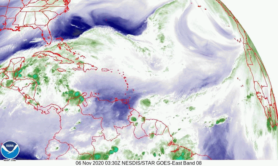
If you look at the surface map below you can see the Bermuda High extending over Florida with easterly surface flow through the Florida Straits. If you look at the water vapor loop, bottom graphic, you can see the very strong westerly winds aloft (shear) over the Straits as well.
My current track takes it across west central Cuba just south of Miami, then turning N, then NW then WNW through the Florida Straits passing close to the Lower Florida Keys. My track is south and west of the NHC's at present. On my track it would pass between 150-200 miles SW of Miami. Due to this South Florida may receive tropical storm conditions on Sunday and early Monday morning, most likely in the 40-50 mph range and should prepare accordingly; however it is still way to early to say for sure if we will have more or less. Due to its slow movement South Florida will likely receive a lot of rain.
After passing South Florida it will probably make landfall in NW Florida somewhere between the Panhandle and the Big Bend area of Florida late next week, hopefully as an even weaker system.
I'll write again tomorrow morning.
I currently do not anticipate hurricane conditions for Florida.
Until next time,
Matt.
PS. As it progresses we'll get a better idea as to just how much weather South Florida will receive.