Good morning.
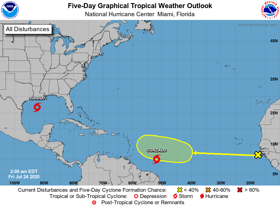
Since my last update on Tuesday both systems which I spoke about are now tropical storms however the overall forecast is really about the same.
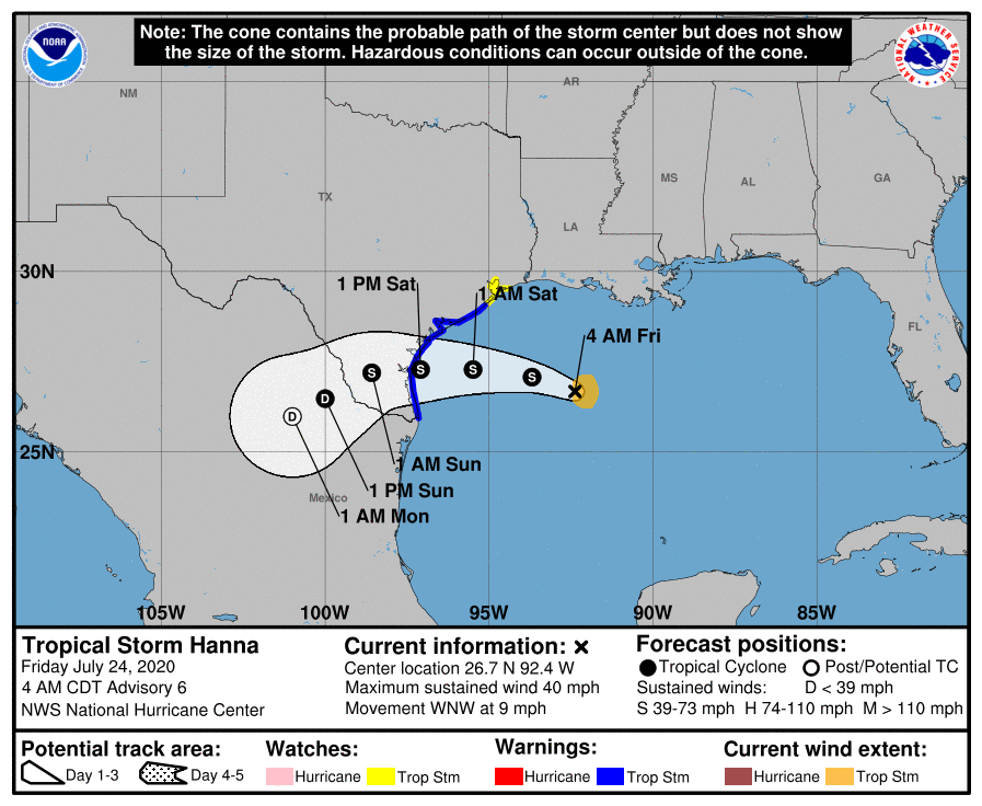
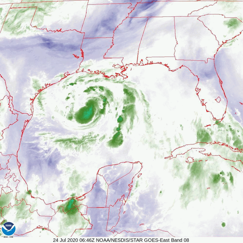
Hanna is currently in the west-central Gulf of Mexico and is heading toward SE Texas. It is forecast to make landfall Saturday afternoon as a 65 mph tropical storm. The primary affects should be heavy rainfall with tree damage. In looking at the Gulf of Mexico water vapor loop below you can see it heading slowly WNW with nothing in front of it to alter it's course.
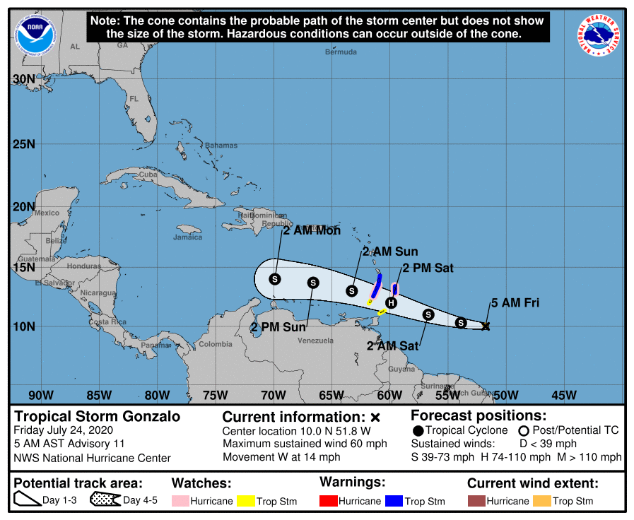
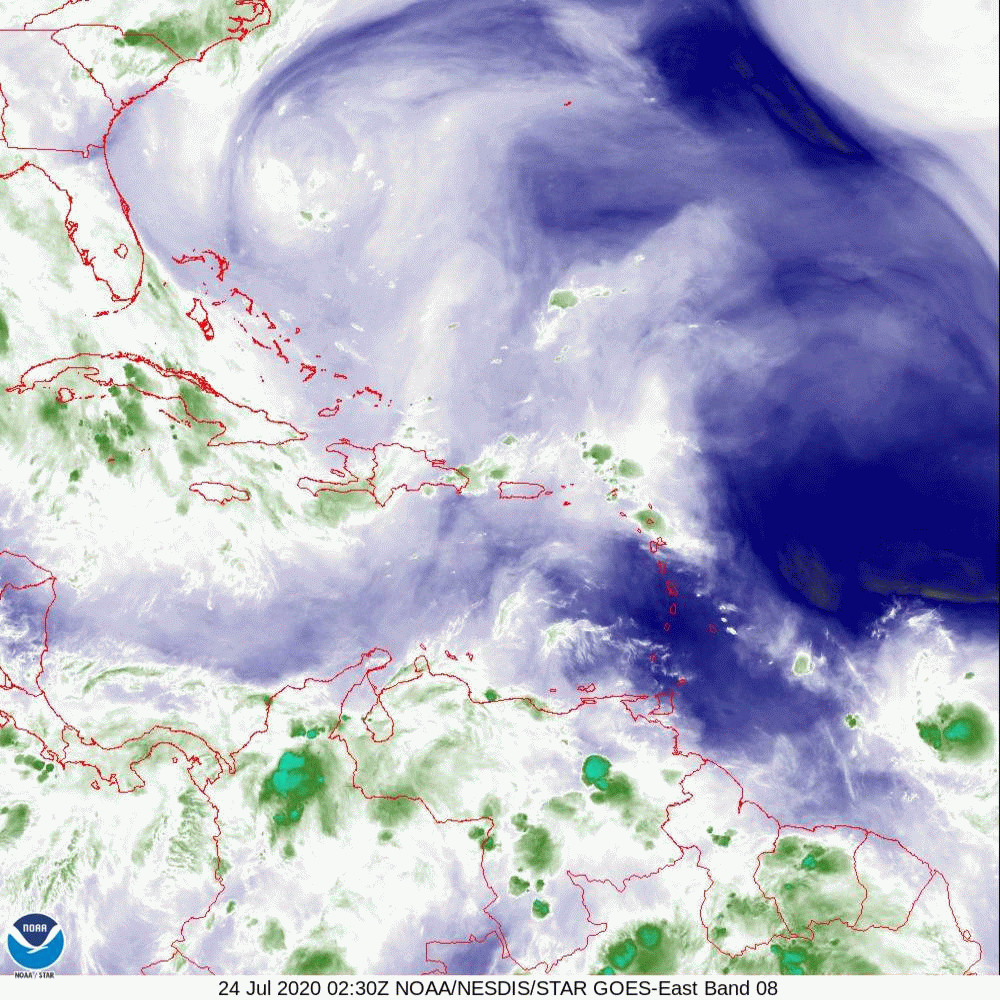
Gonzalo, a tiny storm with storm force winds currently extending only 20 miles from the center, continues to head in the general direction of Barbados / Grenada and Central America. If you look at the water vapor loop of the Caribbean below you will see SW shear north of Venezuela. Also look at the Saharan Air Layer Analysis, next to last diagram. Once it enters the Caribbean it will begin to encounter shear and dry air and dissipation is forecast in 4 days, before it reaches Central America.
The area which we'll need to watch is right off the coast of Africa. See bottom diagram. Note there is abundant dust and dry air in front of it and high shear currently over Florida which should hinder it. I'll be watching it but the current risk to Florida is low.
Until next time,
Matt.
Since my last update on Tuesday both systems which I spoke about are now tropical storms however the overall forecast is really about the same.
Hanna is currently in the west-central Gulf of Mexico and is heading toward SE Texas. It is forecast to make landfall Saturday afternoon as a 65 mph tropical storm. The primary affects should be heavy rainfall with tree damage. In looking at the Gulf of Mexico water vapor loop below you can see it heading slowly WNW with nothing in front of it to alter it's course.
Gonzalo, a tiny storm with storm force winds currently extending only 20 miles from the center, continues to head in the general direction of Barbados / Grenada and Central America. If you look at the water vapor loop of the Caribbean below you will see SW shear north of Venezuela. Also look at the Saharan Air Layer Analysis, next to last diagram. Once it enters the Caribbean it will begin to encounter shear and dry air and dissipation is forecast in 4 days, before it reaches Central America.
The area which we'll need to watch is right off the coast of Africa. See bottom diagram. Note there is abundant dust and dry air in front of it and high shear currently over Florida which should hinder it. I'll be watching it but the current risk to Florida is low.
Until next time,
Matt.