Good morning.
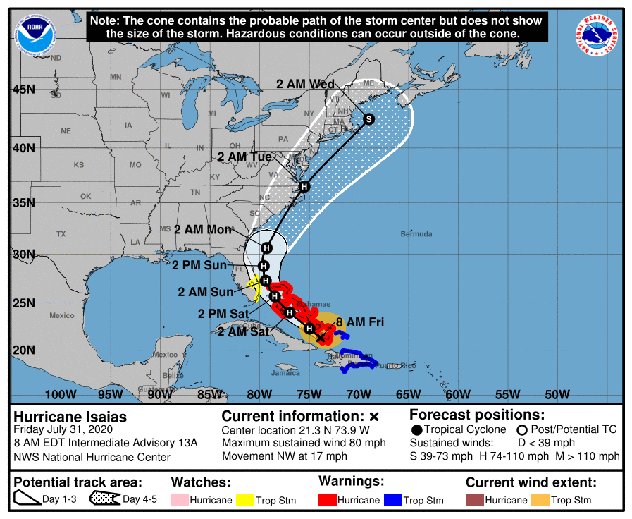
Overnight Isaias has moved WNW and is currently near the island of Great Inagua. Isaias is stronger than the NHC had originally forecast because the new eye that formed north of Hispaniola didn't have to cross the island, so it wasn't disrupted. The original one got wiped out. Additional strengthening is forecast today however once it gets east of the Florida peninsula shear is forecast to increase and gradual weakening is anticipated. The stronger it gets the further east it will tend to go.
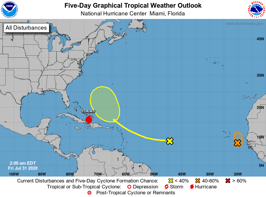
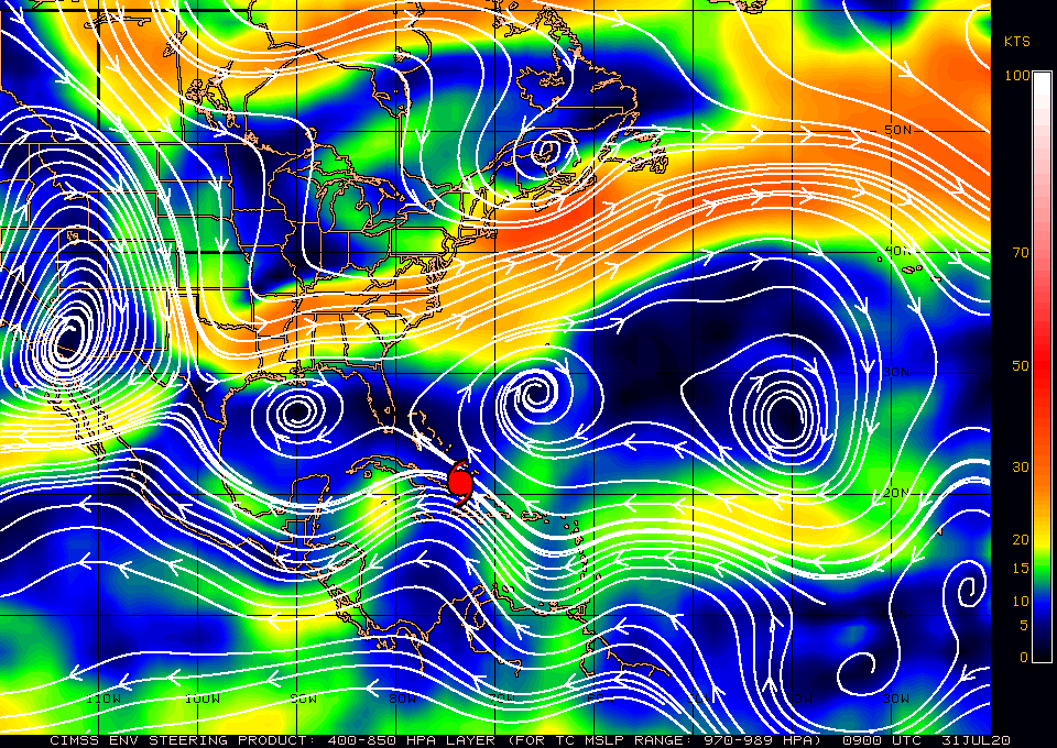
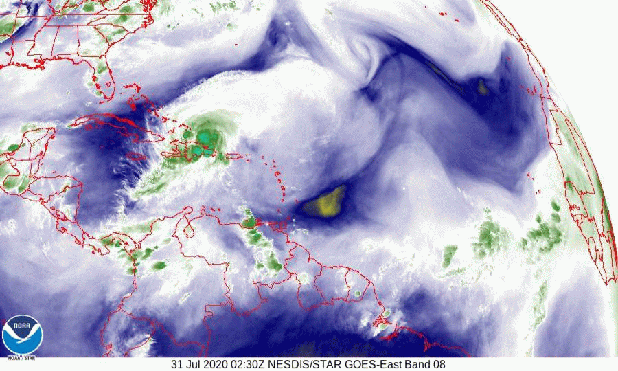
If you look at the surface map below you will see the isobar that it is on cross over the center of Grand Bahama Island. This is the track that it is currently on and my track is unchanged from yesterday. The NHC's track is now in close agreement. After 48 hours there is wide disparity in the models with a spread of over 700 miles. If you look at the water vapor loop below you will see a frontal boundary across the Mississippi Valley pushing eastward. (preceded by a blue line). The timing of this will be the key as to whether any of the US gets any significant weather. Hopefully it will continue to push east and steer Isaias out to sea. There is probably about a 60% chance of that happening, but we'll have to see. This feature will cause the storm to move N and eventually NE after it enters the Bahamas.
The current wind field to the NW, our side of the storm, is hurricane force winds 30 miles, strong storm force winds 80 miles and weak storm force winds 150 miles. Due to the forecast strengthening it is forecast to tighten up and when it is at closest approach tomorrow afternoon the wind field is forecast to be, hurricane force 20 miles, strong storm force 40 miles and weak storm force winds 80 miles. On its present track it is forecast to pass 140 east of the Miami area. Therefore winds should be in the 20s with gusts to the 30s, possibly 40 in a squall. I wouldn't anticipate much rainfall in the Miami area, possibly more towards the central and northern parts of the state.
I currently do not anticipate hurricane conditions for the state of Florida.
I'll write again tomorrow,
Matt.
Overnight Isaias has moved WNW and is currently near the island of Great Inagua. Isaias is stronger than the NHC had originally forecast because the new eye that formed north of Hispaniola didn't have to cross the island, so it wasn't disrupted. The original one got wiped out. Additional strengthening is forecast today however once it gets east of the Florida peninsula shear is forecast to increase and gradual weakening is anticipated. The stronger it gets the further east it will tend to go.
If you look at the surface map below you will see the isobar that it is on cross over the center of Grand Bahama Island. This is the track that it is currently on and my track is unchanged from yesterday. The NHC's track is now in close agreement. After 48 hours there is wide disparity in the models with a spread of over 700 miles. If you look at the water vapor loop below you will see a frontal boundary across the Mississippi Valley pushing eastward. (preceded by a blue line). The timing of this will be the key as to whether any of the US gets any significant weather. Hopefully it will continue to push east and steer Isaias out to sea. There is probably about a 60% chance of that happening, but we'll have to see. This feature will cause the storm to move N and eventually NE after it enters the Bahamas.
The current wind field to the NW, our side of the storm, is hurricane force winds 30 miles, strong storm force winds 80 miles and weak storm force winds 150 miles. Due to the forecast strengthening it is forecast to tighten up and when it is at closest approach tomorrow afternoon the wind field is forecast to be, hurricane force 20 miles, strong storm force 40 miles and weak storm force winds 80 miles. On its present track it is forecast to pass 140 east of the Miami area. Therefore winds should be in the 20s with gusts to the 30s, possibly 40 in a squall. I wouldn't anticipate much rainfall in the Miami area, possibly more towards the central and northern parts of the state.
I currently do not anticipate hurricane conditions for the state of Florida.
I'll write again tomorrow,
Matt.