Good afternoon.
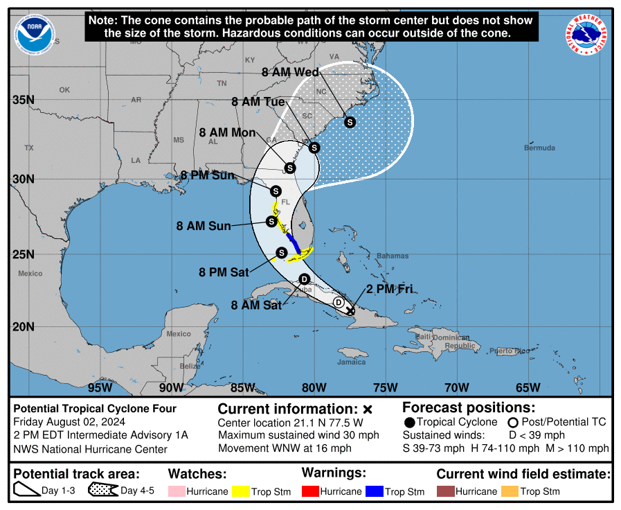
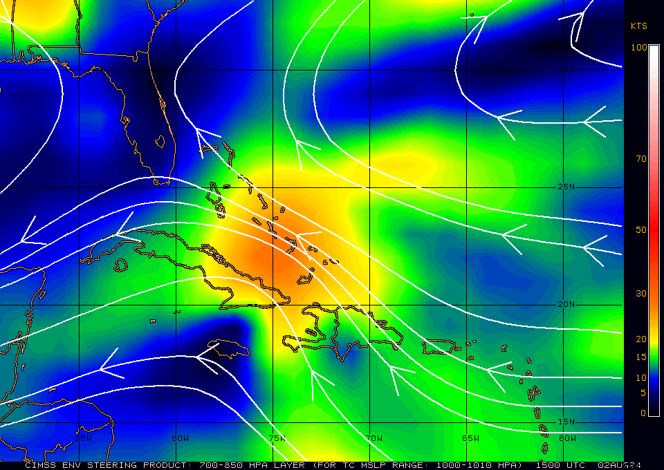
The tropical wave which I've been talking about the past few of days has just been named by the NHC as Potential Tropical Cyclone #4. It still has NOT developed however due to its proximity to Florida and its potential to become a tropical storm or hurricane with a possible landfall this weekend, the NHC is naming it so it can issue storm warnings. Little has changed since yesterday. It remains disorganized w/o a defined center of circulation. It is currently centered over Eastern and Central Cuba with associated shower activity both north and south of the island. It is expected to move over the Florida Straits tomorrow. Once offshore a depression is forecast to form tomorrow. It will be entering an area with very low wind shear, see Wind Shear Analysis diagram below, (Green is favorable for development, red is not.) and very warm sea surface temperatures. See yesterdays Sea Surface Temperatures diagram.
The NHC is currently forecasting it to be a 65 mph Tropical Storm at landfall in the Tampa Bay area on Sunday. With the highly favorable environment, rapid intensification will be possible however that cannot start until it becomes much better organized which should take some time. The longer it takes to develop the better. Likewise the sooner it makes landfall the better. It has potential to be anything from strong tropical wave to a significant hurricane. The NHC is expecting it not to have enough time to get it act together prior to landfall. We'll cross our finger. The good new is that it is not a depression nor tropical storm at this time. Thanks to all the dry air that it had to stave off on its way across the Atlantic.
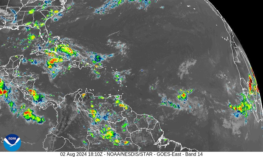
If you look at the Water Vapor Loop below you can see a cold front moving southeastward into the SE US. This is what will prevent it from moving too far west and ultimately move it off towards the NE.
Miami-Dade County should see passing showers tomorrow with winds 15-20 mph, higher in gusts with showers. The NWS is currently forecasting 1-2" of rain tomorrow. If a depression forms possibly 2-4".
I'll be writing again tomorrow.
Until next time,
Matt.
The tropical wave which I've been talking about the past few of days has just been named by the NHC as Potential Tropical Cyclone #4. It still has NOT developed however due to its proximity to Florida and its potential to become a tropical storm or hurricane with a possible landfall this weekend, the NHC is naming it so it can issue storm warnings. Little has changed since yesterday. It remains disorganized w/o a defined center of circulation. It is currently centered over Eastern and Central Cuba with associated shower activity both north and south of the island. It is expected to move over the Florida Straits tomorrow. Once offshore a depression is forecast to form tomorrow. It will be entering an area with very low wind shear, see Wind Shear Analysis diagram below, (Green is favorable for development, red is not.) and very warm sea surface temperatures. See yesterdays Sea Surface Temperatures diagram.
The NHC is currently forecasting it to be a 65 mph Tropical Storm at landfall in the Tampa Bay area on Sunday. With the highly favorable environment, rapid intensification will be possible however that cannot start until it becomes much better organized which should take some time. The longer it takes to develop the better. Likewise the sooner it makes landfall the better. It has potential to be anything from strong tropical wave to a significant hurricane. The NHC is expecting it not to have enough time to get it act together prior to landfall. We'll cross our finger. The good new is that it is not a depression nor tropical storm at this time. Thanks to all the dry air that it had to stave off on its way across the Atlantic.
If you look at the Water Vapor Loop below you can see a cold front moving southeastward into the SE US. This is what will prevent it from moving too far west and ultimately move it off towards the NE.
Miami-Dade County should see passing showers tomorrow with winds 15-20 mph, higher in gusts with showers. The NWS is currently forecasting 1-2" of rain tomorrow. If a depression forms possibly 2-4".
I'll be writing again tomorrow.
Until next time,
Matt.