Good morning.
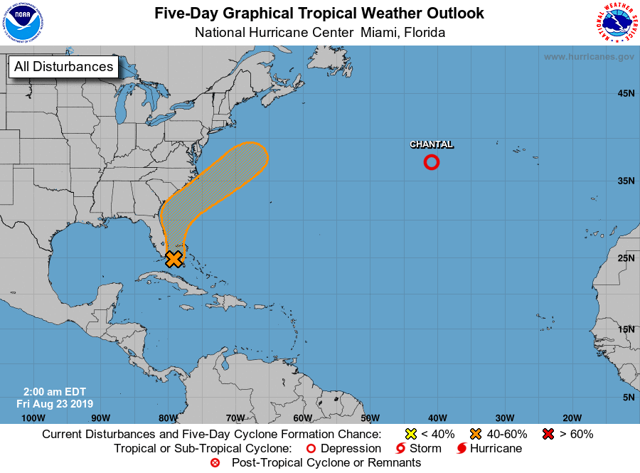
I'm writing this morning about a weak area of low pressure currently located midway between Andros Island and Miami. If you look at local radar you can see it. It is currently moving slowly northward. It is in a low shear environment and the NHC is giving it a 60% chance of tropical development over the next 5 days. Most of it's associated weather is NE of the center. The good news is that it will probably miss the US. Sea surface temperatures under it are quite warm and I believe development is likely but like Chantal it will probably only be an issue for mariners. South Florida will see some passing showers today in association with it. It should move out of South Florida waters by tomorrow.
Elsewhere all remains quiet with abundant Saharan dust and dry air over much of the tropical Atlantic, though some signs of its erosion are now evident. In a couple of weeks things may be different.
I'll keep you posted.
Have a great weekend,
Matt.