Good morning.
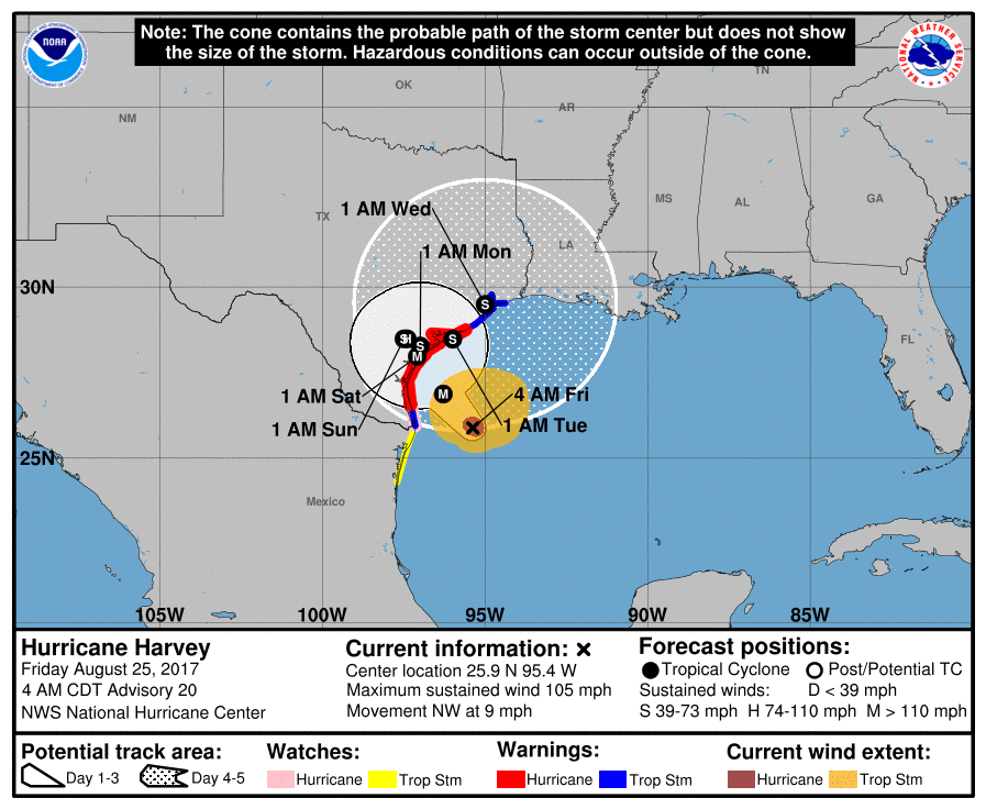
Hurricane Harvey this morning is intensifying and headed toward coastal Texas. The NHC is currently forecasting a landfall tonight just north of Corpus Christi, however radar images this am suggest a move a little more northward and my current track brings it onshore over Matagorda Island & Peninsula near Seadrift, Port Lavaca and Victoria. Though intense Harvey is a compact storm with Hurricane force winds only extending about 20 miles from the center. At landfall they are forecast to extend 30 miles to the NW and 20 to the SW. Steering forces are weak and it is forecast to slow down and meander as it approaches land, see above. Hopefully its meandering will occur over land and not immediately offshore which would be devastating. In addition to wind due to slow movement it will be a major rain event with areas with over 2 feet of rain forecast.
Closer to home an area of low pressure just off the SW Florida coast is forecast to drift NE over the peninsula this weekend. Shear overhead and land interaction should prevent any development until it is past Florida. Some development is possible after it emerges into the Atlantic as it moves away from shore. Expect enhanced shower activity this weekend in South Florida from this system.
Wishing my best to Texas, Matt.