Good morning.
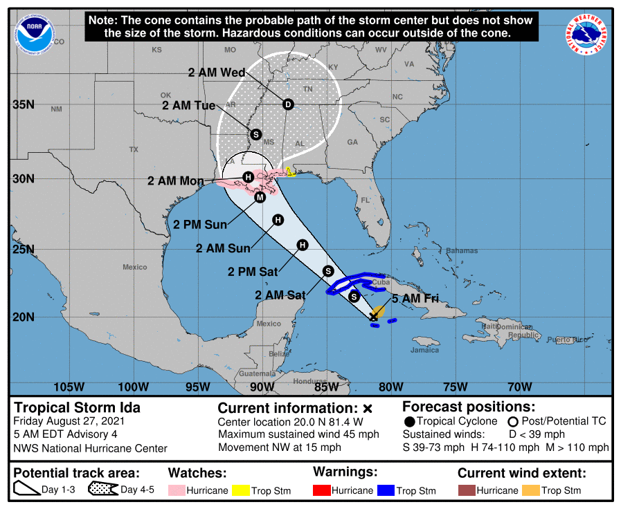
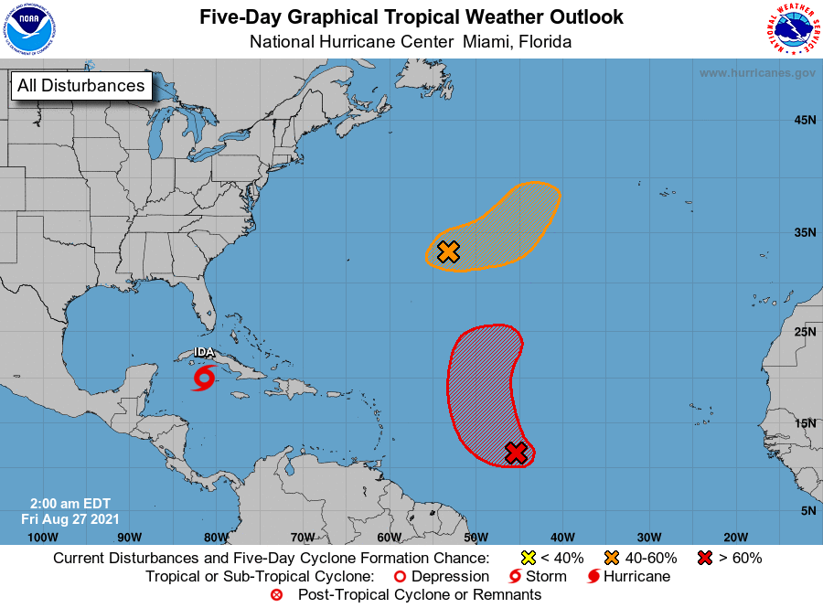
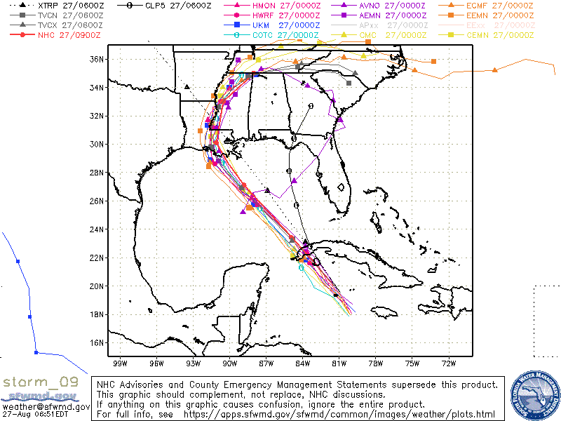
Just a brief update. Florida currently appears to be okay however it looks like Louisiana is going to get another hurricane possibly a major one. If you look at the models below they have become focused on Louisiana.
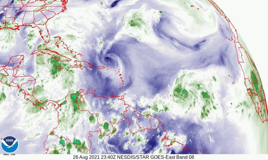
If you look at the Water Vapor Loop below you will notice an upper level low just south of Mississippi moving slowly westward. This was the same ULL that was just off the SE FL coast 2 d ago. Just where it is on Sunday may have a significant influence on just where Ida goes. If it is just to the west of it, it will tend to deflect her eastward, conversely if it remains to its east a more westerly track. If it is not close enough to affect it, it would tend to proceed straight in the direction that it is currently headed which would be towards Lake Charles, Louisiana.
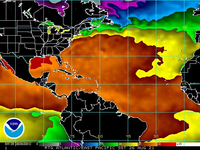
After it enters the Gulf of Mexico it will be entering an area of low shear and very warm water, (see Wind Shear Analysis and SSTs below) and rapid intensification is possible. The NHC is currently forecasting it to be a Cat 3 115 mph hurricane at landfall. It could even be more but hopefully will run out of time before it gets a chance.
I'll try to put out an update tomorrow evening when we should know more.
Until next time,
Matt.
Just a brief update. Florida currently appears to be okay however it looks like Louisiana is going to get another hurricane possibly a major one. If you look at the models below they have become focused on Louisiana.
If you look at the Water Vapor Loop below you will notice an upper level low just south of Mississippi moving slowly westward. This was the same ULL that was just off the SE FL coast 2 d ago. Just where it is on Sunday may have a significant influence on just where Ida goes. If it is just to the west of it, it will tend to deflect her eastward, conversely if it remains to its east a more westerly track. If it is not close enough to affect it, it would tend to proceed straight in the direction that it is currently headed which would be towards Lake Charles, Louisiana.
After it enters the Gulf of Mexico it will be entering an area of low shear and very warm water, (see Wind Shear Analysis and SSTs below) and rapid intensification is possible. The NHC is currently forecasting it to be a Cat 3 115 mph hurricane at landfall. It could even be more but hopefully will run out of time before it gets a chance.
I'll try to put out an update tomorrow evening when we should know more.
Until next time,
Matt.