Good morning.
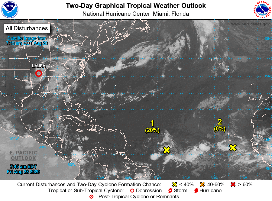
Laura made landfall early yesterday morning as a strong Cat 4 with 150 mph winds and a barometric pressure of 937 mbs, just east of the Texas - Louisiana state line in the region of Cameron, LA. Our thoughts are with those who live in that area, having been through that ourselves.
Elsewhere in the tropical there are a couple of weak systems what I'm watching though none currently pose a threat to Florida. High pressure over the Central Bahamas just east of South Florida should protect most of the state except the Panhandle, see surface map below. Dry air over the western tropical Atlantic and the Caribbean should help us as well.
The main area of concern is Africa where you can see on Infra Red image an active pipeline of storms moving across tropical Africa. These will become the ones to watch over the next 1 - 2 weeks as we approach the peak of hurricane season.
Until next time, Matt.