Good morning.
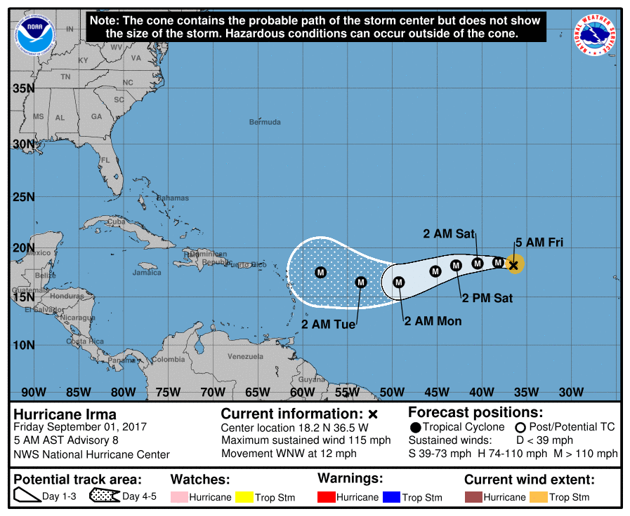
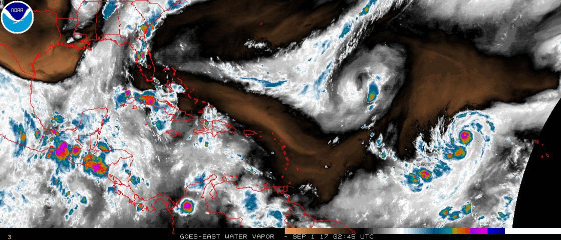
At 5 am Hurricane Irma was moving WNW @ 12 mph, see above, first diagram. Yesterday am the models of Irma were trending southward however due to steady WNW motion over the past 24 hours they are now trending northward which may be good news for us all. An upper level low in front of Irma is moving SW, (see above, second diagram, Water Vapor Loop) which could shift her slightly more northward. The key will be if Irma enters the Caribbean or not. Yesterday it was looking likely, today that is not the case. If Irma stays north of the Caribbean a track through or near the Bahamas followed by a turn to the N and then NE near or along the Coastal Carolinas, hopefully missing the US, would be more likely. If it enters the Caribbean a track toward the NE Gulf Coast would be more likely.
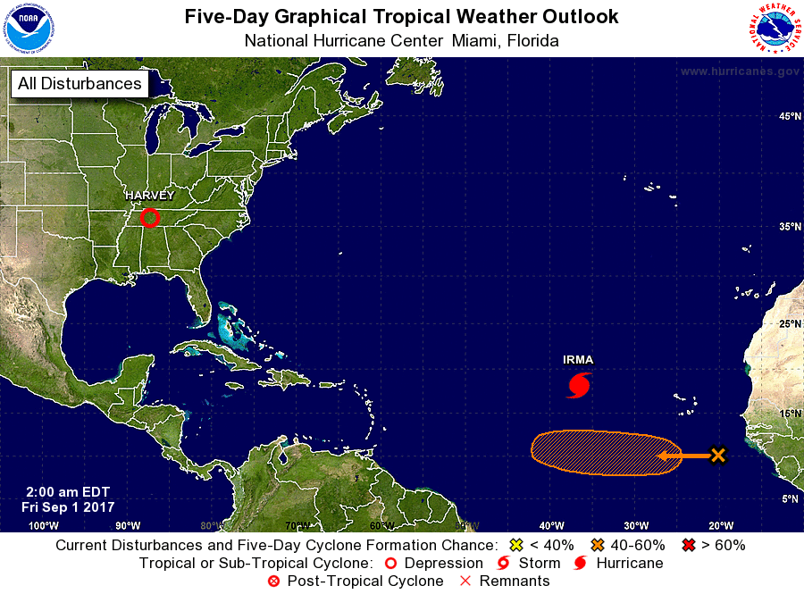
Elsewhere in the tropics one of the other Tropical Waves over Africa has emerged off the coast. see below. This one is significantly lower that Irma, about 10 degrees and has a much greater chance of getting into the Caribbean. This is the one we'll really need to keep an eye on. It is almost 2 weeks away and the weather patterns will certainly change by then. We'll just have to see.
*** FYI waves coming off of Africa between 10 and 12 degrees N latitude are the ones which pose the greatest potential threat to South Florida. Those are the ones with the greatest chances of getting into the Caribbean and getting south of us. Note due to the Coriolis Effect all storms want to move north. They only move in other directions when something is preventing them from moving north. ***
Have a good weekend and I'll keep you posted. Matt.
At 5 am Hurricane Irma was moving WNW @ 12 mph, see above, first diagram. Yesterday am the models of Irma were trending southward however due to steady WNW motion over the past 24 hours they are now trending northward which may be good news for us all. An upper level low in front of Irma is moving SW, (see above, second diagram, Water Vapor Loop) which could shift her slightly more northward. The key will be if Irma enters the Caribbean or not. Yesterday it was looking likely, today that is not the case. If Irma stays north of the Caribbean a track through or near the Bahamas followed by a turn to the N and then NE near or along the Coastal Carolinas, hopefully missing the US, would be more likely. If it enters the Caribbean a track toward the NE Gulf Coast would be more likely.
Elsewhere in the tropics one of the other Tropical Waves over Africa has emerged off the coast. see below. This one is significantly lower that Irma, about 10 degrees and has a much greater chance of getting into the Caribbean. This is the one we'll really need to keep an eye on. It is almost 2 weeks away and the weather patterns will certainly change by then. We'll just have to see.
*** FYI waves coming off of Africa between 10 and 12 degrees N latitude are the ones which pose the greatest potential threat to South Florida. Those are the ones with the greatest chances of getting into the Caribbean and getting south of us. Note due to the Coriolis Effect all storms want to move north. They only move in other directions when something is preventing them from moving north. ***
Have a good weekend and I'll keep you posted. Matt.