Good morning.
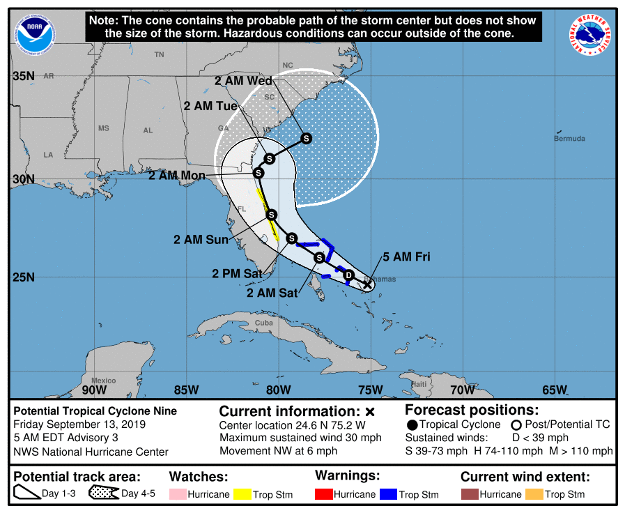
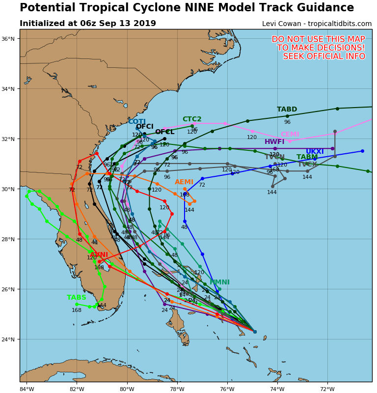
Potential Tropical Cyclone #9 still lacks a center of circulation though the NHC is forecasting it to become a tropical depression later today. The system is centered presently approximately 60 miles to the east and north of where the NHC had projected it to be at this time yesterday. In light of this all of the models have shifted to the N and E. See bottom diagram. The NHC track has it potentially threatening the Space Coast on Sunday however please note that until a defined center of circulation is established any projections could be subject to significant change if the center happens to develop significantly displaced from where they are estimating it to be now.
An additional significant factor in the shift is that it is moving slower than anticipated yesterday. This will allow an approaching cold front presently over the Mississippi Valley to move far enough SE to eventually push it out to sea. My present track keeps it offshore avoiding a US landfall. If that occurs it could become a stronger system due to the lack of land interaction. It will likely bring more rain to the Bahamas but without significant wind. This could be good as it will give them an opportunity to collect rainwater as Great Abaco's and Grand Bahama's fresh water supply was severely compromised by Dorian. It could also help to leach some of the salt out of the soil.
South Florida will see some passing showers the next 2 days due to the SW upper level flow due to the upper level low in the Gulf of Mexico. South Florida should see little if any direct effects from this system.
Until next time, Matt.