Good morning.
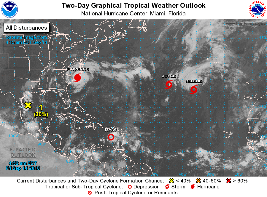
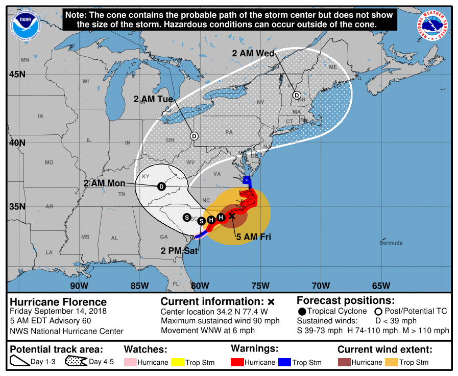
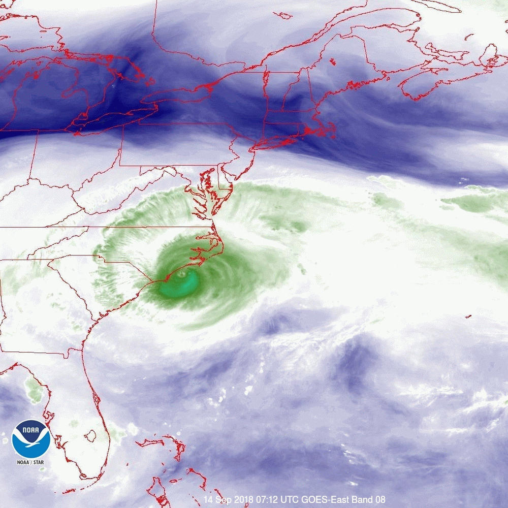
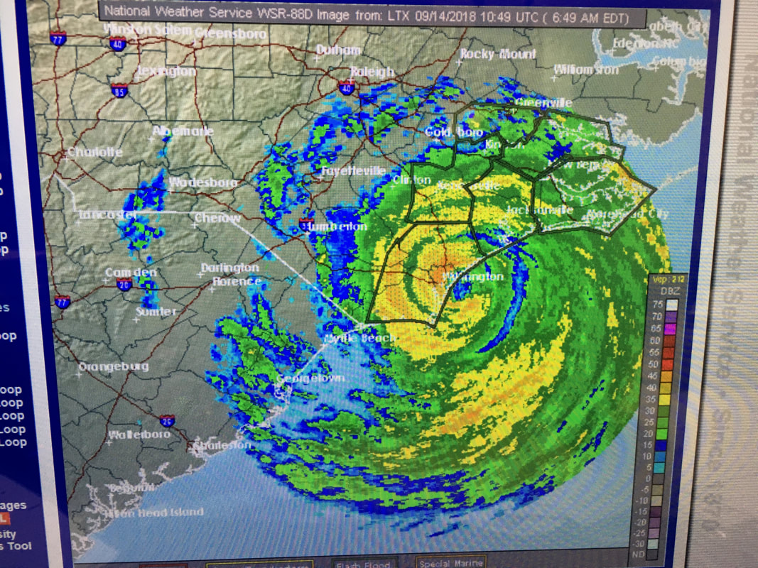
At 6 am Florence was located at 34.2 N & 77.6 W. Florence is making landfall now between Wilmington and Porters Neck NC. The eye, which is about 20 miles wide, should pass over both areas with highest potential winds in the Porters Neck area. So far the highest sustained wind recorded has been 83 mph at Cape Look Out, NC in the Outer Banks. This may be surpassed this am in the Wilmington area. Gusts will be higher. After coming on shore it is expected to drift slowly SW over land. This is relatively good news, compared to if it had remained just offshore, as it should continue to weaken. Florence is making landfall, as projected yesterday, as a Cat 1 hurricane however due to the duration of the event and copious rainfall it is still going to cause a lot of damage, especially to trees and areas along the coast that receive storm surge. It is going to be a long weekend for the Carolinas.
Elsewhere, Isaac, due to dry air and shear, has been downgraded to a tropical depression and the NHC is forecasting dissipation within the next 1-3 d. Hopefully it will not regenerate after it reaches the western Caribbean however it should remain well south of Florida.
All else is quiet on the Eastern Front.
Until next time, Matt.
PS. For what its worth the NHC did an outstanding job in forecasting Florence's track. In looking back over my posts for this storm they've had the Wilmington area as the center of their track for the past 5 days.