Good morning.
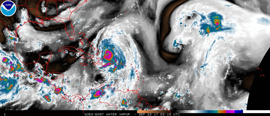
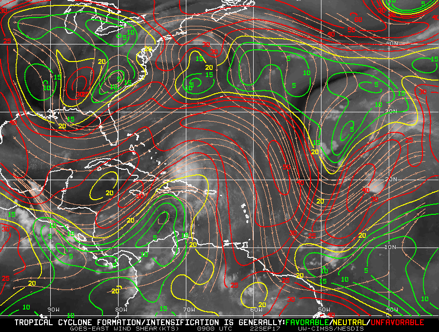
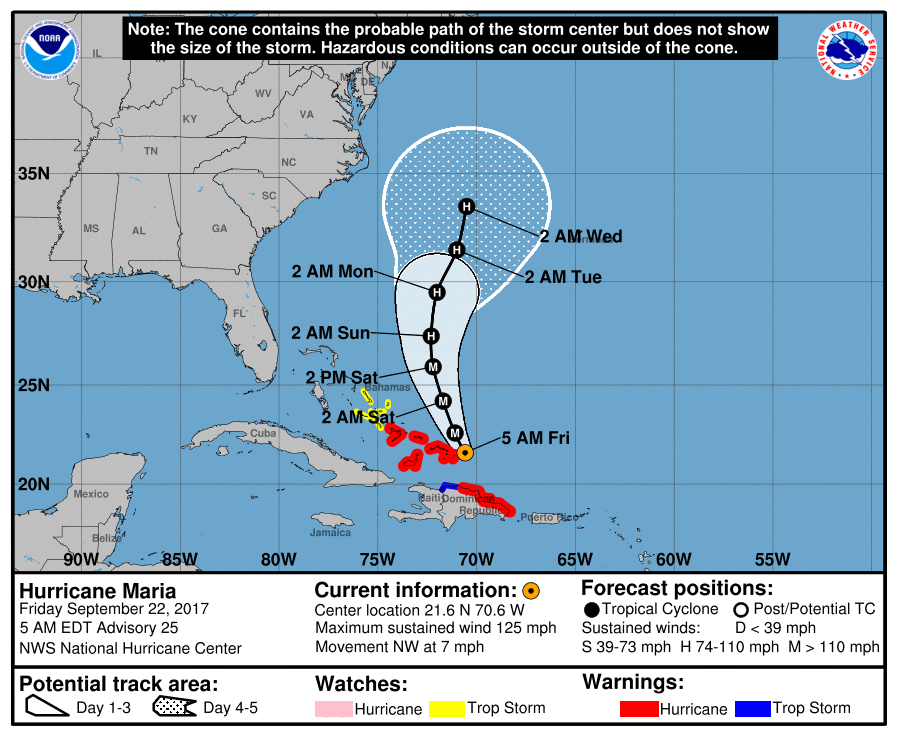
At 5 am Hurricane Maria was located just east of Grand Turk Island. It is moving NW and tomorrow it should start to turn toward the N and then NE, see NHC forecast track above. High pressure over Florida should keep it away from the state, see Water Vapor Loop below. It is currently starting to encounter significant shear, see Wind Shear Analysis, bottom diagram - everything red is unfavorable for development. Pressures are rising and it is starting to weaken. This trend should continue. Notice how its signature on the Water Vapor Loop is becoming less impressive and lopsided.
Unless things change I may not write further about Maria.
Elsewhere all is quiet on the eastern front.
Until next time, Matt.