Good morning.
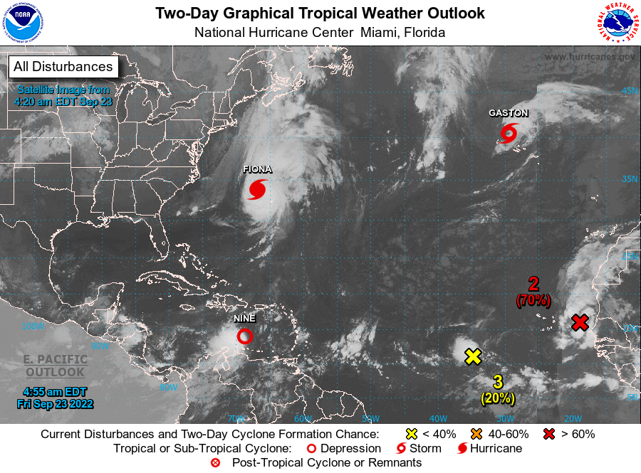
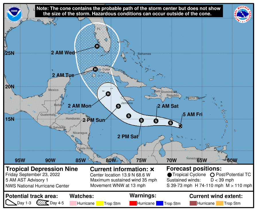
Overnight there have been some significant changes. Most importantly a big burst of convection leading to an earlier than expected development of a depression which will likely become TS Hermine. If you look at the Surface Map below you will see that high pressure over Texas is starting to move east. Next notice the forecast surface maps for 3 days and 7 days. A frontal boundary is forecast to stall over South-Central Florida in the Ft Myers area in 3 d and then start to drift north and is expected to be in the Tampa area in 7 days, when Hermine should be approaching the West Coast of Florida. Where exactly this frontal boundary is when Hermine approaches will be key as the storm will likely be drawn towards it regardless of how far west it goes. A Florida landfall is looking likely and at present the Tampa Bay area appears to be at greatest risk. Dry air over the Gulf of Mexico and Florida will hopefully limit intensity however at present the NHC is forecasting it to be a Cat 2 storm at landfall.
Until next time,
Matt.