Good morning.
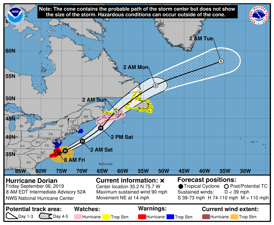
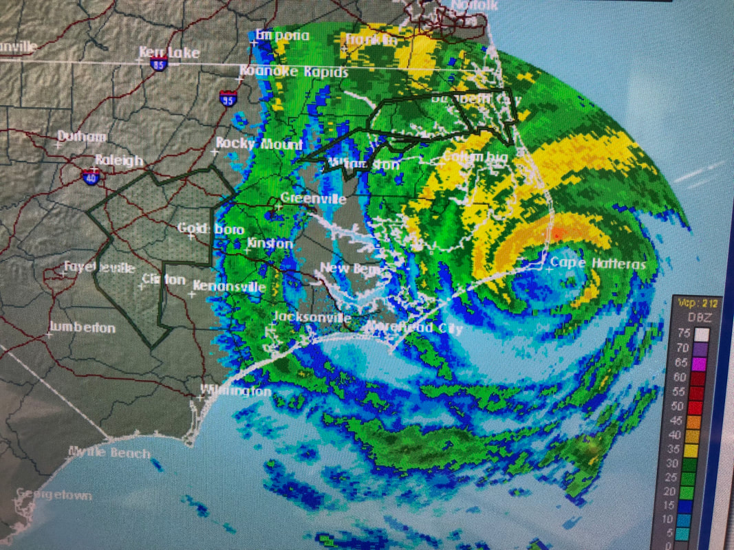
At 8 am Dorian was clipping the Outer Banks with the eye currently right over Cape Hatteras. See radar below. Peak winds so far have been in the 70s due to a forward of 14 mph. It will be moving out to sea over then next couple of hours and will lead to storm conditions over Nova Scotia and Newfoundland over the weekend.
Elsewhere there is a wave which came off of Africa on Wednesday, the one I'd spoken about over a week ago which we'll need to watch. Fortunately we have blocking high pressure to our east. Unless it should get south of Cuba, we should be okay with that one.
Until next time, Matt.