Good morning.
Things are heating up in the tropics and there have been a few changes.
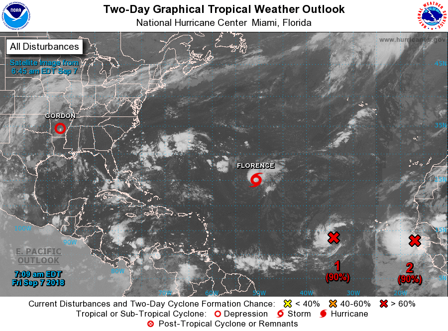
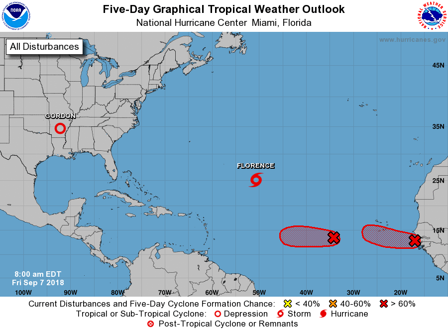
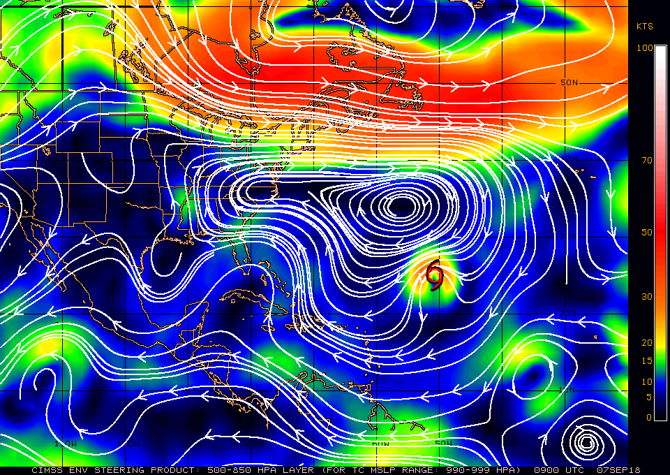
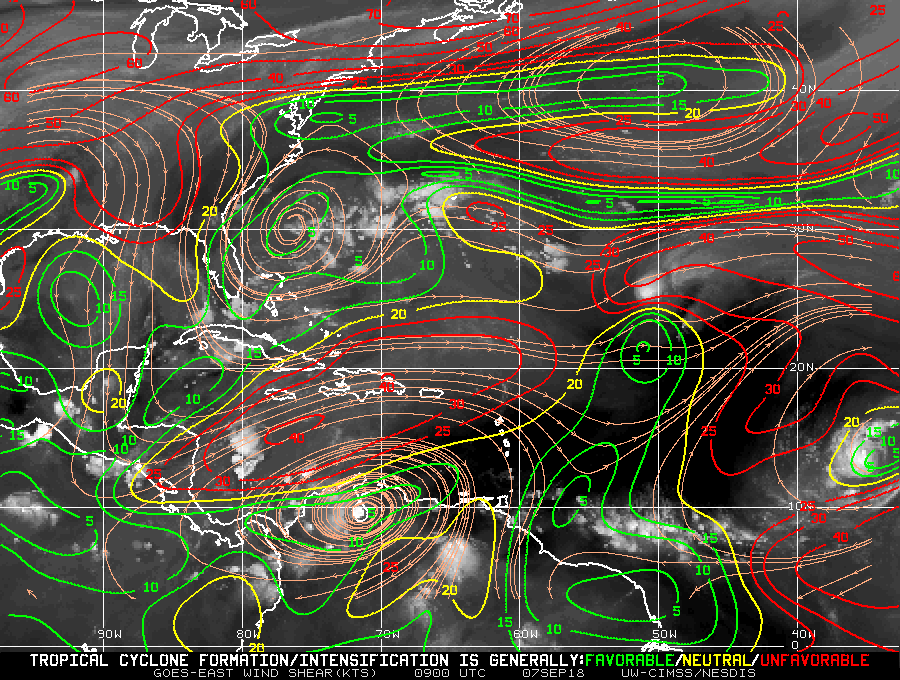
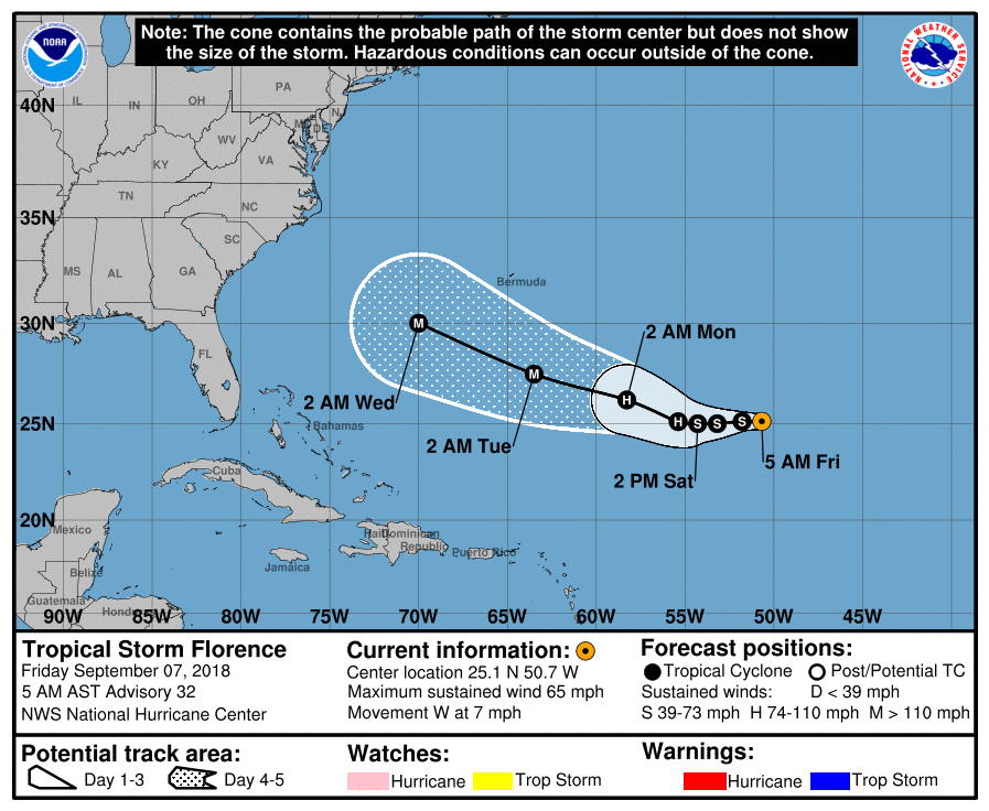
First, high pressure has built north of Florence and its route into the mid-Atlantic Trough has closed which will push it closer to the US. The current atmospheric conditions in the Atlantic are very complicated with numerous variable which are constantly changing. It has weakened significantly as discussed previously from a Cat 4 Hurricane to presently a tropical storm. However if you look at the wind shear analysis below you can see that it will be entering a lower shear environment in a couple of days and regeneration is likely. Fortunately it is still several day away from the US and at this time of year it is likely that a new frontal system will come in in time to prevent it from making a US landfall. The Carolinas to New England are still at risk but my gut feeling is that it will still miss the US.
Second the system labeled #1 on the 2 day map which I spoke about on 9-5 is very small and is approaching a high shear environment, being so small there is a chance that it may dissipate however if it survives it should pass north of the Lesser Antilles. It may pose a threat to the Carolinas however it hopefully will be deflected by a frontal system out to sea. We're just going to have to wait and watch this one.
Third, the system labeled #2, the one I've been writing about for several days, has just emerged off of the coast of Africa. It is the one I'm concerned about. As you can see it is a much larger system. I am encouraged that it has come off of the African coast at about 13 degrees, this is north of the sweet spot of 10-12 degrees which is the window that poses the greatest potential threats to South Florida and the Caribbean. The NHC is anticipating a WNW move which would be good, however with the dynamic atmosphere in front of it, it is just way too early to make an accurate prediction about it at this time. With its large size it has the potential to be a significant storm somewhere.
I'll probably write daily for a few days until things become clearer.
Until next time,
Matt.
Things are heating up in the tropics and there have been a few changes.
First, high pressure has built north of Florence and its route into the mid-Atlantic Trough has closed which will push it closer to the US. The current atmospheric conditions in the Atlantic are very complicated with numerous variable which are constantly changing. It has weakened significantly as discussed previously from a Cat 4 Hurricane to presently a tropical storm. However if you look at the wind shear analysis below you can see that it will be entering a lower shear environment in a couple of days and regeneration is likely. Fortunately it is still several day away from the US and at this time of year it is likely that a new frontal system will come in in time to prevent it from making a US landfall. The Carolinas to New England are still at risk but my gut feeling is that it will still miss the US.
Second the system labeled #1 on the 2 day map which I spoke about on 9-5 is very small and is approaching a high shear environment, being so small there is a chance that it may dissipate however if it survives it should pass north of the Lesser Antilles. It may pose a threat to the Carolinas however it hopefully will be deflected by a frontal system out to sea. We're just going to have to wait and watch this one.
Third, the system labeled #2, the one I've been writing about for several days, has just emerged off of the coast of Africa. It is the one I'm concerned about. As you can see it is a much larger system. I am encouraged that it has come off of the African coast at about 13 degrees, this is north of the sweet spot of 10-12 degrees which is the window that poses the greatest potential threats to South Florida and the Caribbean. The NHC is anticipating a WNW move which would be good, however with the dynamic atmosphere in front of it, it is just way too early to make an accurate prediction about it at this time. With its large size it has the potential to be a significant storm somewhere.
I'll probably write daily for a few days until things become clearer.
Until next time,
Matt.