Good morning.
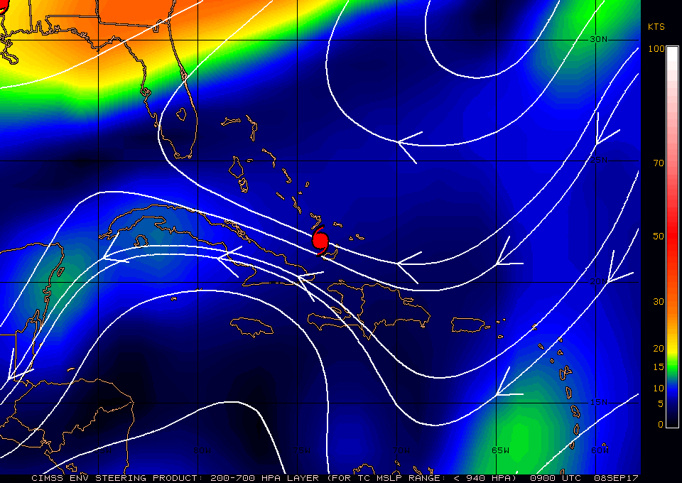
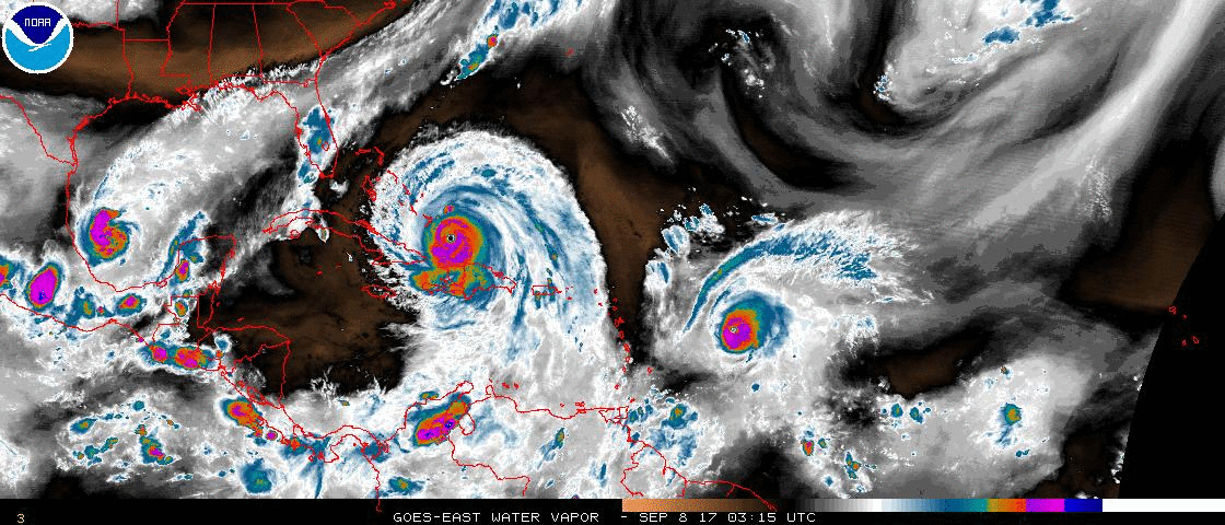
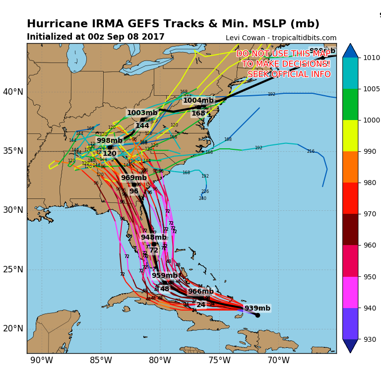
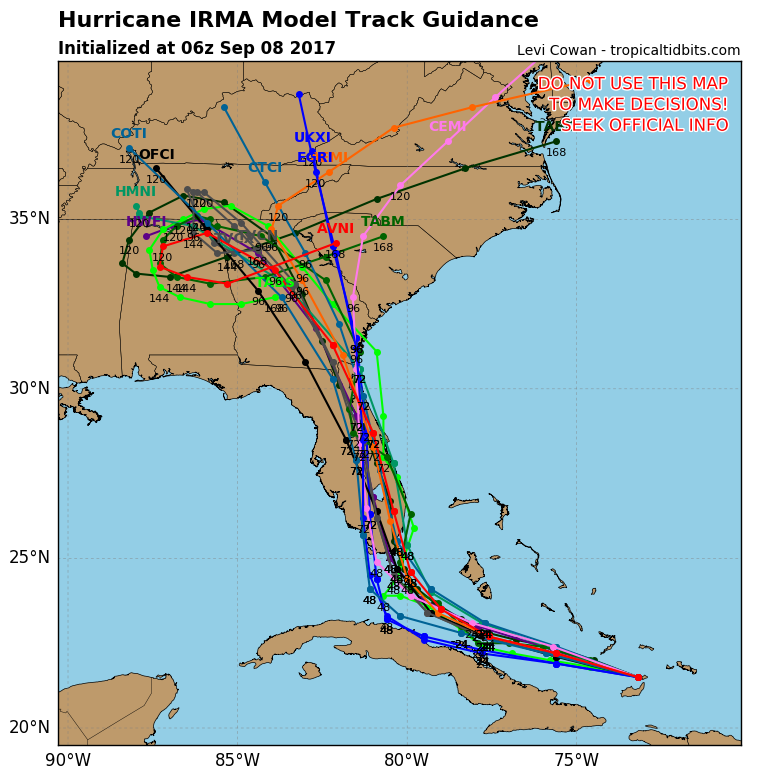
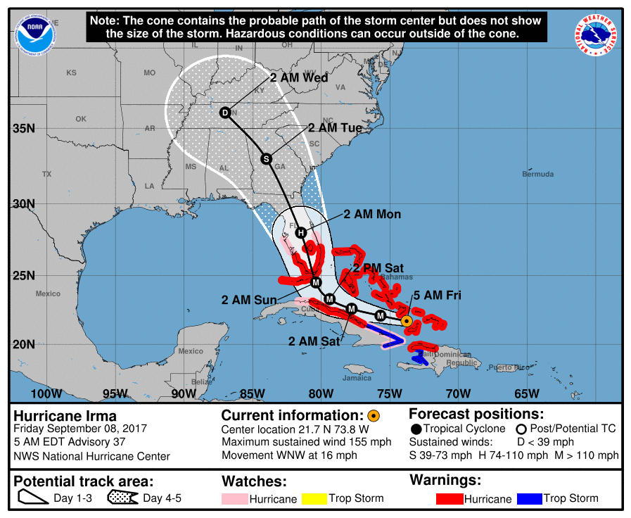
At 5 am Hurricane Irma was located at 21.7 N & 73.8 W and was moving just north of W @ 16 mph. Since last night Irma has taken a definite more westerly move. More so than the NHC track currently reflects. If you look at the surface map below Irma is moving along the periphery of high pressure to its north. With the more southerly and westerly track Irma may come close to or cross into the northern Coast of Central Cuba. If this were to occur it would weaken it some. In addition it would probably lead to a somewhat more westerly course. So far of all the models the European Model (the dark blue line in the lowest diagram which moves along the coast of Cuba) is the one which best reflects the current motion and in addition has been doing the best job in forecasting Irma's track to date.
The NHC track continues to show a worst case scenario.
Based on its current motion my current track takes Irma through the Florida Keys into the Naples area, then northward into the state. After landfall it should weaken due to land interactions and increasing shear to its north. Its eye is currently 20 miles wide and the outer eye wall spans 50 miles. In other words it would need to pass within 30 miles of you (in its current condition) to experience major hurricane conditions. We're just going to have to see. It's still early.
I'll be writing frequently going forward and once thing become clearer will let you know what to expect.
Matt