Good morning.
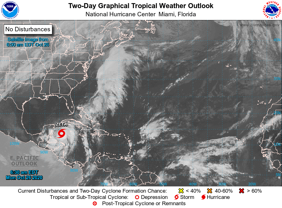
Overnight TS Zeta has become much better organized and if you look at the water vapor loop below you can see that it is now moving NW towards the tip of the Yucatan Peninsula. It is forecast to become a Cat 1 hurricane this morning. If you look at the satellite image, first diagram, you can see the frontal system that I wrote about yesterday approaching, spreading from Texas to the Great Lakes. If you look at the surface map you can see that high pressure has moved over Florida. If you look again at the water vapor loop again you can see dry air and high shear aloft over Florida and the Gulf of Mexico.
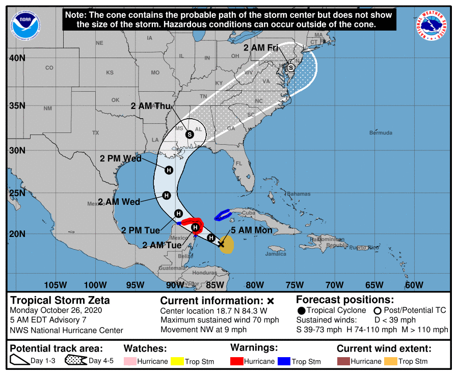
The NHC's track hasn't changed much and the models are coming into better agreement.
It is looking like Louisiana is going to get another storm, most likely a strong tropical storm, but we'll have to see. How much it is affected by its course over the Yucatan and how much it can shield itself from the dry air and shear will be key to how much it will weaken. It will be crossing cooler waters in the northern Gulf as well, however it will be moving faster.
The Florida Panhandle will probably get some squalls however the rest of the state of Florida shouldn't see much.
Elsewhere all is quiet and I'm hoping that this may be the last of them to threaten the US this year.
Until next time,
Matt.
Overnight TS Zeta has become much better organized and if you look at the water vapor loop below you can see that it is now moving NW towards the tip of the Yucatan Peninsula. It is forecast to become a Cat 1 hurricane this morning. If you look at the satellite image, first diagram, you can see the frontal system that I wrote about yesterday approaching, spreading from Texas to the Great Lakes. If you look at the surface map you can see that high pressure has moved over Florida. If you look again at the water vapor loop again you can see dry air and high shear aloft over Florida and the Gulf of Mexico.
The NHC's track hasn't changed much and the models are coming into better agreement.
It is looking like Louisiana is going to get another storm, most likely a strong tropical storm, but we'll have to see. How much it is affected by its course over the Yucatan and how much it can shield itself from the dry air and shear will be key to how much it will weaken. It will be crossing cooler waters in the northern Gulf as well, however it will be moving faster.
The Florida Panhandle will probably get some squalls however the rest of the state of Florida shouldn't see much.
Elsewhere all is quiet and I'm hoping that this may be the last of them to threaten the US this year.
Until next time,
Matt.