Good morning.
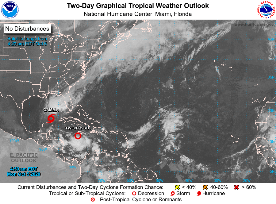
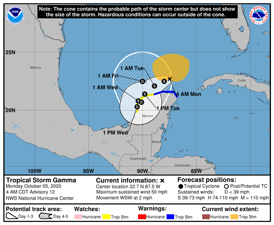
The Western Caribbean Sea remains the area to watch. TS Gamma is currently just north of the Yucatan Peninsula and is totally uncoupled and undergoing significant southerly shear with all of its weather displaced to the north and east of the center. (See water vapor loop below.) It is forecast to meander SW and then eastward as TD # 26, soon to become TS Delta approaches. It should eventually dissipate as its weather and circulation is drawn into TS or Hurricane Delta as it passes through the Yucatan Channel.
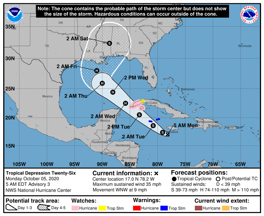
TD#26 is forecast to become TS Delta soon and the NHC is currently forecasting it to make landfall along the Louisiana coast as a Cat 2 hurricane. Due to the abundant shear in the northern Gulf of Mexico I'm not sure that that will happen. If you look at the surface map below you will see a wide window between the Louisiana coast and the Big Bend area of Florida. With the high amount of shear a track to the east of Louisiana appears to be more likely; and a weaker storm, but it is still way too early to make a prediction and just how much interaction that occurs between Gamma and Delta could have a significant impact on where Delta goes. They will come quite close to one another.
South Florida should be okay.
Until next time,
Matt.
The Western Caribbean Sea remains the area to watch. TS Gamma is currently just north of the Yucatan Peninsula and is totally uncoupled and undergoing significant southerly shear with all of its weather displaced to the north and east of the center. (See water vapor loop below.) It is forecast to meander SW and then eastward as TD # 26, soon to become TS Delta approaches. It should eventually dissipate as its weather and circulation is drawn into TS or Hurricane Delta as it passes through the Yucatan Channel.
TD#26 is forecast to become TS Delta soon and the NHC is currently forecasting it to make landfall along the Louisiana coast as a Cat 2 hurricane. Due to the abundant shear in the northern Gulf of Mexico I'm not sure that that will happen. If you look at the surface map below you will see a wide window between the Louisiana coast and the Big Bend area of Florida. With the high amount of shear a track to the east of Louisiana appears to be more likely; and a weaker storm, but it is still way too early to make a prediction and just how much interaction that occurs between Gamma and Delta could have a significant impact on where Delta goes. They will come quite close to one another.
South Florida should be okay.
Until next time,
Matt.