Good morning.
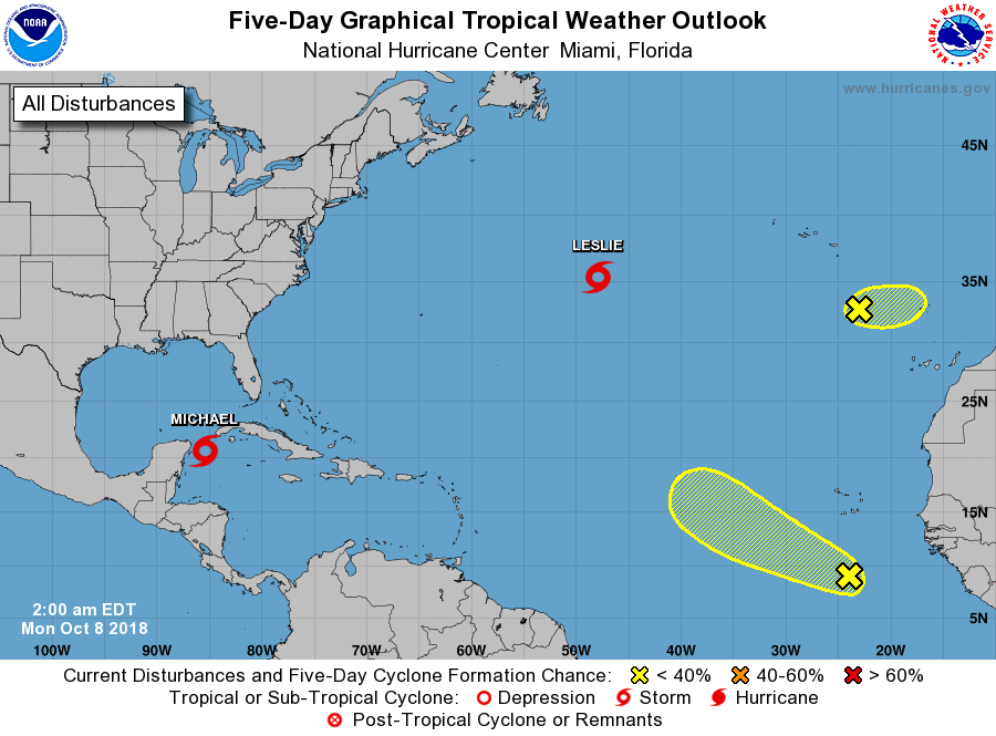
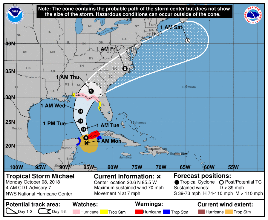
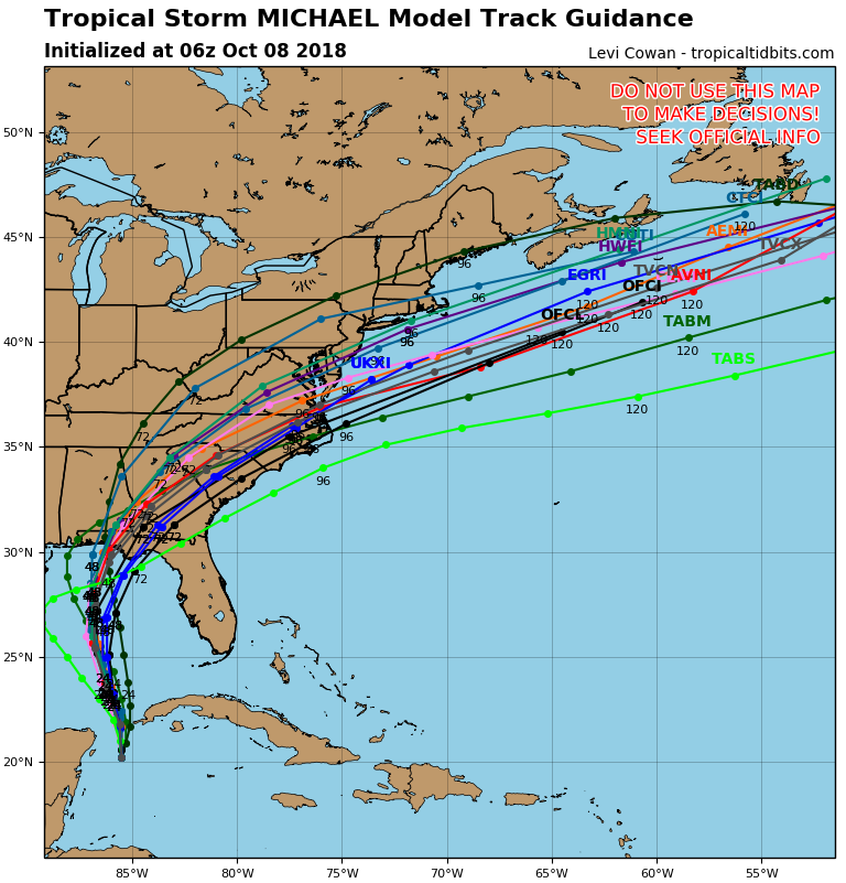
Tropical Storm Michael formed yesterday as expected and there are several developments since yesterday. In a nutshell it is further east, it is moving slower and in spite of significant shear, it is stronger than was anticipated yesterday. Hurricane Hunters this am surprisingly found a central pressure of 983 mbs or 29.02 inches of Mercury. (Note you usually need a pressure around 29.00 inches of Hg to get a hurricane, ie. it is close to hurricane strength.) The models are currently in good agreement for landfall along the Florida Panhandle late Wednesday. The NHC is currently forecasting it to be a 110-115 mph storm. Note intensity forecasting as evidenced already in this system can be very difficult and unexpected development can occur. It is quite possible with lessening shear to its north that it could make landfall as a major hurricane (Winds > or = 115 mph).
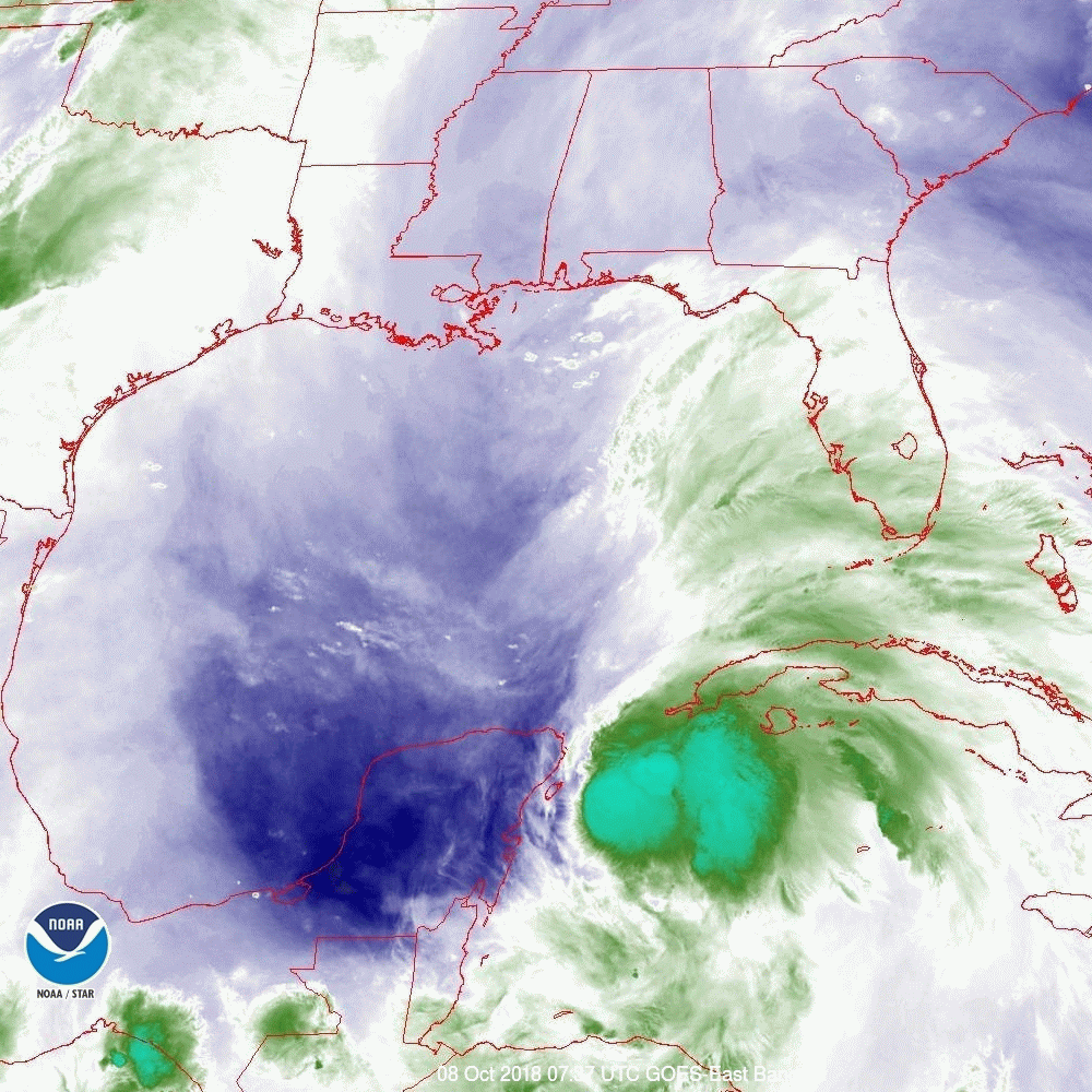
Outer rain bands are starting to move into the Florida Keys already. Expect a rainy next few days for the state of Florida with hurricane and storm conditions from the Panhandle to the Big Bend area on Wednesday. Everyone in those areas should be preparing now.
I'll write further as things develop however it is unlikely that we will see major changes in its track. The intensity will be the main variable to watch.
Until next time, Matt.