Good morning.
TS Eta is currently off the SW coast of Florida. It moved further north than any of the models had forecast however due to dry air intrusion it had relatively little weather associated with it when it was closest to SE Florida. As a result the impacts on the Florida mainland were less than expected. Most areas had peak winds in the 30s and 40s. Highest recorded gusts were 68 mph at Port Everglades, 49 at a pier in Lake Worth and 50 mph in Homestead. I'll report my rainfall total tomorrow.
At closest approach it passed about 80 miles south of Miami. It passed directly over the Middle and Lower Keys.
On the radar loop below you can see that it is currently moving west and a SW motion is anticipated today, see forecast track. A few rain band are still out there and will likely be associated with some gusty winds but the worst is over.
Until next time,
Matt.
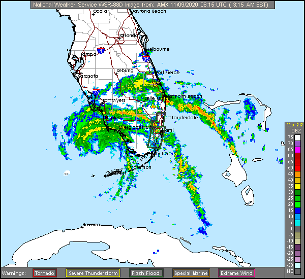