Good morning.
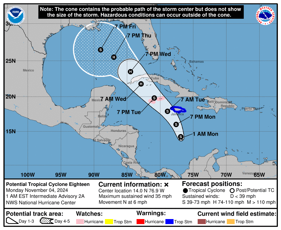
The NHC has been watching an area of disturbed weather in the SW Caribbean for about a week now. This morning it designated it Potential Tropical Cyclone # 18. They anticipate that it will become Tropical Storm Rafael later today.
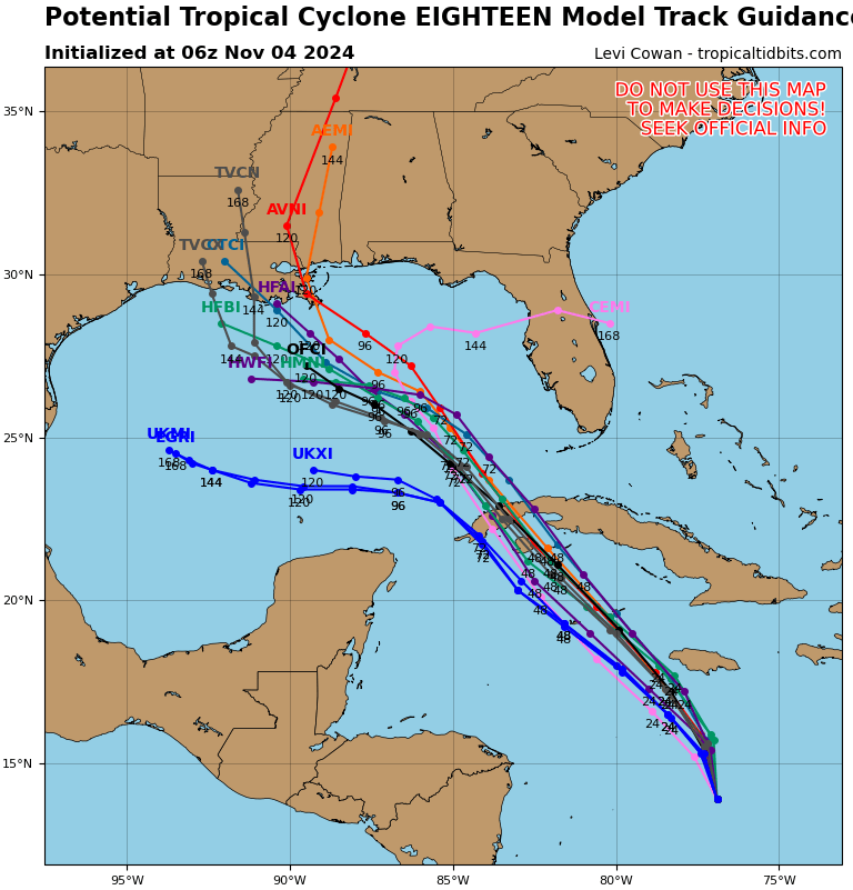
IF you look at the Surface Map below you will notice strong high pressure just off the SE US coast. This will tend to steer it toward the Northern Gulf Coast. This high pressure is forecast to move a little to the east. Currently it would tend to move it toward Louisiana, however timing will be the key. A faster motion could move it closer to Texas where as slower motion could steer towards Alabama or even the Florida Panhandle.
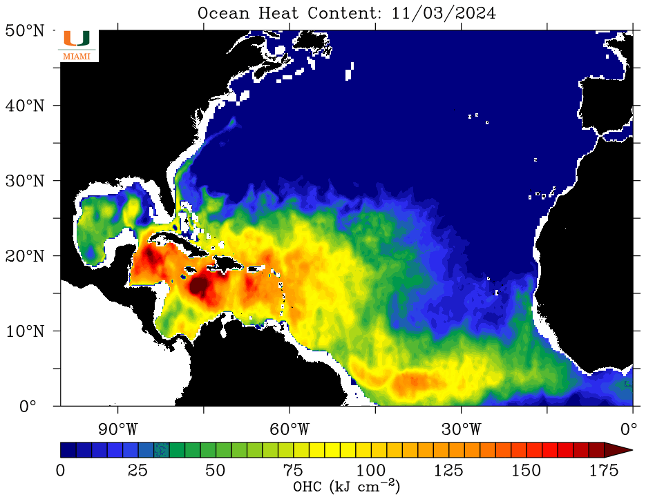
It is currently forecast to track over some of the warmest waters left in the Atlantic Basin (the northern and western Caribbean) and it is forecast to become a hurricane.
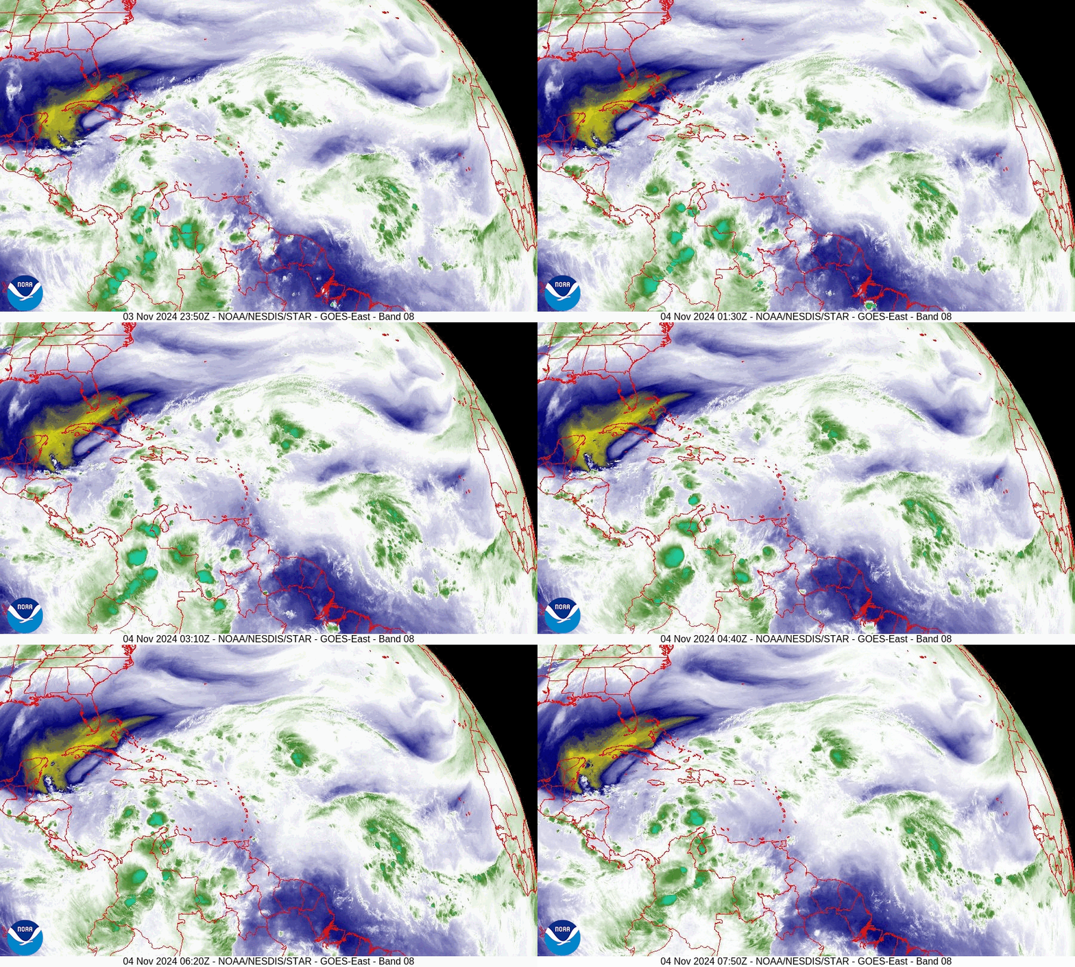
The good new however is that there is abundant dry air, cooler waters and significant shear over the Gulf of Mexico and the NHC currently forecasting it to be a tropical storm at landfall. It is way too early to predict intensity at this point in time and we'll just have to see how things evolve. South Florida may experience some associated showers Wednesday to Thursday morning however it should be far enough away to avoid any significant weather.
Until next time,
Matt.


