Good morning.
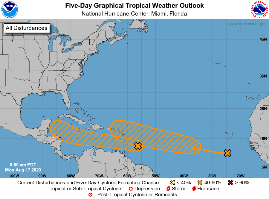
I'm writing about 2 areas of disturbed weather that we'll need to watch though neither appears to present a significant threat to South Florida at this time. Both are very far south in the central and eastern Atlantic, see 2 day outlook below, one just north and one just south of 10 degrees latitude.
If you look at the surface map below you will see that the western one will tend to be steered toward Central America and the Yucatan, after which it should slow down and then turn north toward the Florida Panhandle or the west coast of Florida. The eastern one should approach the NE Caribbean and then turn NW, then N and NE just to the east or over the Central and Northern Bahamas.
Fortunately neither is well organized and there is a lot of shear between them and Florida or the Bahamas and they may not even form or dissipate. However if they should make it to the Gulf of Mexico or the Bahamas shear will lessen in those areas and development could occur. We'll have to see.
A moist light S to SW flow over Florida this week should lead to enhanced shower activity along the Florida east coast.
Until next time,
Matt.