Good morning.
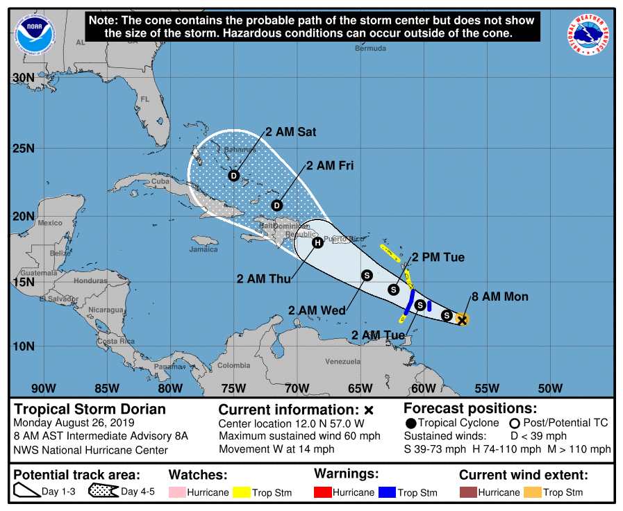
I am writing this morning about TS Dorian which should enter the eastern Caribbean Sea tomorrow.
Dorian is a very small system with storm force winds extending no further than 40 n miles from the center. Note small system are very vulnerable to adverse conditions and can easily dissipate, and likewise intensify when conditions are just right (but they aren't). Notice it is surrounded by dry air. (SAL, second diagram below, yellows, oranges and reds are dry air.) The NHC is currently forecasting it to cross Hispaniola with weakening as it approaches due to increasing shear as it approaches and land interactions. On the current NHC track it would likely miss the US. However in looking at the Surface Map below steering forces will be weak as it enters the northern Caribbean and a track closer to Jamaica could be a concern for Florida IF it can survive the dry air and shear. We'll see.
Elsewhere the next potential threat is a tropical wave over east central Africa which is probably a week away from making it to the Atlantic and over 2 weeks away from anyone. I'll keep an eye on it.
The area of low pressure which I wrote about on Friday may still develop, however it will not pose a threat to the US.
I'll keep you posted. No cause for alarm at this time.
Matt.