Good morning.
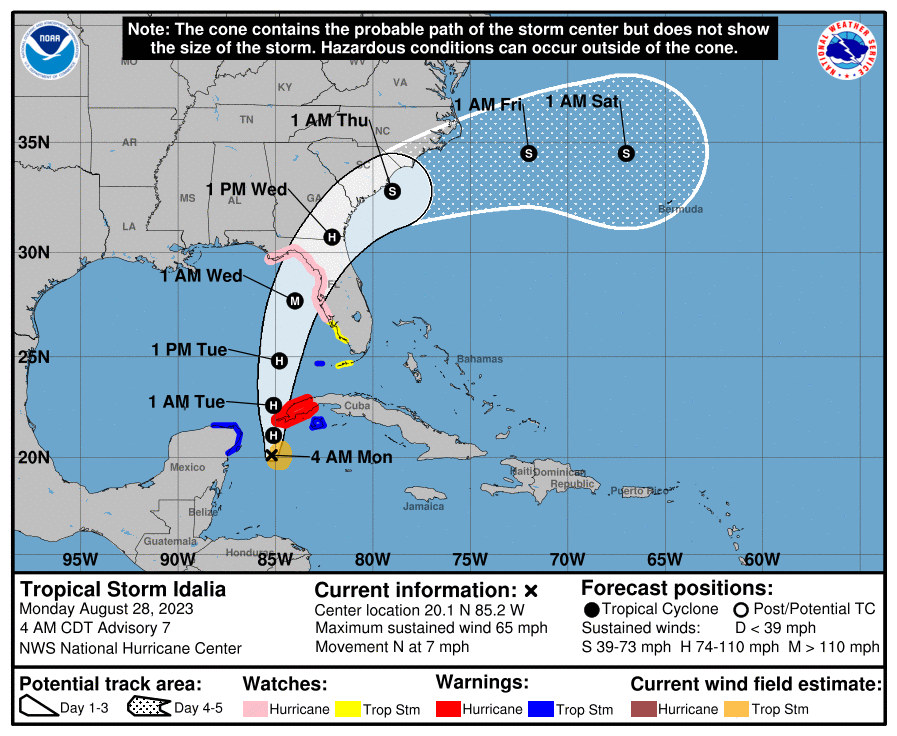
Over the past 24 hours Idalia has drifted SE, however over the past 3 hours it appears that it is starting to finally move northward. If you look at the surface map below you will notice a few things. Since yesterday high pressure over the Western Atlantic has shifted westward as has the high pressure over the south central US. The window between the highs is now centered over the Florida Panhandle. The NHCs track has changed little since yesterday and the models remain in good agreement on this scenario. The Idalia has strengthened since yesterday and the NHC is now forecasting it to become a hurricane by 5 pm today and to be a 115 mph Cat 3 storm at landfall early Wednesday in the Big Bend area of Florida. It has very warm water in front of it and rapid intensification is forecast tomorrow. At this point in time the faster it moves the better as it is likely to continue to intensify until landfall. The longer it is over the warm waters of the Eastern Gulf, the stronger it is likely to become.
South Florida should experience associated showers and rain starting early Tuesday afternoon with clearing by Wednesday morning. Storm surge and high winds in the areas affected by the eyewall will be its greatest effects. The whole state of Florida should see significant rainfall, mostly however from Lake Okeechobee north.
I will be re-evaluating the data after the 5 pm advisory this evening and will probably post again then.
Matt.