Good morning.
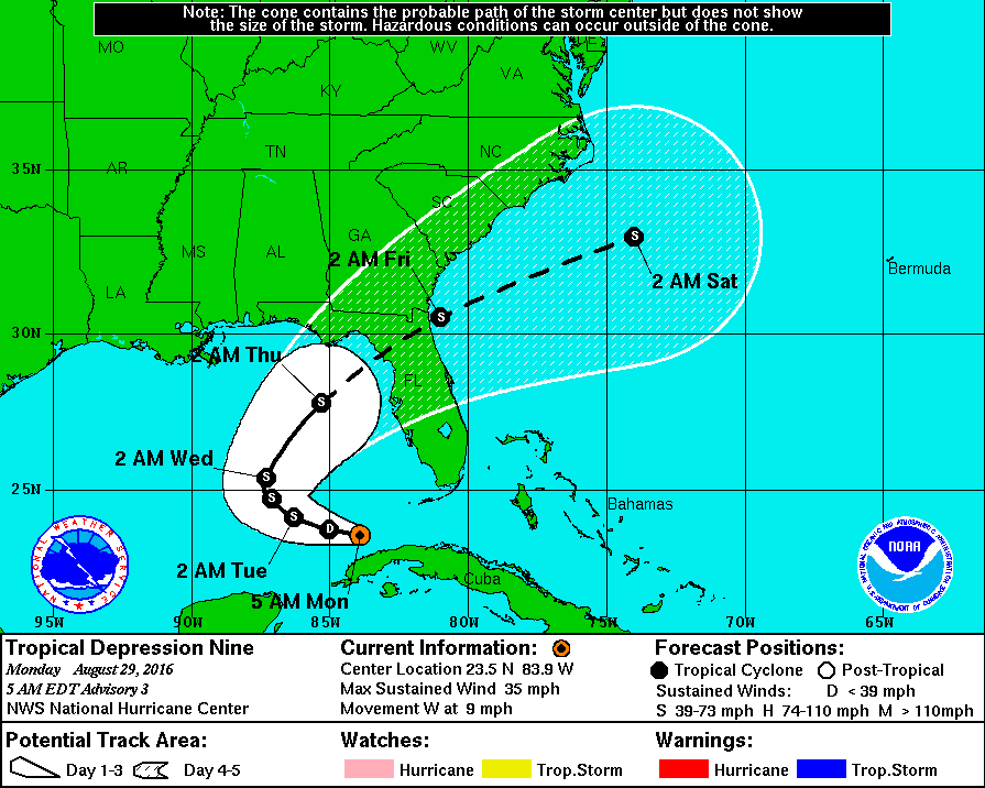
At 8 pm yesterday Invest 99-L was upgraded to TD #9. At that time it was at it's closed approach to the Keys and was 60 mile S of Key West as it passed through the Florida Straits. It is currently located at 23.5 N & 83.9 W, see below, 155 miles WSW of Key West. Due to NW shear from an upper level low off the coast of N FL, GA and SC most of the weather associated with the system remains to the south and east of the center. This also left us with a mostly sunny and dry weekend other than a few passing showers. Rainfall total at my house for the weekend was just over 1/2 an inch. About normal for late August. The NHC models are in good agreement for the system to make landfall in the Big Bend area of Florida on Thursday. We will probably see enhanced shower activity through Thursday due to increased moisture in the area associated with this system. No significant winds are expected in South Florida. North Florida may see a tropical storm, though it is currently very poorly organized and shear is anticipated to persist making it unlikely to become a strong system.
A couple of points of interest if you go to this link ( http://www.goes.noaa.gov/HURRLOOPS/huwvloop.html ) now you will see Hurricane Gaston spinning in the mid Atlantic. It is a major Hurricane now with peak winds of 115 mph, ( Note you usually do not initially see a well defined eye on satellite imagery until winds get to around 100 mph.) The second point is that the area which we will need to watch is a tropical wave coming off of Africa. Another pearl is that waves coming off between 10 and 12 degrees N are the ones that tend to pose the greatest threats to South Florida, and the US for that matter. This one is currently between 13-14 degrees.
We'll see how things develop.
Have a great week,
Matt.
