Good morning.
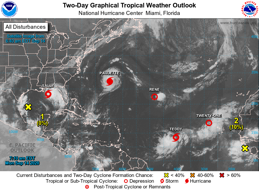
The tropics are active this morning, though Florida remains at low risk.
Sally formed on Saturday, AFTER crossing South Florida giving us a rainy Saturday as forecast. It is currently forecast to make landfall in Mississippi tomorrow PM as a Cat 1 hurricane.
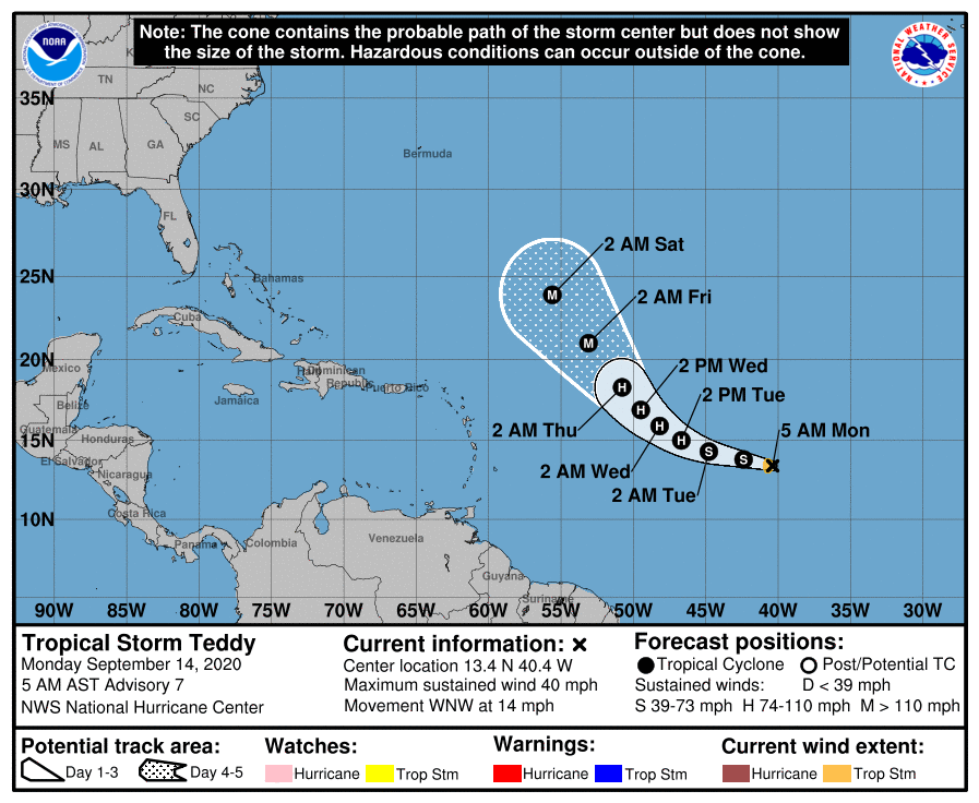
The NHC has changed its forecast on Teddy, formerly TD# 20, and it is now forecast to follow in the wake Paulette and Rene and move out to sea. I wrote about that on Friday.
TD# 21 is too far north and is forecast to dissipate, as is Rene.
Paulette, a Cat 1 hurricane, is in the region of Bermuda and is moving out to sea.
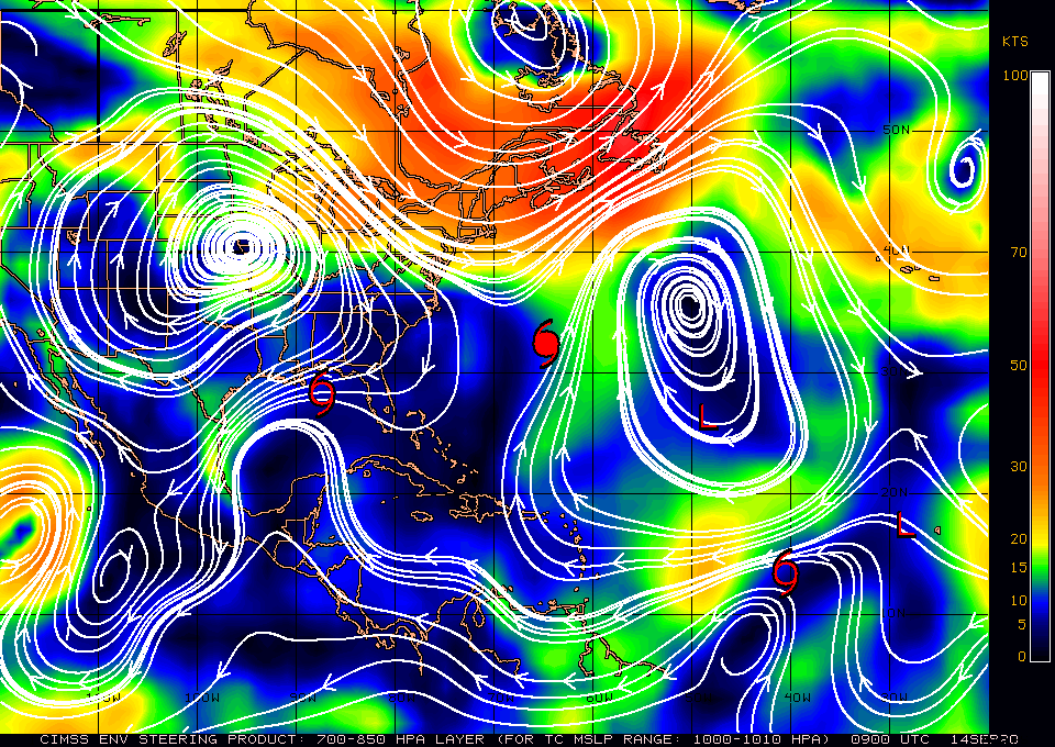
We'll need to watch the tropical wave just off the coast of Africa, however if you look at the surface map below, bottom diagram, you'll see a broad window between the Bermuda High and high pressure over the Central US which would tend to steer anything that enters the Caribbean or SW Atlantic out to sea, likely east of the Bahamas.
So far so good. A strong wave over Central Africa should emerge off the coast in 4-5 days. I'll be watching.
Until next time, Matt.
PS. Don't be intimidated by all these storms out there. Its actually good as each one diminishes the heat content of the ocean a little bit. Some more than others.
The tropics are active this morning, though Florida remains at low risk.
Sally formed on Saturday, AFTER crossing South Florida giving us a rainy Saturday as forecast. It is currently forecast to make landfall in Mississippi tomorrow PM as a Cat 1 hurricane.
The NHC has changed its forecast on Teddy, formerly TD# 20, and it is now forecast to follow in the wake Paulette and Rene and move out to sea. I wrote about that on Friday.
TD# 21 is too far north and is forecast to dissipate, as is Rene.
Paulette, a Cat 1 hurricane, is in the region of Bermuda and is moving out to sea.
We'll need to watch the tropical wave just off the coast of Africa, however if you look at the surface map below, bottom diagram, you'll see a broad window between the Bermuda High and high pressure over the Central US which would tend to steer anything that enters the Caribbean or SW Atlantic out to sea, likely east of the Bahamas.
So far so good. A strong wave over Central Africa should emerge off the coast in 4-5 days. I'll be watching.
Until next time, Matt.
PS. Don't be intimidated by all these storms out there. Its actually good as each one diminishes the heat content of the ocean a little bit. Some more than others.