Good morning.
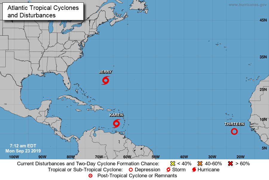
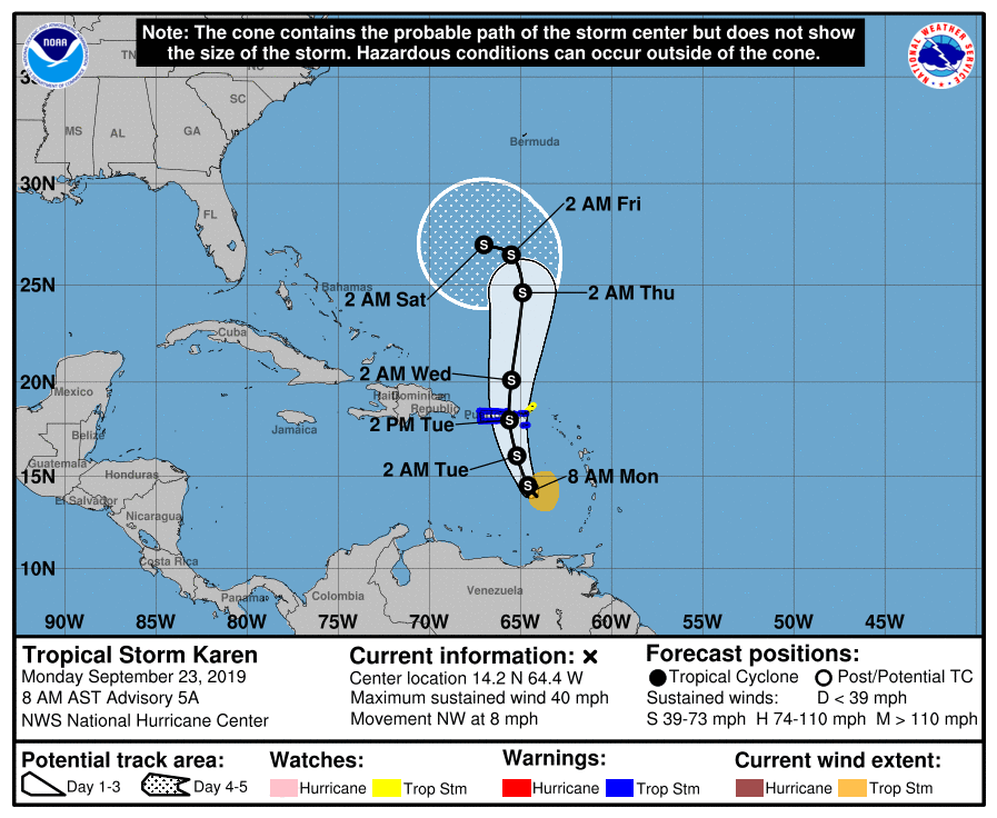
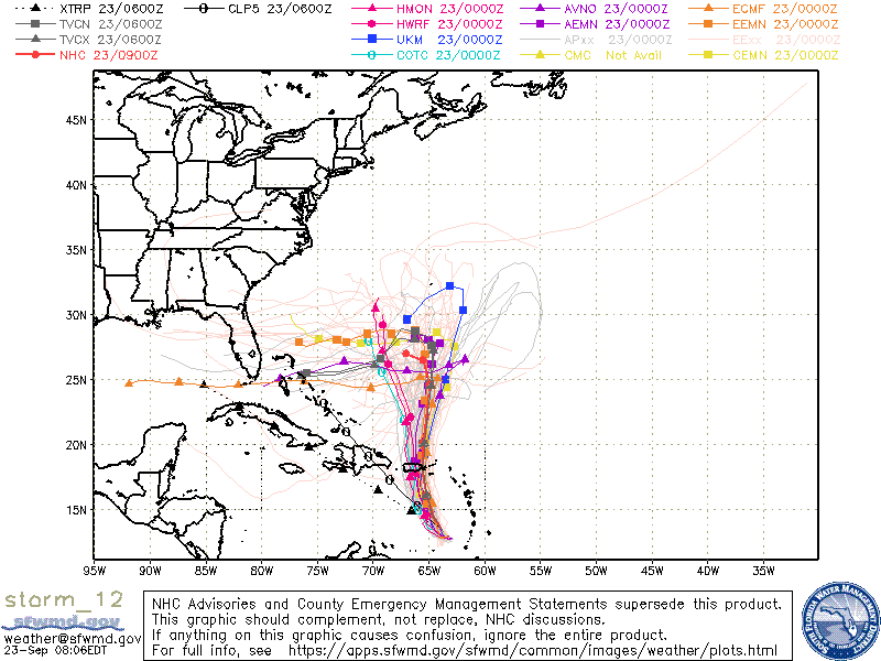
I'm writing about a few areas in the tropics. First TS Jerry and TD #13 are going to both move out to sea. The only area of potential concern is TS Karen. It is in an area of high shear and is forecast to pass over or near Puerto Rico tomorrow afternoon as a weak tropical storm. The main concern there will be rainfall over the mountainous terrain. On Friday it is forecast to stall east of Florida, south of Bermuda. If you look at the models they are all over the place after it stalls.
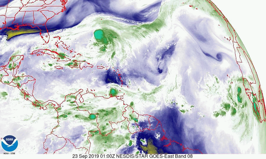
If you look at the water vapor loop below you will see it struggling under easterly shear. You will also notice very strong westerly upper level winds over South and Central Florida. This is good. It is way too early to predict where it will ultimately go. We probably won't really know until late this weekend. Currently conditions do NOT favor a storm for South Florida, however the atmosphere is constantly changing and when systems stall, things can change. There is a good chance that it will stall, loop and then go back out to sea.
I'll write again later in the week, though at this time I am not overly concerned.
Until next time,
Matt.
PS. Please note Sea Surface Temperatures (SST), bottom diagram, notice how these past several storms have reduced the overall water temperatures. Compare to SST chart of 9-10-19.
I'm writing about a few areas in the tropics. First TS Jerry and TD #13 are going to both move out to sea. The only area of potential concern is TS Karen. It is in an area of high shear and is forecast to pass over or near Puerto Rico tomorrow afternoon as a weak tropical storm. The main concern there will be rainfall over the mountainous terrain. On Friday it is forecast to stall east of Florida, south of Bermuda. If you look at the models they are all over the place after it stalls.
If you look at the water vapor loop below you will see it struggling under easterly shear. You will also notice very strong westerly upper level winds over South and Central Florida. This is good. It is way too early to predict where it will ultimately go. We probably won't really know until late this weekend. Currently conditions do NOT favor a storm for South Florida, however the atmosphere is constantly changing and when systems stall, things can change. There is a good chance that it will stall, loop and then go back out to sea.
I'll write again later in the week, though at this time I am not overly concerned.
Until next time,
Matt.
PS. Please note Sea Surface Temperatures (SST), bottom diagram, notice how these past several storms have reduced the overall water temperatures. Compare to SST chart of 9-10-19.