Good evening.
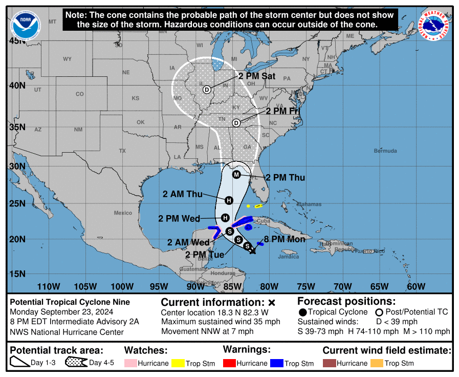
I am writing about Potential Tropical Cyclone #9 which is likely to become Tropical Storm Helene tomorrow. The NHC is currently forecasting it to make landfall along the Florida Panhandle late Thursday. It is currently undergoing quite a bit of shear from the SW which is displacing most of its associated weather to its NE. Once it enters the Gulf of Mexico the shear will lessen and it will likely become a hurricane. (See Wind Shear Analysis below) It is in an area of extremely warm water, see Sea Surface temps below, and rapid intensification is forecast after it enters the Gulf.
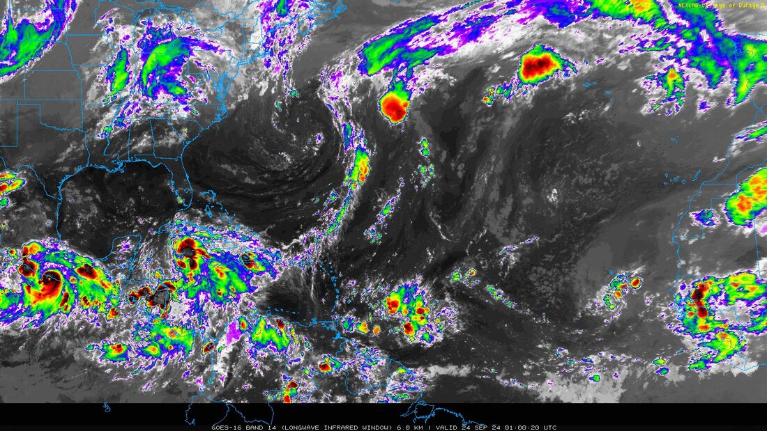
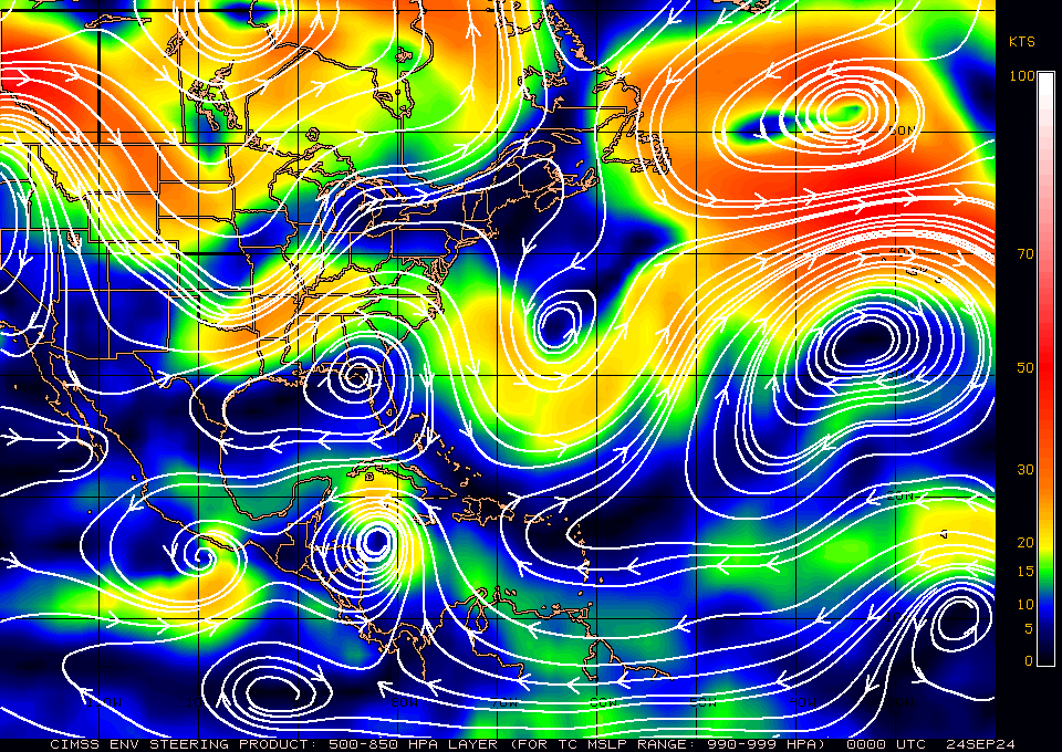
If you look at the surface map below you will see that high pressure remains over Florida. If you look at the bottom water vapor loop you will notice a frontal system over the Mississippi Valley moving eastward as well as a large upper level low over the Western Atlantic with a trailing frontal boundary moving ESE. This will allow the high pressure over Florida to shift eastward. Just where that frontal boundary is late Thursday afternoon will determine where Helene makes landfall. The slower it moves the further east it may go. Conversely a faster motion could lead to a more westerly track.
This time of year cold fronts generally do not make it into South Florida and SE Florida is at low risk from this system.
With the low shear and warm waters beneath it it has the potential of becoming a major hurricane prior to landfall. A return of shear in the Northern Gulf may potentially slow or stop intensification the last few hours before landfall. The models are currently in fairly close agreement with the current NHC track however as alway things can change. As noted above timing will be the key.
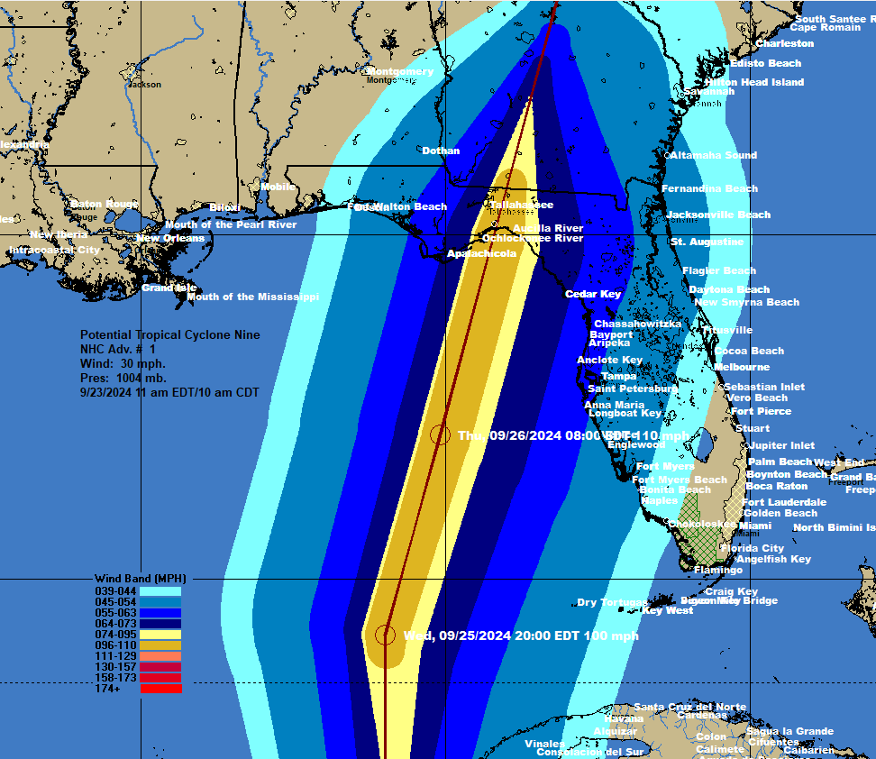
The current Wind Field forecast is included, next to bottom diagram.
Until next time,
Matt.


