Good morning.
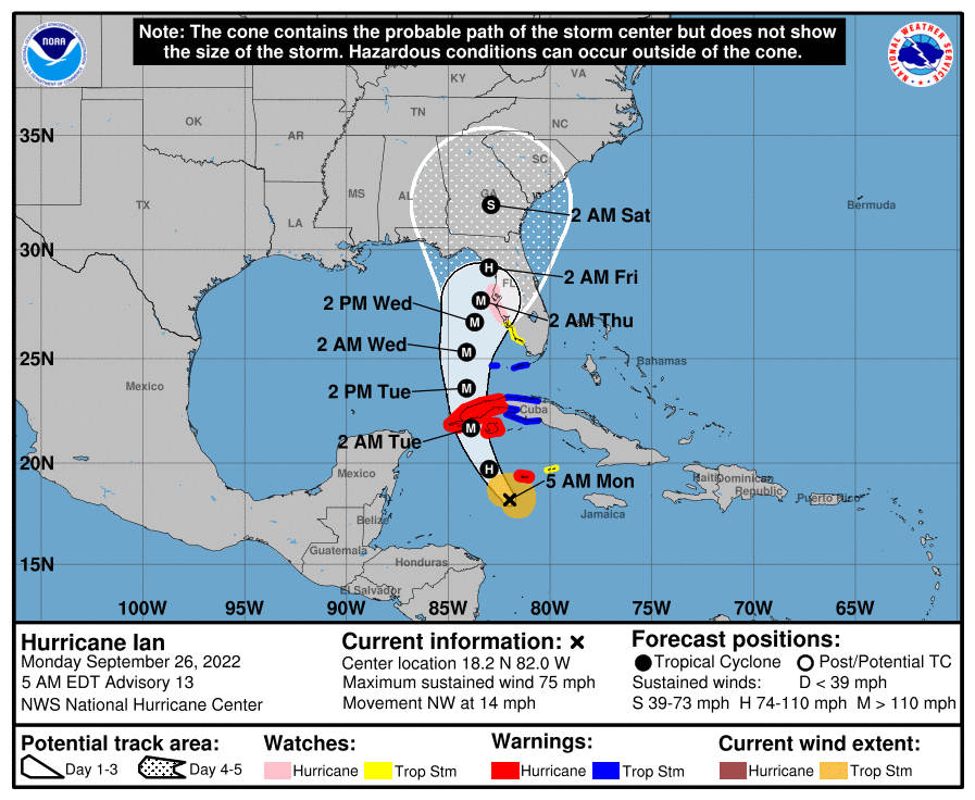
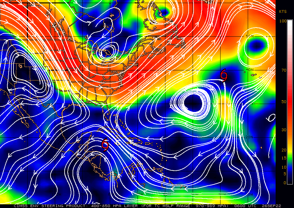
Ian became a Hurricane as of the 5 am advisory today and is expected to under go rapid intensification today. It has been moving steadily NW over night and is about to enter the very warm waters of the NW Caribbean. If you look at the Surface Map below you can see that there is a wide window currently open for Ian to its N and NW, roughly from Ft Myers to the Florida Panhandle. In addition steering forces are light there and it should slow down as it enters that window.
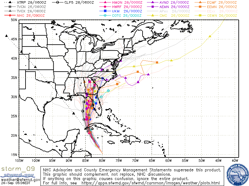
If you look at the models below you will notice that they are in fairly tight agreement for the first 48 hour, and then start to spread. When storms slow things can change and wobbles can become significant. It is currently forecast to make landfall early Friday morning. We will probably have a better idea of just where it will make landfall on Wednesday morning. The stationary front which I spoke about the past few day is forecast to be in the Big Bend area, where the current NHC forecast has it making landfall on this map. Timing will be key as the front can waver up or down with time.
High shear and dry air which I've spoken about previous are forecast to weaken it prior to landfall. Just how much we'll have to see.
Until next time,
Matt.
Ian became a Hurricane as of the 5 am advisory today and is expected to under go rapid intensification today. It has been moving steadily NW over night and is about to enter the very warm waters of the NW Caribbean. If you look at the Surface Map below you can see that there is a wide window currently open for Ian to its N and NW, roughly from Ft Myers to the Florida Panhandle. In addition steering forces are light there and it should slow down as it enters that window.
If you look at the models below you will notice that they are in fairly tight agreement for the first 48 hour, and then start to spread. When storms slow things can change and wobbles can become significant. It is currently forecast to make landfall early Friday morning. We will probably have a better idea of just where it will make landfall on Wednesday morning. The stationary front which I spoke about the past few day is forecast to be in the Big Bend area, where the current NHC forecast has it making landfall on this map. Timing will be key as the front can waver up or down with time.
High shear and dry air which I've spoken about previous are forecast to weaken it prior to landfall. Just how much we'll have to see.
Until next time,
Matt.