Good evening.
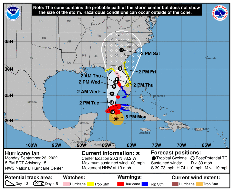
Ian has been intensifying steadily today and I am expecting a distinct eye to form soon. If you look at the latest NHC forecast you will notice that they have shifted it further east, once again towards the Tampa Bay area. This is in response to an earlier than expected turn to the NNW today. Just how far west Ian gets before turning north will be key in determining where it will make land fall. The further west the longer the track and the later its arrival, (giving more time for the stationary front to drift northward). The further east the shorter the track and the earlier the arrival. The further north it gets the weaker it will become. On its the current NHC forecast track it is forecast to get to 84.0 W, it is currently 83.2 degrees west. If if gets to greater than 84.0 W a track more northward would be more likely, conversely less than 84.0 W would favor a more southerly track. We should have that answer by around 5 pm tomorrow.
On its present track it should pass > 200 miles west of Miami and Ft Lauderdale areas. Some passing rain bands would be expected tomorrow and Wednesday with ? 2-4 inches of rain and winds in the 20s.
The lower Keys should experience squalls accompanied by some storm force winds in the 40s. The West Coast will have significantly more weather however it is too early to say. We should know by tomorrow evening.
Until next time,
Matt.